Category:Maps of the history of Israel
Jump to navigation
Jump to search
The overall wikimedia map index is here: Category:Maps
Wikimedia category | |||||
| Upload media | |||||
| Instance of | |||||
|---|---|---|---|---|---|
| Category combines topics | |||||
 | |||||
Subcategories
This category has the following 22 subcategories, out of 22 total.
!
1
A
B
- Maps of the Byzantine Levant (66 F)
C
D
G
H
M
- Maps of Idumaea (2 F)
- Maps of the Six-Day War (63 F)
O
P
U
Y
Pages in category "Maps of the history of Israel"
This category contains only the following page.
Media in category "Maps of the history of Israel"
The following 89 files are in this category, out of 89 total.
-
Seljuq Empire1100-es.svg 2,758 × 1,689; 410 KB
-
1187 Kingdom Of Jerusalem based on 1889 map (fa).jpg 512 × 880; 210 KB
-
1187 Kingdom Of Jerusalem based on 1889 map-es.svg 512 × 880; 495 KB
-
1187 Kingdom Of Jerusalem based on 1889 map.svg 512 × 880; 207 KB
-
ImperioOtomano.svg 2,433 × 2,000; 2.58 MB
-
ImperioOtomanoSimplificado-pt.svg 912 × 750; 753 KB
-
ImperioOtomanoSimplificado.svg 912 × 750; 2.27 MB
-
MACCOUN(1899) p211 MOSLEM JERUSALEM - 636 TO 1099 A.D. BAIT-AL-MAKDIS.jpg 1,978 × 3,562; 3.08 MB
-
Ccolombustrail.jpg 1,024 × 530; 297 KB
-
1956 Suez war - conquest of Sinai blank.jpg 740 × 918; 186 KB
-
1956 Suez war - conquest of Sinai-ar.png 740 × 918; 1 MB
-
1956 Suez war - conquest of Sinai-HE.jpg 740 × 918; 215 KB
-
1956 Suez war - conquest of Sinai.jpg 740 × 918; 132 KB
-
1967 Six Day War - Battle of Golan Heights-es.svg 2,036 × 2,000; 1.01 MB
-
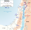
1967 Six Day War - Battle of Golan Heights.svg 904 × 884; 433 KB
-
Aliyah numbers by country.svg 744 × 387; 2.09 MB
-
Aliyahnumbersby country.png 2,000 × 1,015; 305 KB
-
Armenia Throughout History.gif 700 × 525; 38 KB
-
Berekhat-Ram Map.png 212 × 308; 16 KB
-
Crisi de Suez (1956).png 1,032 × 881; 227 KB
-
Distribution of pottery Neolithic sites in southern Levant-en.svg 1,984 × 2,952; 85 KB
-
Distribution of pottery Neolithic sites in southern Levant-fr.svg 1,984 × 2,952; 87 KB
-
Distribution of pottery Neolithic sites in southern Levant.svg 1,800 × 2,550; 46 KB
-
Damascus Eyalet, Ottoman Empire (1795).png 2,434 × 2,037; 591 KB
-
Sidon Eyalet, Ottoman Empire (1795).png 2,434 × 2,037; 590 KB
-
Faisal-Weizmann map.png 330 × 715; 36 KB
-
First Fitna map.png 642 × 368; 71 KB
-
Free Lebanon State.png 2,231 × 2,258; 51 KB
-
Frontières d'Israël 1949 - 1956 2.PNG 330 × 715; 26 KB
-
Frontières d'Israël 1949 - 1956.png 330 × 715; 26 KB
-
Gezer Map.jpg 640 × 480; 17 KB
-
H1N1 Israel Map.png 1,000 × 2,681; 92 KB
-
H1N1 Israel map.svg 304 × 816; 19 KB
-
Halakhische Grenzen.jpg 681 × 856; 179 KB
-
Hamagen map.png 191 × 291; 16 KB
-
Historiska gränser Armenien.gif 698 × 507; 38 KB
-
IOTAPATA SIEGE 67 AD png.png 2,780 × 2,583; 413 KB
-
Israel 1949-1967.svg 904 × 884; 318 KB
-
Israel's northern border 1924.svg 1,115 × 920; 105 KB
-
Israelmap001.jpg 450 × 824; 41 KB
-
Izrael - społeczność żydowska.svg 1,021 × 1,488; 70 KB
-
Jewish settlements 1947.png 308 × 555; 502 KB
-
Jewish zones 1947 2.jpg 684 × 803; 28 KB
-
Jewish zones 1947 3.JPG 684 × 803; 63 KB
-
Jezreel Valley Railway, Valley Train, Kfar Yehoshua train station 19.jpg 2,112 × 2,816; 1.01 MB
-
Karame battle-HE.png 985 × 1,355; 382 KB
-
Kingdom of Israel 1020 map zh-hans.svg 2,168 × 3,300; 128 KB
-
Kingdom of Israel 1020 map-de.svg 2,168 × 3,300; 70 KB
-
Lmlk sites map.gif 781 × 1,651; 56 KB
-
Makkabäer Zerstörung.jpg 848 × 708; 111 KB
-
MandatoryPalestine1948.svg 1,153 × 2,232; 1.06 MB
-
Map Iof srael after 1967.GIF 357 × 370; 8 KB
-
Map Land of Israel.jpg 571 × 800; 117 KB
-
Map of Israel-Survey of Israel, 1961.jpg 3,776 × 8,837; 12.73 MB
-
Map of Judaea at the time of Jesus.png 3,195 × 3,934; 497 KB
-
Map of Mandatory Palestine in 1946 with cities and towns.png 614 × 1,141; 93 KB
-
Map of Mandatory Palestine in 1946 with cities and towns.svg 614 × 1,141; 141 KB
-
Map of Mandatory Palestine in 1946 with districts cities and towns.svg 614 × 1,141; 180 KB
-
Map of Operation Hiram.jpg 1,294 × 1,600; 227 KB
-
Map of Operation Horev.jpg 1,130 × 1,600; 166 KB
-
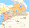
Map of the Armenian Empire of Tigranes (English).svg 512 × 506; 61 KB
-
Map of the Battles of the Ten Days.jpg 1,138 × 1,600; 190 KB
-
Map of the British Mandate of Palestine in 1947.png 3,217 × 8,452; 526 KB
-
Maps of the Armenian Empire of Tigranes-es.svg 1,975 × 1,958; 640 KB
-
Maps of the Armenian Empire of Tigranes-he.svg 512 × 506; 38 KB
-
Maps of the Armenian Empire of Tigranes-pt.svg 512 × 506; 50 KB
-
Maps of the Armenian Empire of Tigranes.gif 673 × 669; 56 KB
-
Mohammad adil-Muslim invasion of Syria-3-es.svg 1,367 × 1,520; 509 KB
-
Nachala efraim 4.jpg 800 × 600; 91 KB
-
Nachalat naftali 3.jpg 800 × 600; 89 KB
-
Nenashe 5.jpg 800 × 600; 74 KB
-
Nenashe 6.jpg 800 × 600; 62 KB
-
Operation-Pleshet-map heb.png 897 × 1,019; 103 KB
-
Operation-Pleshet-map rus.png 897 × 1,019; 153 KB
-
Orient Mejan - Fin de la Premiera Crosada.png 703 × 929; 127 KB
-
Ottoman Syria 1900-ca.svg 463 × 533; 248 KB
-
Ottoman Syria 1900-es.svg 463 × 533; 217 KB
-
Ottoman Syria 1900.svg 356 × 500; 55 KB
-
RomanEmpire 117 - Earliest locations of Mithraism.svg 2,180 × 1,600; 1.87 MB
-
Rome-Seleucia-Parthia 200bc.jpg 1,205 × 567; 767 KB
-
South jordan valley.png 888 × 1,220; 199 KB
-
Südpalästina Makkabäer.jpg 1,345 × 960; 350 KB
-
UNESCO "Occupied Palestine Resolution" Votes.png 4,500 × 2,234; 272 KB
-
מפת המושבות הראשונות.JPG 621 × 870; 131 KB
-
נסיכות עבר הירדן.jpg 559 × 788; 54 KB
-
קו צינור אילת אשקלון.svg 436 × 724; 161 KB
-
السلطنة الأيوبية.jpg 589 × 427; 87 KB
-
فتوح مصر والنوبة.jpg 1,345 × 1,929; 695 KB


