Category:Maps of the history of Laos
Jump to navigation
Jump to search
Subcategories
This category has the following 4 subcategories, out of 4 total.
Media in category "Maps of the history of Laos"
The following 50 files are in this category, out of 50 total.
-
Ayutthaya and Country in mainland south east Asia(1606).svg 512 × 1,132; 281 KB
-
Bán đảo đông dương 1950.png 3,142 × 4,754; 631 KB
-
Cambodge, Laos, Siam and Vietnam at 1760.jpg 776 × 870; 334 KB
-
Cambòtja - Empèri Khmer dins lo corrent dau sègle XII.png 840 × 828; 181 KB
-
Cochinch-tonkin.JPG 1,401 × 2,371; 947 KB
-
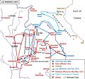
Dissident Activities in Indochina.svg 754 × 1,140; 392 KB
-
Franco-Siamese Treaty of 1893.jpg 10,000 × 15,000; 16.2 MB
-
Indochina 1300 CE.png 628 × 717; 150 KB
-
Indochina 1954 to 55 map de.svg 543 × 771; 1.9 MB
-
Indochina 1954 to 55 map es.svg 543 × 771; 5.25 MB
-
Indochina 1954 to 55 map it.svg 543 × 771; 1.01 MB
-
Indochina 1954-es.svg 703 × 1,013; 665 KB
-
Indochina Francesa - Organizacion territòriala.png 854 × 1,145; 200 KB
-
Japanese Empire - 1942.svg 1,100 × 837; 875 KB
-
Japanese Empire2.png 1,032 × 1,201; 927 KB
-
Kingdom of Luang Prabang (Japanese puppet state).png 1,280 × 640; 120 KB
-
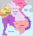
Lan Xang Locator.png 1,034 × 836; 16 KB
-
Laos - Division territòriala vèrs 1750 (vuege).png 840 × 1,076; 205 KB
-
Laos - Division territòriala vèrs 1750.png 840 × 1,076; 189 KB
-
Laos - Reiaume de Lan Xang.png 783 × 874; 179 KB
-
LaoSiam1.jpg 644 × 603; 186 KB
-
Laosiam2.jpg 696 × 950; 280 KB
-
Manipur map of Khagemba Period.png 838 × 698; 162 KB
-
Manipur of loiyumba period.png 706 × 375; 162 KB
-
Map-of-southeast-asia 1000 - 1100 CE-es.svg 744 × 1,047; 944 KB
-
Map-of-southeast-asia 1000 - 1100 CE.png 791 × 1,114; 162 KB
-
Map-of-southeast-asia 1300 CE-es.svg 744 × 1,047; 1,015 KB
-
Map-of-southeast-asia 1300 CE.png 800 × 1,125; 251 KB
-
Map-of-southeast-asia 1400 CE-es.svg 791 × 1,114; 535 KB
-
Map-of-southeast-asia 1400 CE.png 791 × 1,114; 190 KB
-
Map-of-southeast-asia 900 CE.png 791 × 1,114; 182 KB
-
Mongol empire 1290 and the travel of Marco Polo.png 587 × 851; 1.18 MB
-
Siam in 1778.png 1,000 × 1,800; 367 KB
-
Southeast Asian history (around 1540) es.svg 776 × 1,138; 519 KB
-
Southeast Asian history (around 1540) ru.svg 776 × 1,138; 218 KB
-
Southeast Asian history (around 1540) zh-hans.svg 970 × 1,423; 169 KB
-
Southeast Asian history (around 1750) es.svg 746 × 950; 452 KB
-
Southeast Asian history (around 1750) ru.svg 746 × 950; 217 KB
-
Southeast Asian history - 13th century (Thai language).png 840 × 1,280; 416 KB
-
Southeast Asian history - 13th century-es.svg 709 × 872; 1.23 MB
-
Southeast Asian history - 13th century.png 753 × 1,147; 159 KB
-
Southeast Asian history - Around 1540.png 755 × 1,189; 172 KB
-
Tailàndia - Annadas 1830.png 639 × 822; 166 KB
-
Tonkin1893.jpg 1,900 × 1,758; 1.39 MB
-
Vietnam1650.GIF 428 × 713; 15 KB
-
VietnamMac1540.gif 428 × 713; 14 KB
-
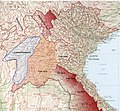
Zones bombardées par l'Armée américaine au Laos de 1964 à 1973.JPG 411 × 592; 117 KB
-
Đàng Trong - Đàng Ngoài (1757).png 822 × 1,037; 748 KB
-
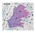
盆忙.jpg 4,590 × 4,213; 1.53 MB
-
镇宁府1830.jpg 978 × 709; 588 KB


