Category:Maps of Ottoman Syria
Jump to navigation
Jump to search
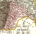
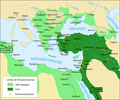
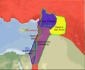
English: Maps of Ottoman Syria.
Subcategories
This category has the following 6 subcategories, out of 6 total.
Media in category "Maps of Ottoman Syria"
The following 111 files are in this category, out of 111 total.
-
ImperioOtomano.svg 2,433 × 2,000; 2.58 MB
-
ImperioOtomanoSimplificado-pt.svg 912 × 750; 753 KB
-
ImperioOtomanoSimplificado.svg 912 × 750; 2.27 MB
-
Ottoman empire.svg 900 × 750; 2.45 MB
-
OttomanEmpire1600.png 1,357 × 821; 44 KB
-
1680 Sidon detail map Turcicum imperium by Frederik de Wit BPL 15917.png 1,064 × 748; 1.55 MB
-
Syria,-detail-from-Ottoman-Empire- by Jaillot.jpg 597 × 580; 215 KB
-
Moll, Herman. Turkey in Asia; or Asia Minor &c. 1736 (I).jpg 1,438 × 991; 328 KB
-
Moll, Herman. Turkey in Asia; or Asia Minor &c. 1736 (K).jpg 846 × 837; 173 KB
-
Rigobert Bonne. Turquie d'Asie. 1791 (K).jpg 693 × 760; 144 KB
-
Anville, Jean Baptiste Bourguignon. Turkey in Asia. 1794 (EA).jpg 1,322 × 1,577; 481 KB
-
Cedid Atlas (Syria) 1803.jpg 4,203 × 3,579; 3.31 MB
-
Bowen, Frances. Turkey in Asia. 1810 (I).jpg 1,060 × 1,140; 143 KB
-
Darton, William. Turkey in Asia. 1811 (DB).jpg 768 × 923; 186 KB
-
Arrowsmith, Aaron; Lewis, Samuel. Asia Minor. 1812 (F).jpg 2,461 × 1,423; 897 KB
-
Pinkerton, John. Turkey in Asia. 1813 (F).jpg 1,375 × 1,354; 523 KB
-
Pinkerton, John. Turkey in Asia. 1813 (FB).jpg 898 × 913; 287 KB
-
Pinkerton, John. Turkey in Asia. 1813 (FC).jpg 467 × 593; 106 KB
-
Palestine and Syria, Syria Antiqua et Palaestina.jpg 12,190 × 8,811; 16.18 MB
-
Lucas, Fielding Jr. Turkey in Asia. 1823 GB.jpg 576 × 978; 170 KB
-
Das Osmanische Reich in Asien 1829 Palaestina and Soria.JPG 750 × 1,400; 334 KB
-
Daniel Lizars. Turkey in Asia. 1831 (H).jpg 1,189 × 1,378; 472 KB
-
Syr.jpg 6,132 × 7,150; 8.24 MB
-
1851 Henry Warren Map of Syria (cropped).jpg 3,162 × 4,413; 12.73 MB
-
1851 Henry Warren Map of Syria.jpg 3,750 × 4,700; 15.66 MB
-
Martin, R.M.; Tallis, J. & F. Turkey in Asia. 1851 (E).jpg 1,434 × 1,189; 621 KB
-
Martin, R.M.; Tallis, J. & F. Turkey in Asia. 1851 (F).jpg 1,033 × 885; 325 KB
-
Martin, R.M.; Tallis, J. & F. Turkey in Asia. 1851 (G).jpg 446 × 635; 111 KB
-
Johnston, Alexander Keith (1804-1871). Turkey in Asia, Transcaucasia. 1861 (C).jpg 1,720 × 1,417; 460 KB
-
Garnier, F. A., Turquie, Syrie, Liban, Caucase. 1862. (C).jpg 572 × 668; 119 KB
-
Abhandlungen der Königlichen Akademie der Wissenschaften in Berlin (1863) (16559246347).jpg 3,228 × 3,527; 1.72 MB
-
Le Tour du monde-07-p051.jpg 960 × 1,232; 682 KB
-
Stein, Christ. Gottfr. Dan.West-Asien. 1865 KA.jpg 906 × 1,160; 205 KB
-
Stieler, Adolf. Das Mittellandische Meer Und Nord-Afrika. 1875 BG.jpg 1,224 × 1,142; 373 KB
-
New General Map of the Asian-Eastern Provinces of the Ottoman Empire - Without Arabia.png 1,690 × 1,024; 3.15 MB
-
Palestine (1889 book) 33.jpg 1,698 × 2,886; 535 KB
-
1889 Modern Palestine, shewing Turkish provinces.jpg 1,743 × 2,926; 2.86 MB
-
Ottoman Syria, 1893 map.jpg 1,178 × 1,331; 271 KB
-
CUINET(1896) LA SYRIE.jpg 3,459 × 6,075; 8.83 MB
-
Ottoman Syria 1900-es.svg 463 × 533; 217 KB
-
Ottoman Syria 1900.svg 356 × 500; 55 KB
-
W. & A.K. Johnston. Asia Minor. 1911 DB.jpg 920 × 1,154; 263 KB
-
Mount Lebanon, Ottoman Syria 1914.png 1,070 × 1,888; 239 KB
-
Palestine in 1914.jpg 3,040 × 4,560; 2.94 MB
-
SL 1914 D092 central lebanon.jpg 1,404 × 1,042; 147 KB
-
Ottoman Syria 1918-ar.jpg 688 × 570; 31 KB
-
Ottoman Syria 1918.png 1,038 × 865; 543 KB
-
Bowen, Frances. Turkey in Asia. 1810 (G).jpg 3,560 × 1,810; 695 KB
-
Carte de la Terre Promise. LOC 99466734.jpg 2,805 × 5,641; 3.3 MB
-
Colton, G.W. Turkey In Asia And The Caucasian Provinces Of Russia. 1856 (F).jpg 1,401 × 1,569; 664 KB
-
Darton, William. Turkey in Asia. 1811 (D).jpg 2,874 × 2,089; 1.06 MB
-
Darton, William. Turkey in Asia. 1811 (DA).jpg 1,556 × 1,433; 540 KB
-
Domains of Fakhr al-Din in Ottoman Syria, at Zenith.png 928 × 1,006; 538 KB
-
Egypt Ottoman border 1906.jpg 578 × 1,247; 147 KB
-
Empire Ottoman.jpg 727 × 528; 245 KB
-
Aleppo Eyalet, Ottoman Empire (1609)-ar.png 1,600 × 1,250; 1.55 MB
-
Aleppo Eyalet, Ottoman Empire (1609).png 1,600 × 1,250; 1.27 MB
-
Aleppo Eyalet, Ottoman Empire (1795).png 2,434 × 2,037; 591 KB
-
Damascus Eyalet, Ottoman Empire (1795).png 2,434 × 2,037; 591 KB
-
Sidon Eyalet, Ottoman Empire (1795).png 2,434 × 2,037; 590 KB
-
FEisalKingdom.png 1,033 × 860; 384 KB
-
Garnier, F. A., Turquie, Syrie, Liban, Caucase. 1862. (D).jpg 347 × 338; 46 KB
-
ImperioOtomanoSimplificado-ar.svg 912 × 750; 901 KB
-
Jewish east mediterranea for Tiger66.png 724 × 601; 177 KB
-
Karte von Syrien. den Manen Jacotin's und Burckhardt's gewidmet. von H. Berghaus.jpg 9,647 × 13,939; 23.6 MB
-
Lajjun Sanjak in Ottoman Palestine.png 1,930 × 2,359; 9.97 MB
-
Lebanon religious groups distribution with Mount Lebanon 1862-1917 borders shown.svg 2,700 × 3,484; 677 KB
-
Levant botanical map - Jughrafiya-i Osmani.jpg 2,994 × 4,994; 1.7 MB
-
Map of Palestine.jpg 2,931 × 3,461; 2.52 MB
-
Map of the Sinai peninsula to illustrate the Turco-Egyptian frontier dispute.jpg 818 × 1,104; 111 KB
-
Map showing Turco-Egyptian Boundrary of 1st October 1906.jpg 859 × 1,567; 162 KB
-
McMahon letter 'districts'-ar.png 756 × 1,776; 1.02 MB
-
McMahon letter 'districts'.png 307 × 668; 212 KB
-
Mutasarrifato del Monte Libano.jpg 1,682 × 2,484; 1.05 MB
-
OETA Syria.png 1,038 × 865; 631 KB
-
Ottoman Empire in Asia 1914.jpg 2,422 × 1,769; 999 KB
-
Ottoman Empire in Asia.jpg 2,447 × 1,709; 873 KB
-
Ottoman Empire in the Middle East.jpg 1,753 × 2,439; 1.19 MB
-
Ottoman levant.png 756 × 1,392; 981 KB
-
Ottoman Syria 1900-ar.svg 356 × 500; 56 KB
-
Ottoman Syria 1900-ca.svg 463 × 533; 248 KB
-
Ottoman Syria.png 650 × 540; 270 KB
-
Palestine (1915).png 7,251 × 9,254; 99.95 MB
-
Palestine (1918).png 6,852 × 9,792; 90.46 MB
-
Peel-Commission Report Map1 AdminDistrictsSyriaPalestine 1154x1846.png 1,154 × 1,846; 36 KB
-
SL 1914 D106 hauran from hermon to druse mountain.jpg 1,096 × 1,079; 98 KB
-
Southern Syria.png 6,372 × 10,530; 103.56 MB
-
Syria Vilayet, Ottoman Empire (1900).png 2,975 × 1,905; 395 KB
-
W. & A.K. Johnston. Asia Minor. 1911 DA.jpg 1,482 × 1,305; 438 KB
-
Zahir al-Umar maximum extent map-es.svg 524 × 860; 727 KB
-
Zahir al-Umar maximum extent map.svg 552 × 905; 80 KB
-
Östliches Mittelmeer - Südliches Schwarzes Meer.jpg 10,276 × 6,734; 12.1 MB
-
إقطاعات المعنيين والشهابيين.jpg 1,260 × 967; 373 KB
-
المقاطعات الإدارية في الشام قبل الحرب العالمية الأولى.jpg 1,829 × 3,281; 1.08 MB
-
مقاطعة الغرب في عهد البحتريين.jpg 655 × 692; 212 KB
-
ولايات المشرق العربي العثماني.jpg 507 × 1,105; 195 KB
-
ولايات سورية العثمانية حتى 1917.png 331 × 859; 415 KB
Categories:
- Maps of the Ottoman Empire by region
- Maps of the history of the Levant
- Maps of the Near East
- Maps of the history of Israel
- Maps of the history of Lebanon
- Maps of the history of Jordan
- Maps of the history of Syria
- Maps of the history of Palestine
- Ottoman period in the history of Lebanon
- Ottoman Syria
- Ottoman period in the history of Palestine
- Acre Sanjak
- Old maps of Jordan


