Category:Maps of the history of the Philippines
Jump to navigation
Jump to search
Subcategories
This category has the following 7 subcategories, out of 7 total.
Media in category "Maps of the history of the Philippines"
The following 68 files are in this category, out of 68 total.
-
1636-1748 sulu ph.jpg 640 × 435; 93 KB
-
Mapa de Filippinas Formosa y costa de China para el Galeon de Manila.JPG 3,508 × 2,552; 930 KB
-
1764-1848 sulu ph.jpg 640 × 432; 73 KB
-
1848-1899 sulu ph.jpg 640 × 435; 83 KB
-
1899-1935 sulu ph.jpg 640 × 425; 66 KB
-
1935-1946 sulu ph.jpg 640 × 433; 68 KB
-
1946-1972 sulu ph.jpg 640 × 428; 59 KB
-
1972 present sulu ph.jpg 640 × 432; 79 KB
-
Basilan Political Map (as of 2000).jpg 712 × 469; 89 KB
-
Bataan Death March route ja.PNG 379 × 421; 36 KB
-
Bataan Death March route vector ja.svg 309 × 379; 45 KB
-
Bataan Death March route vector ru.svg 303 × 379; 47 KB
-
Bataan Death March route vector-zhs.svg 315 × 379; 63 KB
-
Bataan Death March route vector-zht.svg 315 × 379; 63 KB
-
Bataan Death March route vector.svg 315 × 379; 47 KB
-
Bataan Death March route.PNG 379 × 421; 16 KB
-
Biakmap.tiff 1,911 × 2,679; 12.12 MB
-
Bohol PoParty 2019.jpg 893 × 689; 92 KB
-
Buayan.png 1,601 × 1,528; 95 KB
-
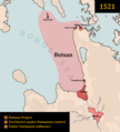
Butuan 1521.png 1,100 × 1,217; 57 KB
-
Colonial Boundaries in Southeast Asia.jpg 1,229 × 898; 220 KB
-
ConfederateStatesOfLanao1616.png 2,934 × 2,900; 160 KB
-
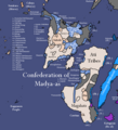
Confederation of Madjaas.png 2,624 × 3,170; 455 KB
-
Mapcorregidor.jpg 852 × 655; 84 KB
-
Expansion of Iloilo City.png 778 × 647; 20 KB
-
Fedvis.jpg 1,257 × 1,539; 645 KB
-
Fedvis.png 1,257 × 1,539; 70 KB
-
Jade culture distribution.jpg 1,280 × 1,056; 251 KB
-
Japanese Empire2.png 1,032 × 1,201; 927 KB
-
Japanese Philippines.svg 600 × 600; 644 KB
-
Kingdom of Jambangan2.jpg 3,180 × 4,961; 721 KB
-
Labanan ng Tres de Abril.png 263 × 321; 4 KB
-
Las islas felipenas (1543).png 2,000 × 3,120; 197 KB
-
Linguistic Map of the Philippines AD 1500.png 2,664 × 2,664; 192 KB
-
Madja-as.png 748 × 822; 36 KB
-
MaguindanaoMapMaximumExtent.png 1,820 × 1,115; 364 KB
-
Manilla Raid (1798).png 857 × 1,149; 566 KB
-
Map British troop movement Philippines 1762.jpg 1,271 × 1,650; 356 KB
-
Map of British Conquest of Manila 1762.jpg 2,250 × 1,041; 457 KB
-
Map of Cainta (1570).png 2,734 × 2,984; 185 KB
-
Map of Lanao (c. 1900, Philippines).gif 1,626 × 2,075; 583 KB
-
Map of Maynila (1570).png 2,734 × 2,984; 185 KB
-
Map of Namayan.png 2,734 × 2,984; 181 KB
-
Map of Negros Revolution Frontlines.gif 640 × 360; 102 KB
-
Map of Panay Mar 1945.png 1,500 × 1,713; 252 KB
-
Map of the Idalemen Tribe.png 1,265 × 1,208; 27 KB
-
Map of the Kingdom of Namayan.jpg 333 × 599; 43 KB
-
Map of the Philippine Revolution from February to June 1897.png 2,716 × 3,582; 935 KB
-
Map of the Sultanate of Sulu.png 1,826 × 1,715; 1.26 MB
-
Map of Tondo (1570).png 2,734 × 2,984; 185 KB
-
Mapa ng Republika ng Lucbuan.png 873 × 737; 20 KB
-
Mapa precolonial filipino (~1500).svg 512 × 675; 735 KB
-
MelayuKingdom001.jpg 300 × 367; 48 KB
-
Old Province of Manila map.PNG 700 × 1,260; 28 KB
-
Operation Big Bird.png 1,357 × 628; 46 KB
-
Philippine migration patterns.jpg 750 × 879; 116 KB
-
PhilippineRevolutionMapDuringTheInaugurationOfTheMalolosConstitution.png 5,992 × 4,773; 943 KB
-
Pre-colonial Central and Southern Luzon closeup.png 2,206 × 1,786; 303 KB
-
Pre1636 sulupre1636 sulu ph.jpg 640 × 434; 69 KB
-
PreCol Manila.png 1,615 × 1,482; 213 KB
-
PROVINCIA CALAMIANES.jpg 854 × 621; 265 KB
-
República de Negros en Cap. Gen. de Filipinas.PNG 411 × 250; 88 KB
-
Siegeofbalermap.png 900 × 800; 64 KB
-
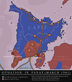
Situation in Panay April 1942.png 1,500 × 1,708; 211 KB
-
Sugbumap.png 2,604 × 3,376; 241 KB
-
United States Pacific change 1901-07-04.png 2,046 × 1,321; 232 KB
-
United States Pacific change 1911-07-17.png 2,046 × 1,321; 230 KB
-
United States Pacific change 1935-11-15.png 2,046 × 1,321; 230 KB


