Category:Maps of the history of Vietnam
Jump to navigation
Jump to search
I. Ancient Vietnam (越南古代史, ? - 968)
- Nányuè (南越國, 207.BC - 111.BC)
- [Chinese] Jiāozhǐ (交趾州, 111.BC - 544 / 602 - 679)
- Wànchūn (萬春國, 544 - 602)
- Liu (लियू, 192 - 605)
- Nokor Phnom (នគរវ្នំ, 68 - 550)
- Chenla (ចេនឡា, 550 - 802)
II. Classical Vietnam (越南中代史, 605 - 1887)
- Nagar Champa (नगर चम्पा, 605 - 1471)
- Indrapura (इन्द्रपुरम्, 757 - 1471)
- Amaravati (अमरावती, 757 - 1471)
- Vijaya (विजय, 757 - 1471)
- Kauthara (कौथर, 757 - 1653)
- Panduranga (पाण्डुराग, 757 - 1832)
- [Chinese] Ānnán (安南州, 679 - 968)
- Imperial Annam (安南國, 968 - 1407 / 1427 - 1945)
- Kingdom of Annam (安南國, 1545 - 1787)
- Kingdom of Quangnam (廣南國, 1558 - 1778)
- [Chinese] Jiāozhǐ (交趾處, 1407 - 1427)
III. Modern Vietnam (越南現代史, 1887 - ?)
- [French] Indochinese Union (東洋聯邦, 1887 - 1945)
- Empire of Vietnam (越南帝國, 1945)
- Democratic Republic of Vietnam (越南民主共和國, 1946 - 1947 / 1954 - 1976)
- [French] Autonomous Republic of Cochinchina (南圻自治共和國, 1946 - 1948)
- State of Vietnam (越南國, 1948 - 1955)
- Republic of Vietnam (越南共和國, 1955 - 1975)
- Republic of South Vietnam (越南南方共和國, 1969 - 1976)
- Socialist Republic of Vietnam (越南社會主義共和國, 1976 - ?)
Subcategories
This category has the following 12 subcategories, out of 12 total.
Media in category "Maps of the history of Vietnam"
The following 152 files are in this category, out of 152 total.
-
1100 asean trade.jpg 1,500 × 2,022; 1.31 MB
-
12 Su quan.jpg 800 × 600; 221 KB
-
Trận Chi Lăng - Xương Giang.png 802 × 1,148; 287 KB
-
19th-Unified-Dai-Nam-Map.png 1,466 × 1,077; 278 KB
-
1bgdgdgd.jpg 873 × 629; 99 KB
-
Asia 200bc.jpg 2,037 × 1,191; 763 KB
-
Ayutthaya and Country in mainland south east Asia(1606).svg 512 × 1,132; 281 KB
-
BiếnĐộngBiênGiớiViệtTrung1428-1895.jpg 11,264 × 4,800; 16.43 MB
-
Bản đồ các quận phía Đông Bắc nước Nam Việt.png 700 × 416; 184 KB
-
Bản đồ hành chính tỉnh Bình Tuy năm 1970.png 316 × 324; 30 KB
-
Bản đồ Việt Nam dưới thời vua Lê Thánh Tông, vương triều Lê Sơ năm 1480.png 2,549 × 2,500; 1.27 MB
-
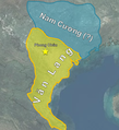
Bản đồ Văn Lang- Âu Việt ,Map of Van Lang-Au Lac.png 543 × 595; 444 KB
-
Cambodge, Laos, Siam and Vietnam at 1760.jpg 776 × 870; 334 KB
-
Cambòtja - Empèri Khmer dins lo corrent dau sègle XII.png 840 × 828; 181 KB
-
Champa ca. 1000-1300.png 1,001 × 1,475; 425 KB
-
Chien tranh dong nam a tram nam.jpg 1,300 × 1,752; 1.11 MB
-
Chien tranh viet trung 1075 vi.jpg 1,164 × 809; 554 KB
-
Chinese invasion of vietnam 1406-07.jpg 2,400 × 2,990; 2.06 MB
-
Chiến tranh Nam Việt - Âu Lạc (179 TCN).png 5,224 × 3,568; 315 KB
-
Chongquannguyenlan1.svg 1,550 × 1,086; 103 KB
-
Chongquannguyenlan2.svg 969 × 1,412; 125 KB
-
Chongquannguyenlan3.svg 1,158 × 867; 152 KB
-
Dai Viet in 1802.png 428 × 715; 34 KB
-
Easter offensive -- Vietnam.png 319 × 500; 831 KB
-
Easter offensive 2-- Vietnam.png 319 × 500; 831 KB
-
Easter offensive 3-- Vietnam.png 319 × 500; 831 KB
-
Gdgdgdgd.jpg 664 × 651; 100 KB
-
Hanh Chinh Thanh Hoa.svg 774 × 623; 196 KB
-
Haripunjaya Kingdom.png 293 × 261; 51 KB
-
HungHoa.jpg 9,500 × 4,200; 22.46 MB
-
Indochina 1300 CE.png 628 × 717; 150 KB
-
Indochina 1954 to 55 map de.svg 543 × 771; 1.9 MB
-
Indochina 1954 to 55 map es.svg 543 × 771; 5.25 MB
-
Indochina 1954 to 55 map it.svg 543 × 771; 1.01 MB
-
Indochina Francesa - Organizacion territòriala.png 854 × 1,145; 200 KB
-
Indochinaambush.svg 741 × 606; 63 KB
-
Japanese Empire - 1942.svg 1,100 × 837; 875 KB
-
Japanese Empire2.png 1,032 × 1,201; 927 KB
-
Khmers rouges map.png 881 × 800; 421 KB
-
Laos - Division territòriala vèrs 1750 (vuege).png 840 × 1,076; 205 KB
-
Laos - Division territòriala vèrs 1750.png 840 × 1,076; 189 KB
-
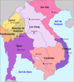
Laos - Reiaume de Lan Xang.png 783 × 874; 179 KB
-
Loan12Suquan EN.png 4,000 × 5,171; 2.55 MB
-
LocationEmpireofVietnam.svg 1,000 × 500; 860 KB
-
LocationTonkin.svg 1,000 × 500; 860 KB
-
Loạn 12 xứ quân.png 3,744 × 4,840; 1.57 MB
-
Luoc do nghia quan lam son tien quan ra bac 500.jpg 500 × 465; 122 KB
-
Luoc do tran chi lang - xuong giang thang.jpg 580 × 757; 71 KB
-
Manipur map of Khagemba Period.png 838 × 698; 162 KB
-
Manipur of loiyumba period.png 706 × 375; 162 KB
-
Map of 12 Warlords in Anarchy of the 12 Warlords.svg 710 × 500; 20 KB
-
Map of Dai (Viet) Nam, 1830s.png 1,000 × 1,342; 365 KB
-
Map of French Indochina expansion.svg 675 × 970; 733 KB
-
Map of provinces and cities of the Socialist Republic of Vietnam 1976.png 800 × 1,280; 239 KB
-
Map of South Vietnam Displayed in Muesum.jpg 1,961 × 2,697; 1.52 MB
-
Map of Southern and Northern Dynasties of Vietnam.png 650 × 800; 124 KB
-
Map of the Lý dynasty.png 650 × 800; 121 KB
-
Map of the Rattanakosin Kingdom.svg 656 × 1,243; 686 KB
-
Map of the Trần dynasty (1225-1400).png 650 × 800; 121 KB
-
Map of Tây Sơn dynasty png.png 640 × 794; 34 KB
-
Map of Đàng ngoài-Đàng Trong.png 352 × 667; 29 KB
-
Map-of-southeast-asia 1000 - 1100 CE-es.svg 744 × 1,047; 944 KB
-
Map-of-southeast-asia 1000 - 1100 CE.png 791 × 1,114; 162 KB
-
Map-of-southeast-asia 1300 CE-es.svg 744 × 1,047; 1,015 KB
-
Map-of-southeast-asia 1300 CE.png 800 × 1,125; 251 KB
-
Map-of-southeast-asia 1400 CE-es.svg 791 × 1,114; 535 KB
-
Map-of-southeast-asia 1400 CE.png 791 × 1,114; 190 KB
-
Map-of-southeast-asia 900 CE.png 791 × 1,114; 182 KB
-
Ming Dynasty 1415.png 556 × 537; 92 KB
-
Mongol empire 1290 and the travel of Marco Polo.png 587 × 851; 1.18 MB
-
Mongol invasion of vietnam (map).png 1,098 × 1,140; 1.74 MB
-
Nam Tien traducido al español.jpg 467 × 649; 67 KB
-
Nam Tien-es2.svg 1,200 × 2,349; 1.24 MB
-
Nam Tien.PNG 428 × 713; 14 KB
-
Nam-Viet 200bc.jpg 1,166 × 960; 856 KB
-
Nanyue.svg 595 × 583; 107 KB
-
Nguyen Dynasty, administrative divisions map (1838).png 5,988 × 8,471; 5 MB
-
Pays Taï.jpg 1,200 × 2,349; 1.63 MB
-
Route taken by Pallavas to bring Nandivarman II.png 1,920 × 1,080; 2.03 MB
-
Siamvietnam1.jpg 900 × 731; 171 KB
-
Siamvietnam2.jpg 890 × 746; 117 KB
-
Sino-Vietnamese War - Campaign 1427 cz.svg 725 × 569; 41 KB
-
Southeast Asian Historical Mandalas.svg 512 × 503; 154 KB
-
Southeast Asian history (around 1540) es.svg 776 × 1,138; 519 KB
-
Southeast Asian history (around 1540) ru.svg 776 × 1,138; 218 KB
-
Southeast Asian history (around 1540) zh-hans.svg 970 × 1,423; 169 KB
-
Southeast Asian history (around 1750) es.svg 746 × 950; 452 KB
-
Southeast Asian history (around 1750) ru.svg 746 × 950; 217 KB
-
Southeast Asian history - 13th century (Thai language).png 840 × 1,280; 416 KB
-
Southeast Asian history - 13th century-es.svg 709 × 872; 1.23 MB
-
Southeast Asian history - 13th century.png 753 × 1,147; 159 KB
-
Southeast Asian history - Around 1540.png 755 × 1,189; 172 KB
-
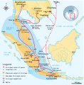
Srivijaya Empire.svg 468 × 476; 336 KB
-
Sơ đồ trận Bắc Ninh.svg 788 × 487; 189 KB
-
Tailàndia - Annadas 1830.png 639 × 822; 166 KB
-
Tau xam luoc vietnam 1406-07.jpg 2,400 × 2,990; 1.79 MB
-
Territories of Champa.jpg 1,897 × 2,078; 2.53 MB
-
The Vietnam map of Haiguotuzhi.jpg 1,808 × 1,600; 1 MB
-
Thăng Long tứ trấn - Nhà Hậu Lê & Mạc.jpg 1,596 × 1,197; 692 KB
-
ThủyVĩ1397-1688.jpg 1,427 × 695; 413 KB
-
TienquanvaoNgheAnLeLoi.jpg 579 × 805; 106 KB
-
Tonkin, annam, and cochin china.jpg 1,198 × 2,053; 718 KB
-
Tonkin1893.jpg 1,900 × 1,758; 1.39 MB
-
TranDynasty1306.png 416 × 708; 16 KB
-
Trận Như Nguyệt.png 1,930 × 1,435; 423 KB
-
Trận Tốt Động Chúc Động 1426.jpg 500 × 383; 59 KB
-
Vietnam at the end of 18th century (Vi).png 2,000 × 2,482; 812 KB
-
Vietnam china.jpg 532 × 481; 39 KB
-
Vietnam in 18th century (orthographic projection).svg 512 × 512; 184 KB
-
Vietnam nam tien map.svg 592 × 907; 107 KB
-
Vietnam railway progress.gif 369 × 720; 33 KB
-
Vietnam within the Japanese Empire (orthographic projection).svg 600 × 600; 525 KB
-
VietNam(1009-1945).gif 767 × 638; 3.3 MB
-
Vietnam, 1895, late Nguyễn dynasty.png 1,657 × 3,680; 475 KB
-
Vietnam1650.GIF 428 × 713; 15 KB
-
Vietnamin laajentuminen.png 428 × 713; 20 KB
-
VietnamMac1540.gif 428 × 713; 14 KB
-
Việt Nam thời Minh Mạng.png 800 × 400; 96 KB
-
Vùng lãnh thổ do các chúa Nguyễn khai phá.png 512 × 296; 16 KB
-
Wędrówki ludów w Azji Południowo-Wschodniej.png 200 × 198; 57 KB
-
ĐạiViệtThờiMạc.jpg 2,645 × 847; 369 KB
-
Вьетнамны территориясыны къуралыуу.jpg 500 × 1,000; 164 KB
-
Формирование территории Вьетнама.png 500 × 1,000; 199 KB
-
Французский Вьетнам.png 330 × 713; 55 KB
-
乂安府、演州府。.jpg 4,378 × 3,283; 2.85 MB
-
义安府、演州府.jpg 4,400 × 3,409; 4.46 MB
-
义州.jpg 937 × 927; 288 KB
-
交阯嘉興直隸州及歸化直隸州.jpg 2,184 × 3,075; 2.44 MB
-
兴化省.jpg 4,542 × 3,791; 2.46 MB
-
化州.jpg 2,144 × 1,513; 739 KB
-
升华府.jpg 2,360 × 2,299; 1.1 MB
-
升州.jpg 1,316 × 797; 530 KB
-
华州.jpg 1,016 × 731; 267 KB
-
南進/南进·남진·Nam tiến·南進.png 510 × 713; 66 KB
-
太原州.jpg 1,354 × 2,403; 930 KB
-
宣化州.jpg 1,909 × 2,695; 1.33 MB
-
思州.jpg 1,309 × 719; 268 KB
-
支棱戰圖.png 802 × 1,203; 425 KB
-
新平府.jpg 2,526 × 2,045; 1,007 KB
-
新平府·顺化府.jpg 4,253 × 3,324; 2.45 MB
-
明代交阯宣化府太原府圖.jpg 2,185 × 3,074; 2.47 MB
-
水舍、火舍.jpg 914 × 828; 128 KB
-
演州府.jpg 1,782 × 1,511; 739 KB
-
玉麻州.jpg 2,321 × 1,847; 897 KB
-
藍山起義圖.png 791 × 1,184; 735 KB
-
镇宁府1830.jpg 978 × 709; 588 KB
-
顺州.jpg 1,269 × 992; 443 KB


