Category:Maps of the Kingdom of Jerusalem
Jump to navigation
Jump to search
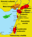
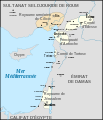
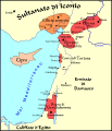
- Maps of the Crusaders' Catholic Kingdom of Jerusalem (1099 – 1291).
Subcategories
This category has the following 11 subcategories, out of 11 total.
M
- Maps of the First Crusade (35 F)
Media in category "Maps of the Kingdom of Jerusalem"
The following 80 files are in this category, out of 80 total.
-
C. 1100 Eastern Roman Empire.jpg 1,859 × 1,395; 2.73 MB
-
Asia minor 1140.jpg 1,078 × 1,164; 566 KB
-
C. 1140 Asia Minor and Crusader States.jpg 1,322 × 1,373; 1.41 MB
-
Map Crusader states ca. 1100.jpg 454 × 1,114; 157 KB
-
1187 County of Jaffa and Shkelon.svg 512 × 880; 165 KB
-
1187 Kingdom Of Jerusalem based on 1889 map (fa).jpg 512 × 880; 210 KB
-
1187 Kingdom Of Jerusalem based on 1889 map-es.svg 512 × 880; 495 KB
-
1187 Kingdom Of Jerusalem based on 1889 map.svg 512 × 880; 207 KB
-
Plan de la bataille d'Arsouf-es.svg 756 × 1,737; 28 KB
-
Plan de la bataille d'Arsouf-fa.svg 756 × 1,737; 73 KB
-
C. 1210 Southeastern Europe and Asia Minor.jpg 4,000 × 3,000; 2.92 MB
-
Campaign of the Battle of Ain Jalut 1260.svg 432 × 572; 146 KB
-
Mongol raids in Syria and Palestine 1260.svg 657 × 901; 316 KB
-
1889 The Kingdom of Jerusalem, shewing the Fiefs, about 1187 A.D..jpg 1,683 × 2,838; 2.64 MB
-
Asia minor 1140-es.svg 932 × 1,008; 978 KB
-
Asia Minor and the States of the Crusaders.jpg 1,200 × 1,282; 364 KB
-
Asia Minor and the States of the Crusaders.svg 250 × 272; 651 KB
-
Campagna della battaglia di Ain Jalut-1260.svg 432 × 572; 195 KB
-
Campaign Ain Galut-ar.png 432 × 573; 67 KB
-
Campaign of the Battle of Ain Jalut 1260 hu.svg 432 × 572; 178 KB
-
Campaign of the Battle of Ain Jalut 1260-ms.svg 432 × 572; 99 KB
-
Campaign of the Battle of Ain Jalut 1260-ru.svg 432 × 572; 60 KB
-
Campanha da Batalha de Ain Jalut 1260-es.svg 432 × 572; 207 KB
-
Campanha da Batalha de Ain Jalut 1260.svg 432 × 572; 68 KB
-
CiliciaPrincipadoDeAntioquíaYCondadoDeTrípoli.svg 955 × 1,315; 180 KB
-
Crusade states in levant.PNG 291 × 504; 14 KB
-
Crusader castels heb.jpg 288 × 559; 138 KB
-
Crusader States 1190 cs.svg 978 × 1,330; 250 KB
-
Ein-jalut-fa.png 432 × 572; 75 KB
-
Forteresses templières-es.svg 556 × 989; 231 KB
-
Forteresses templières.png 552 × 986; 70 KB
-
Forteresses templières.svg 556 × 989; 47 KB
-
Map Crusader states 1102-cs.svg 589 × 687; 148 KB
-
Map Crusader states 1102-es.svg 591 × 690; 359 KB
-
Map Crusader states 1102-fr.svg 591 × 690; 118 KB
-
Map Crusader states 1102-hu.svg 591 × 690; 73 KB
-
Map Crusader states 1102-it.svg 591 × 690; 716 KB
-
Map Crusader states 1102-pt.svg 591 × 690; 42 KB
-
Map Crusader states 1135-de2.svg 690 × 738; 563 KB
-
Map Crusader states 1135-pl.png 1,631 × 2,217; 632 KB
-
Map Crusader states 1148-fa.svg 978 × 1,330; 385 KB
-
Map Crusader states 1165-en.svg 955 × 1,315; 362 KB
-
Map Crusader states 1165-es.svg 955 × 1,315; 662 KB
-
Map Crusader states 1165-fa.svg 955 × 1,315; 308 KB
-
Map Crusader states 1165-it.svg 955 × 1,315; 129 KB
-
Map Crusader states 1165-ka.png 955 × 1,315; 248 KB
-
Map Crusader states 1165-pt.svg 955 × 1,315; 117 KB
-
Map Crusader states 1197-en.svg 507 × 690; 76 KB
-
Map Crusader states 1197-es.svg 507 × 690; 114 KB
-
Map Crusader states 1197-fr.svg 507 × 690; 596 KB
-
Map Crusader states 1197-it.svg 507 × 690; 77 KB
-
Map Crusader states 1197-ka.png 502 × 683; 104 KB
-
Map Crusader states 1197-ru.svg 507 × 690; 76 KB
-
Map Crusader states 1240-de.svg 507 × 690; 162 KB
-
Map Crusader states 1240-eng.png 600 × 823; 110 KB
-
Map Crusader states 1240-es.svg 507 × 690; 385 KB
-
Map Crusader states 1240-fa.png 600 × 823; 117 KB
-
Map Crusader states 1240-fr.svg 507 × 690; 636 KB
-
Map Crusader states 1240-it.svg 507 × 690; 699 KB
-
Map Crusader states 1240-pt.svg 507 × 690; 38 KB
-
Map Crusader states ca. 1100-es.svg 545 × 1,337; 662 KB
-
Mongol raids in Syria and Palestine 1260-ar.svg 657 × 901; 318 KB
-
Mongol raids in Syria and Palestine 1260-es.svg 657 × 901; 383 KB
-
Mongol raids in Syria and Palestine 1260-he.svg 657 × 901; 272 KB
-
Mongol raids in Syria and Palestine 1260-hu.svg 657 × 901; 210 KB
-
Mongol raids in Syria and Palestine 1260-pt.svg 657 × 901; 173 KB
-
Oultrejordain-es.svg 519 × 675; 291 KB
-
Oultrejordain.png 540 × 693; 83 KB
-
Plan de la bataille d'Arsouf-ar.svg 756 × 1,737; 78 KB
-
Plan de la bataille d'Arsouf-ka.jpg 756 × 1,737; 161 KB
-
Plan de la bataille d'Arsouf-pt.svg 756 × 1,737; 25 KB
-
Raids mongoli in Siria e Palestina-1260.it.svg 657 × 901; 434 KB
-
Saladin and the fall of the Kingdom of Jerusalem (1898) (14597840770).jpg 2,512 × 2,020; 708 KB
-
Transjordania.png 726 × 990; 95 KB
-
נסיכות עבר הירדן.jpg 559 × 788; 54 KB
-
الإمارات الصليبية والأتابكيات في الشام.jpg 675 × 973; 202 KB
-
الإمارات الصليبية وما جاورها.jpg 827 × 1,371; 277 KB
-
الدولة الأيوبية.jpg 1,087 × 950; 343 KB
Categories:
- Kingdom of Jerusalem
- Maps of the history of Asia by former country
- Maps of Crusader states
- Maps of the Levant in the 12th century
- Maps of the Levant in the 13th century
- Maps of the history of Israel
- Jerusalem in the 12th century
- Jerusalem in the 13th century
- Maps of medieval Syria
- Maps of the history of Jerusalem


