
Category:Old maps of Israel
Old maps of Israel — in the Near East of Western Asia.
Use the appropriate category for maps showing all or a large part of Israel. See subcategories for smaller areas:
| If the map shows | Category to use |
|---|---|
| Israel on a recently created map | Category:Maps of Israel or its subcategories |
| Israel on a map created more than 70 years ago | Category:Old maps of Israel or its subcategories |
| the history of Israel on a recently created map | Category:Maps of the history of Israel or its subcategories |
| the history of Israel on a map created more than 70 years ago | Category:Old maps of the history of Israel or its subcategories |

Subcategories
This category has the following 17 subcategories, out of 17 total.
Media in category "Old maps of Israel"
The following 147 files are in this category, out of 147 total.
-
 Land of Israel by Rabbi Chaim Salomon Pinta of Zefat.1875.jpg 800 × 600; 735 KB
-
 Hadera map sketch.jpg 747 × 569; 138 KB
-
 A dictionary of the Bible.. (1887) (14595190740).jpg 2,032 × 3,288; 990 KB
-
 A Plan of Rehovot.jpg 2,515 × 2,147; 1.57 MB
-

-
 Al Auja.jpg 2,764 × 1,737; 9.76 MB
-
 Al-Nabi Yusha'.jpg 563 × 523; 185 KB
-
 An-Far.jpg 1,170 × 604; 1.32 MB
-
 Brockhaus and Efron Encyclopedic Dictionary b44 625-0.jpg 2,552 × 3,379; 2.62 MB
-
 Brockhaus and Efron Jewish Encyclopedia e12 199-0.jpg 1,789 × 2,618; 1.54 MB
-
 Brockhaus and Efron Jewish Encyclopedia e12 227-0.jpg 1,099 × 1,520; 302 KB
-
 Brockhaus and Efron Jewish Encyclopedia e12 229-0.jpg 1,105 × 1,502; 299 KB
-
 Brockhaus and Efron Jewish Encyclopedia e12 247-2.jpg 1,123 × 1,587; 386 KB
-
 Brockhaus and Efron Jewish Encyclopedia e3 865-0.jpg 445 × 637; 109 KB
-
 Brockhaus and Efron Jewish Encyclopedia e9 667-0.jpg 652 × 1,067; 134 KB
-
 Canaan (Spruner-Menke, Atlas Antiquus, 1865).jpg 6,698 × 5,448; 27.02 MB
-
 Conrad Buno00a. The Geographer.jpg 2,222 × 400; 335 KB
-
 DCawm4-1-64-7Ap6sk.jpeg 1,746 × 1,083; 346 KB
-
 DCawm4-1-64-7Ap6skM.jpeg 1,812 × 1,354; 455 KB
-
 Die Sieben Säulen der Weisheit, Skizze II.jpg 904 × 1,172; 225 KB
-
 Die Sieben Säulen der Weisheit, Skizze IV.jpg 861 × 1,255; 260 KB
-
 Diunot zal.jpg 656 × 1,008; 171 KB
-
 Edmond Halley, De Bergh Carmel (FL6882390 2476033).jpg 3,106 × 2,000; 3.44 MB
-
 Edmond Halley, De Bergh Thabor (FL6879701 2476167).jpg 3,076 × 2,000; 4.05 MB
-
 Edmond Halley, De Olyf Berg (FL6880687 2476195).jpg 3,100 × 2,011; 3.36 MB
-
 Edmond Halley, Joppe (FL6880171 2476100).jpg 3,109 × 2,010; 3.72 MB
-
 Environs de Ptolémaïs ou d'Acre pour l'Histoire de Saladin. par le Sr d'Anville.jpg 2,152 × 2,018; 880 KB
-
 Falls Map 21det.jpeg 2,408 × 3,446; 1.4 MB
-
 Falls sketch 12.jpeg 683 × 1,050; 239 KB
-
 Falls sketch 14.jpeg 662 × 1,041; 236 KB
-
 Falls sketch 15.jpeg 650 × 1,004; 284 KB
-
 Falls sketch 16.jpeg 1,470 × 1,004; 541 KB
-
 Falls sketch 24.jpeg 1,437 × 1,100; 598 KB
-
 Falls sketch24 det 1.jpeg 1,196 × 2,321; 800 KB
-
 Falls skMap20 PassageNahr Auja.jpeg 1,354 × 2,088; 673 KB
-
 Falls skMap31Megiddo.jpeg 1,471 × 1,762; 636 KB
-
 Falls skMap32Megiddo.jpeg 1,429 × 1,758; 580 KB
-
 Falls2Map1SthPalDetMegiddo.jpeg 2,521 × 2,012; 1.2 MB
-
 Gottlieb Schumacher. Karte des Ostjordanlandes Blatt I. 1900.jpg 1,024 × 1,200; 249 KB
-
 Greater Jerusalem, May 2006. LOC 2006458043.jpg 8,264 × 10,696; 11.45 MB
-
 Greater Jerusalem, May 2006. LOC 2006458043.tif 8,264 × 10,696; 252.89 MB
-
 Grimm, J.L. Mahlmann, H. Tiberias. 1850-2.jpg 7,771 × 5,661; 8.84 MB
-
 Herrmann M. Z. Meyer Israel 1961 cover.jpg 1,181 × 1,847; 512 KB
-
 Historische Karte von der Umgebung Jerusalem MK1888.png 369 × 580; 59 KB
-
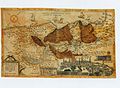 HOLY LAND Gerard de Jode. Speculum Orbis Terrarum.jpg 800 × 588; 269 KB
-
 Hug Haarech.JPG 1,230 × 755; 158 KB
-
 Hurlbut's Life of Christ for young and old (1915) (14586247508).jpg 1,558 × 2,394; 384 KB
-
 Image from page 230 of "A dictionary of the Bible.." (1887) (14595154277).jpg 1,848 × 1,228; 323 KB
-

-
 Israel Batch 1 (114).JPG 3,648 × 2,736; 3.92 MB
-
 IsraelMapByRabbiJosephSchwarzAt1847.JPG 3,392 × 5,780; 3.25 MB
-
 Israerail24.jpg 550 × 1,024; 144 KB
-
 Jaffa 1587.jpg 1,886 × 2,199; 1.57 MB
-
 Jean Baptiste Bourguignon d'Anville. La Palestine. 1767.jpg 8,904 × 7,695; 9.98 MB
-
 Jean Baptiste Bourguignon d'Anville. La Palestine. 1767.Positions.jpg 1,562 × 2,438; 661 KB
-

-

-

-
 Joseph Romain Joly. Carte de la Palestine depuis la captivité de Babylone. 1784.jpg 2,964 × 4,135; 8.36 MB
-
 Judea3.jpg 1,308 × 1,506; 479 KB
-
 Karl Baedeker. Akka & Umgebung (1910) (14766736185).jpg 1,245 × 1,279; 408 KB
-
 Karm&elBuqqarDet.jpeg 692 × 1,746; 279 KB
-
 Karte des Ostjordanlandes.jpg 22,772 × 20,864; 364.37 MB
-
 La Palestine, les tribus, et Jerusalem. LOC 99446187.jpg 6,746 × 5,357; 6.48 MB
-
 La Palestine, les tribus, et Jerusalem. LOC 99446187.tif 6,746 × 5,357; 103.39 MB
-
 La Palestine, pour l'Histoire des empereurs romains de M. Crévier. 1750.jpg 4,792 × 5,949; 4.48 MB
-

-
 The lands of the Saracen (IA landsofsaracen00tayl 0) (page 11 crop).jpg 1,679 × 2,505; 348 KB
-
 Large-scale-detailed-old-map-of-palestine-during-the-monarchy-1895.jpg 7,020 × 10,030; 27.44 MB
-
-
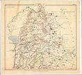
 Map of the Jerusalem Sanjak.jpg 571 × 1,006; 95 KB
-
 Map of the River Jordan and Dead Sea by W. F. Lynch.png 1,024 × 1,954; 2.98 MB
-
 Map of The River Jordan. 1871.jpg 1,679 × 2,734; 1.09 MB
-
 Maps 57 palestine megiddo (1600).jpg 1,600 × 1,232; 270 KB
-
 Mataheh.jpg 376 × 357; 289 KB
-
 Maury Geography 122D Palestine.jpg 484 × 798; 92 KB
-
 Medieval Arab Palestine.jpg 824 × 1,064; 191 KB
-
 Mishmar HaEmek i.jpg 893 × 405; 629 KB
-
 Mosaic Sail Tower.jpg 1,024 × 769; 404 KB
-
 Moshe Ganbash - Shiviti - Google Art Project.jpg 4,121 × 3,338; 7.68 MB
-
 Nr. 5. Acht Karten zur Geschichte Palaestinas.png 4,220 × 3,308; 39.97 MB
-
 Oldest surviving Ptolemaic map of Palestine, from Ptolemy's fourth map of Asia.png 1,313 × 836; 1.89 MB
-
 Operation Dekel.jpg 1,148 × 1,007; 2.33 MB
-
 Operation Hametz.jpg 733 × 378; 558 KB
-
 Operation Hiram.jpg 1,315 × 1,223; 2.76 MB
-
 Operation Nachshon i.jpg 1,062 × 539; 1.24 MB
-
 Operation Nachshon.jpg 1,453 × 645; 1.85 MB
-
 Operation Yiftach.jpg 597 × 1,094; 1.28 MB
-
 Operation Yoav iii.jpg 1,775 × 2,130; 6.33 MB
-
 Palestine according to Eusbius and Jerome - Smith 1915.jpg 2,416 × 3,987; 5.55 MB
-
 Palestine Arab Refugee Office map, showing Jewish-owned Land 31 March 1945.jpg 5,784 × 8,344; 11.53 MB
-

-

-
 Palestine Map in Gujarati - Jesus Period.png 472 × 684; 198 KB
-
 Palestine under the Maccabees Smith 1915.jpg 2,444 × 3,886; 6.03 MB
-
 Palestine under the Persians Smith 1915.jpg 2,155 × 3,460; 1.49 MB
-
 Palestine, Ptolemy, Claude R Conder, 1889.jpg 824 × 817; 126 KB
-
 Palestine-WW1-3-HE.jpg 588 × 848; 141 KB
-
 Palestine. LOC 98687122.jpg 5,784 × 8,344; 5.87 MB
-
 Palestine. LOC 98687122.tif 5,784 × 8,344; 138.08 MB
-
 Pauly-Wissowa II,1, 0360 b.jpg 749 × 914; 87 KB
-

-
 Plan of Sussita by Gottlieb Schumacher 1885.jpg 1,947 × 2,037; 1.52 MB
-
 Poleg.jpg 412 × 163; 16 KB
-
 Powles pp.160-1 16.11.17.jpg 2,265 × 2,814; 3.16 MB
-
 Powles pp.48-9 Magdhaba.jpg 2,572 × 2,144; 2.12 MB
-
 Ptolémaïde ou Acre. Jean Baptiste Bourguignon d'Anville. 18th century.jpg 1,120 × 1,300; 194 KB
-
 Ramma (Ramla) 1587.jpg 2,016 × 2,688; 1,019 KB
-
 Ramma (Ramla) 1657.jpg 2,472 × 1,517; 1.47 MB
-
 Routes et Villes de la Palestine. 1905-1905.jpg 1,870 × 2,365; 1.34 MB
-
 Sacred geography, and antiquities (1872) (14768851981).jpg 2,264 × 3,068; 740 KB
-
 Sacred geography, and antiquities (1872) (14769667914).jpg 2,136 × 3,536; 1.1 MB
-
 Sacred geography, and antiquities (1872) (14771693882).jpg 2,272 × 3,548; 965 KB
-
 Samaria, George Adam Smith.jpg 2,165 × 1,587; 1.18 MB
-
 Sarahanu el 'Amar cropped.jpg 5,935 × 2,932; 5.28 MB
-
 Sea of Galilee. A map of Canaan (8343807206) (cropped).jpg 662 × 848; 707 KB
-
 Shepherd-c-006-007.jpg 1,541 × 1,917; 827 KB
-
 Shepherd-c-024.jpg 984 × 1,544; 321 KB
-

-
 SofE7-22.1.17 697ZGaBee.jpeg 3,467 × 2,521; 1.93 MB
-
 Stieler, Adolf. Das Mittellandische Meer Und Nord-Afrika. 1875 BC.jpg 920 × 987; 251 KB
-
 Stieler, Adolf. Das Mittellandische Meer Und Nord-Afrika. 1875 BD.jpg 920 × 987; 257 KB
-
 Stielers Handatlas 1891 58.jpg 5,050 × 4,300; 6.87 MB
-
 Tabula moderna Terræ Sanctæ. RRA 3= 72. Pièce 49.jpg 2,304 × 1,790; 800 KB
-
 Tell Abu Hawam Plan 1932 (cropped).jpg 1,374 × 1,202; 495 KB
-
 Terra Canaan 1.jpg 1,400 × 2,919; 5.22 MB
-
-

-

-
-
 The Holman new self-pronouncing Sunday-school teachers Bible (1895) (14586876538).jpg 2,528 × 3,984; 1.36 MB
-
 The journeys, and deeds of Jesus, and scriptoral index on a new map of Palestine LOC 2009579464.jpg 8,975 × 12,631; 14.06 MB
-

-
-

-
 Toussaint, A. Carte de la Palestine. 1834.jpg 8,590 × 5,987; 7.18 MB
-
 Tribes of Israel 1658.jpg 2,483 × 1,995; 2.13 MB
-
 Tribus Aser.jpg 2,809 × 1,740; 1.99 MB
-
 Tribus des Juifs et Peuples avoisinants. 1905-1905.jpg 1,864 × 2,385; 1.06 MB
-
 Tribus Simeon 1658.jpg 2,487 × 1,896; 2.23 MB
-

-
 WoodheadMapB.png 1,000 × 1,485; 162 KB
-
 Березкин Д.М. Библейский атлас. (1911). — Палестина во время земной жизни Иисуса Христа.jpg 1,623 × 2,200; 1.81 MB
-
 Палестина (БЭАН).png 2,567 × 4,165; 248 KB
-
 אזור ואדי חנין במפת ז'אקוטן 1799.jpg 960 × 720; 120 KB
-
 חיספין במפה של גוטליב שומאכר מ-1885.jpg 461 × 405; 70 KB
-
 מפת המושבות היהודיות.png 2,592 × 4,294; 1.35 MB


_(14595190740).jpg)


.jpg)


.jpg)
.jpg)
.jpg)
.jpg)


_(14586247508).jpg)
_(14595154277).jpg)
.jpg)
.JPG)


_(14766736185).jpg)


_(page_11_crop).jpg)


.jpg)


.jpg)
.jpg)


.jpg)


_1587.jpg)
_1657.jpg)

_(14768851981).jpg)
_(14769667914).jpg)
_(14771693882).jpg)


_(cropped).jpg)


_-_par_le_Sr_Henry_Michelot,_pilote_r%C3%A9al_des_gal%C3%A8res_du_Roy_-_btv1b530281039_(12_of_55)_(cropped).jpg)


.jpg)


_(14586247508)_(cropped).jpg)
_(14586876538).jpg)

_(14578770890).jpg)
_(14578835499).jpg)


._Future_government_of_Palestine_Annex_A_Plan_of_Partition_with_Economic_Union.gif)

._%E2%80%94_%D0%9F%D0%B0%D0%BB%D0%B5%D1%81%D1%82%D0%B8%D0%BD%D0%B0_%D0%B2%D0%BE_%D0%B2%D1%80%D0%B5%D0%BC%D1%8F_%D0%B7%D0%B5%D0%BC%D0%BD%D0%BE%D0%B9_%D0%B6%D0%B8%D0%B7%D0%BD%D0%B8_%D0%98%D0%B8%D1%81%D1%83%D1%81%D0%B0_%D0%A5%D1%80%D0%B8%D1%81%D1%82%D0%B0.jpg)
.png)


.jpg)