Category:Maps of the history of Indonesia
Jump to navigation
Jump to search
| NO WIKIDATA ID FOUND! Search for Maps of the history of Indonesia on Wikidata | |
| Upload media |
Many in Category:History of Southeast Asia also depicts Indonesia. Some files there might not be categorized in this category yet.

Use the appropriate category for maps showing all or a large part of Indonesia. See subcategories for smaller areas:
| If the map shows | Category to use |
|---|---|
| Indonesia on a recently created map | Category:Maps of Indonesia or its subcategories |
| Indonesia on a map created more than 70 years ago | Category:Old maps of Indonesia or its subcategories |
| the history of Indonesia on a recently created map | Category:Maps of the history of Indonesia or its subcategories |
| the history of Indonesia on a map created more than 70 years ago | Category:Old maps of the history of Indonesia or its subcategories |
Subcategories
This category has the following 18 subcategories, out of 18 total.
!
*
C
- Maps of the Chola Empire (43 F)
D
M
- Maps of Tarumanagara (4 F)
- Maps of the Kingdom of Sunda (6 F)
- Maps of the Majapahit Empire (18 F)
- Maps of the Mataram Sultanate (13 F)
N
- Maps of Netherlands New Guinea (22 F)
U
Media in category "Maps of the history of Indonesia"
The following 80 files are in this category, out of 80 total.
-
 Sultanate of Aceh.png 2,900 × 3,770; 629 KB
-
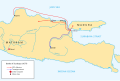
 Battle of Surabaya 1677 campaign map.png 921 × 615; 149 KB
-
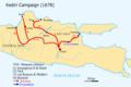 Kediri campaign map (1678).png 930 × 620; 162 KB
-
 Tunipalangga's conquests.png 516 × 778; 392 KB
-
 80LangMap002.jpg 700 × 374; 56 KB
-
 Aceh Sultanate Map.png 1,004 × 860; 106 KB
-
 AcehSultanate.png 4,072 × 2,420; 451 KB
-
 Administratif Majapahit Kingdom id.png 1,316 × 864; 461 KB
-
 Banjar Sultanate (orthographic projection) 1700.png 500 × 500; 97 KB
-
 Banjar Sultanate (orthographic projection).png 500 × 500; 97 KB
-
 Battle of Surabaya 1677 (id).svg 1,677 × 1,126; 1.54 MB
-
 Battle of Surabaya 1677.svg 1,677 × 1,126; 1.54 MB
-
 Borneo1945.png 1,219 × 659; 72 KB
-
 Buni Culture Map Crop.jpg 6,000 × 4,000; 14.33 MB
-
 Buni Culture Map.jpg 3,660 × 3,496; 6.56 MB
-
 Chola-Kingdom-Map 0.jpg 900 × 450; 46 KB
-
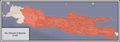
 Demak extent.png 2,359 × 1,082; 238 KB
-
 Demak locator-2.png 234 × 335; 92 KB
-
 Dermayu Kingdom id.jpg 3,201 × 2,567; 1.16 MB
-
 Dermayu Kingdom maps.jpg 1,280 × 1,280; 690 KB
-
 Founding of Talloq.png 1,028 × 628; 393 KB
-
 Galuh Kingdom.png 249 × 212; 26 KB
-
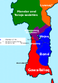
 Gowa vs Tellumpocco 1590 id.png 474 × 923; 148 KB
-
 Gujarat Jawadwipa maps.svg 1,000 × 670; 964 KB
-
 Gujarat Jawadwipa.svg 1,100 × 837; 956 KB
-
 Indonesia - Conquista neerlandesa après 1824.png 1,203 × 586; 239 KB
-
 Indonesia - Implantacion de la VOC en 1790.png 4,125 × 2,144; 879 KB
-
 Indonesia - Periòde dei Sultanats.png 1,556 × 868; 317 KB
-
 Indonesia - Srivijaya (sègles VII-IX).png 1,042 × 1,102; 277 KB
-
 Indonesia Rebublic provinces map-fr.svg 1,322 × 620; 420 KB
-
 Jambi Kingdom Map.png 1,280 × 1,280; 529 KB
-
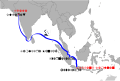
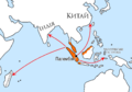
 JapanAdvanceIndonesia1942.png 1,254 × 450; 31 KB
-
 Japanese Empire2.png 1,032 × 1,201; 927 KB
-
 Japanese forces Borneo.jpg 2,009 × 1,408; 1.7 MB
-
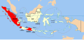
 JapaneseOccupiedIndonesia (ru).png 1,254 × 450; 55 KB
-
 JapaneseOccupiedIndonesia.png 1,254 × 450; 51 KB
-
 Japanseaanvallennederland.PNG 1,254 × 450; 42 KB
-
-
 Kerajaan di Jawa Barat.jpg 3,264 × 3,264; 2.22 MB
-
 Kongsi map.png 2,772 × 2,745; 1.19 MB
-
 Majapahit Kingdom.jpg 3,264 × 2,787; 1.3 MB
-
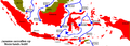
 Maluku sectarian conflict full.png 10,572 × 10,394; 29.85 MB
-
 Maluku sectarian conflict.png 6,626 × 4,292; 6.05 MB
-
 Manukan Kingdom id.jpg 3,264 × 2,579; 1.23 MB
-
 Map of Banjar Sultanate under Sultan Sulaiman.png 1,600 × 1,310; 424 KB
-
 Map of Manukan or Pawanuhan Kingdom.png 2,449 × 2,609; 3.67 MB
-
 Map of the Sultanate Demak and Dermayu id.png 3,264 × 2,777; 2.74 MB
-
 Mataram Baru 1830.png 1,137 × 1,128; 54 KB
-
 Merdeka Square 1965.jpg 458 × 519; 243 KB
-
 Miklouho-Maclay's travels - ru.png 1,500 × 1,254; 3.08 MB
-
 Pacific War - Dutch East Indies 1941-42 - Map.jpg 1,261 × 971; 187 KB
-
 PacificTheaterAug1942.jpg 1,199 × 873; 256 KB
-
 Pasai.jpg 348 × 256; 53 KB
-
 Peta Kerajaan Dermayu.jpg 1,280 × 1,031; 302 KB
-
 Peta Kerajaan Di Jawa Barat.png 1,648 × 1,296; 1.52 MB
-
 Rodrigues map.png 2,353 × 1,607; 353 KB
-
 Singhapura Kingdom id.jpg 1,278 × 754; 120 KB
-
 Singhapura Kingdom id.png 1,009 × 1,423; 1,000 KB
-
 Singhasari.gif 1,469 × 807; 26 KB
-
 Singkal and Kediri, Java.jpg 1,219 × 1,933; 514 KB
-
 South Sulawesi (1590) ID.svg 268 × 465; 272 KB
-
 South Sulawesi between Gowa and the Tellumpocco.png 474 × 902; 125 KB
-
 South Sulawesi circa 1600.svg 744 × 1,052; 207 KB
-
 Southeast Asia Portuguese Empire 1.png 1,600 × 1,060; 1.93 MB
-
 Southeast Asia Portuguese Empire.png 1,600 × 1,060; 1.93 MB
-
 Southeast Asia trade route map XIIcentury.jpg 1,696 × 1,440; 521 KB
-
 Srivijayan Expansion.gif 362 × 369; 568 KB
-
 SrivijayaUKR.png 3,036 × 2,118; 176 KB
-
 Sultanate of Mataram 1636.png 3,138 × 1,096; 583 KB
-
 Sultanate of the Demak id.png 3,264 × 3,264; 1.71 MB
-
 Sultanate of the Dermayu map.jpg 2,807 × 2,925; 941 KB
-
 SultanateMalacca.GIF 353 × 264; 26 KB
-
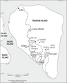 Tarakan Island map marked with locations relevant to the 1945 Battle of Tarakan.png 1,181 × 1,454; 197 KB
-
 Tarakan operations 1945.jpg 1,461 × 1,794; 524 KB
-
 Territorial Evolution of the Dutch East Indies.png 443 × 187; 20 KB
-
 Timor - Indonesian Invasion de2018.png 3,088 × 1,852; 654 KB
-
 Timor - Indonesian Invasion.png 3,088 × 1,852; 669 KB
-
 Timor 1700.png 2,000 × 1,683; 299 KB
-
 Timor sea.jpg 459 × 282; 37 KB
-
 Westtimor 1911.png 2,296 × 1,796; 1.19 MB


.png)


_1700.png)
.png)
.svg)


.png)


_ID.svg)


.png)