
Category:Maps of the history of Sri Lanka
Subcategories
This category has the following 9 subcategories, out of 9 total.
A
C
- Maps of the Chola Empire (46 F)
D
- Maps of Dutch Ceylon (4 F)
J
K
P
- Maps of the Pandyan Dynasty (13 F)
S
Media in category "Maps of the history of Sri Lanka"
The following 36 files are in this category, out of 36 total.
-
 Ancient trisinhalaya-locator-map.png 1,000 × 1,413; 249 KB
-
 Campaign of Danture 1594.png 2,307 × 2,876; 324 KB
-
 Ceylon 1880.jpg 2,732 × 3,689; 8.55 MB
-
 Charte von Ostindien nach I. Rennel. Gebrüder Lotter — between 1777 and 1810.jpg 1,637 × 2,000; 932 KB
-
 Danish Trincomalee ca 1620.png 800 × 1,116; 198 KB
-
 De jure political map of Sri Lanka, early 17th century.png 2,293 × 3,175; 622 KB
-
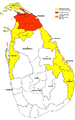 Extent of territorial control in sri lanka-08-2008.png 601 × 960; 208 KB
-
 Extent of territorial control in sri lanka.png 601 × 960; 243 KB
-
 Growth of sitawaka final.png 700 × 944; 1.89 MB
-
 Joris van Spilbergen visits King Kandy (1602).jpg 842 × 540; 378 KB
-
 Karte von Ceylon.jpg 352 × 540; 57 KB
-
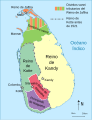
 Kingdom of Dambadeniya.jpg 782 × 980; 100 KB
-
 Kingdom of Dambadeniya.svg 512 × 781; 69 KB
-
 Kingdom of Gampola.jpg 782 × 980; 98 KB
-
 Kingdom of Gampola.svg 512 × 781; 68 KB
-
 Kingdom of Polonnaruwa.jpg 782 × 980; 101 KB
-
 Kingdom of Polonnaruwa.svg 512 × 781; 71 KB
-
 Kingdom of Tambapanni.svg 512 × 714; 54 KB
-
 Kotte kingdom.jpg 336 × 375; 23 KB
-
 Map of Santa Cruz de Gale (1640).png 2,486 × 3,144; 711 KB
-
 Map of Sri Jayawardenapura Kotte (1557 -1565).png 2,241 × 2,434; 961 KB
-
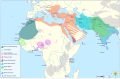 Map of the MENA region in 1798.svg 1,543 × 1,006; 528 KB
-
 Maya Rata map.jpg 2,000 × 2,827; 990 KB
-
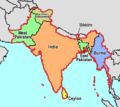
 Modern india.png 1,581 × 1,226; 162 KB
-
 Partition of India.PNG 450 × 400; 27 KB
-
 Sri Lanka - Division territòriala en 1520.png 781 × 1,159; 118 KB
-
 Sri Lanka - Guèrra Civila (situacion en 2007).png 781 × 1,159; 173 KB
-
 Sri Lanka geopolitics - after "Spoiling of Vijayabahu".png 2,441 × 3,257; 575 KB
-
 Sri Lanka geopolitics - after Spoiling of Vijayabahu (Ver.Japanese).jpg 3,000 × 4,000; 2.62 MB
-
 Sri Lanka geopolitics, 1520s.png 700 × 944; 703 KB
-
 SriLankaGeopoliticsAfterSpoilingOfVijayabahu-es.svg 596 × 775; 553 KB
-
 SungaEmpireMap.jpg 1,202 × 1,440; 322 KB
-
 Territorial control in Sri Lanka 2007.png 601 × 960; 89 KB
-
 Territorial control in Sri Lanka 200704.png 601 × 960; 293 KB
-
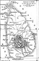
 The Mahavamsa or the Great Chronicle of Ceylon - Map of Ancient Ceylon.png 1,956 × 3,305; 710 KB
-
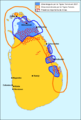
 Vijayabahu I's battle plan.png 568 × 853; 69 KB


.jpg)


.png)
.png)


.png)

.jpg)


