Category:Maps showing 20th-century history
Jump to navigation
Jump to search
| Preceded by: 19th century maps |
20th century maps 1901 AD-2000 AD |
Succeeded by: 21st century maps |
Subcategories
This category has the following 34 subcategories, out of 34 total.
Pages in category "Maps showing 20th-century history"
This category contains only the following page.
Media in category "Maps showing 20th-century history"
The following 116 files are in this category, out of 116 total.
-
154-155BriarcliffManor1.jpg 1,536 × 1,079; 409 KB
-
1900azie.jpg 914 × 709; 51 KB
-
1908- Ossining, Briarcliff Manor.jpg 11,710 × 8,080; 13.31 MB
-
1939 Eastern Pacific Hurricane Track Map.PNG 5,184 × 4,352; 1.04 MB
-
1960azie.jpg 914 × 709; 42 KB
-
Armenien 1914.png 2,360 × 1,650; 1,002 KB
-
Balkans 1913.jpg 3,689 × 2,835; 2.58 MB
-
Bitwa pod Krajanką.png 850 × 425; 151 KB
-
BleialfArea 429.jpg 1,459 × 886; 121 KB
-
BriarcliffOutlookV1-Oct.1906-Mar.1907Image1.jpg 1,003 × 680; 200 KB
-
BriarcliffOutlookV1-Oct.1906-Mar.1907Image2.jpg 2,416 × 1,668; 3.52 MB
-
Burned villages central Asia Minor Greeks 1919-1922.jpg 3,812 × 2,415; 1.98 MB
-
CampañaRumana1944.jpg 1,280 × 990; 940 KB
-
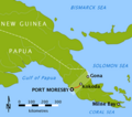
Capture of Noemfoor.jpg 1,400 × 1,831; 557 KB
-
Caucasiamapussr-ar.gif 739 × 623; 199 KB
-
Convention de Varsovie.png 1,400 × 625; 27 KB
-
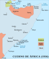
Cuerno de Africa1936-es.svg 1,387 × 1,659; 303 KB
-
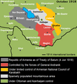
Eastern Armenia October 1918 map.png 582 × 634; 43 KB
-
Europe 1911 Caucasus and the Black Sea.jpg 887 × 591; 144 KB
-
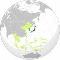
Greater Japanese empire.png 1,004 × 1,004; 280 KB
-
Guerre des Malouines.png 1,207 × 2,018; 1.4 MB
-
Israel nach Sechstagekrieg.svg 1,350 × 2,029; 144 KB
-
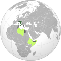
Italian Colonial Empire (orthographic projection).svg 551 × 550; 758 KB
-
ItaliaUnità.png 387 × 2,293; 60 KB
-
Jan Emmer 08.jpg 1,520 × 2,128; 1.08 MB
-
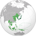
Japanese Empire (orthographic projection).svg 600 × 600; 665 KB
-
Japanese concessions in Tianjin (天津日本租界全圖).jpg 1,587 × 1,443; 255 KB
-
Japanese Korea (orthographic projection).svg 600 × 600; 515 KB
-
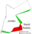
Jordan-Saudi Arabia Land Exchange.gif 335 × 355; 6 KB
-
Karte Reichsparteitagsgelände Nürnberg 1940 high.png 3,335 × 2,607; 709 KB
-
Killikiadana.gif 700 × 520; 52 KB
-
Kingdom of Kampuchea (Japanese puppet state).png 1,280 × 640; 119 KB
-
Landkarte sössen 1903.jpg 1,744 × 1,374; 1.4 MB
-
Lemko, West-Ukrainien & Hutsul claims 1918.png 645 × 439; 150 KB
-
Leyte map annotated.jpg 1,001 × 1,454; 251 KB
-
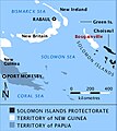
Location of Bougainville.jpg 223 × 251; 56 KB
-
Luxgrenz.jpg 605 × 454; 43 KB
-
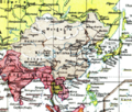
Map of Asia from 1932 Meyers Konversationslexikon.jpg 3,114 × 2,512; 2.36 MB
-
Map of Mountain ASSR.png 996 × 513; 67 KB
-
Map of Southern Rhodesia c1927.jpg 1,400 × 828; 252 KB
-
Map of the Southern Front w.jpg 1,411 × 638; 600 KB
-
Mapa-mediterraneo-sxx-ac.jpg 1,400 × 947; 337 KB
-
Nastuplenie gruppy ar Sever na Leningrad 1941.jpg 982 × 1,006; 152 KB
-
Oberschlesien 1921 Voten.png 411 × 323; 13 KB
-
Oberschlesien 1921.png 411 × 323; 13 KB
-
Op Urgent Fury Invasion Map.jpg 816 × 539; 106 KB
-
Operation Wunderland.png 1,772 × 1,772; 677 KB
-
Oulun läänin eteläinen vaalipiiri.png 1,409 × 1,629; 128 KB
-
PalestineAndTransjordan-HE.jpg 636 × 599; 139 KB
-
PalestineAndTransjordanPL.png 636 × 599; 1.46 MB
-
Partiment de l'Empèri Otoman (1923).png 574 × 694; 133 KB
-
Partiment de l'Empèri Otoman 1923-es.svg 398 × 515; 2.17 MB
-
Partiment Germanosovietic d'Euròpa Orientala.png 905 × 622; 141 KB
-
Peking environs 1912.jpg 2,031 × 2,330; 835 KB
-
Pieni 2 0791 China.png 514 × 437; 611 KB
-
Pink's War map.png 689 × 681; 86 KB
-
Plan of Moscow 1917 cropped.jpg 1,711 × 970; 826 KB
-
Plan of Rostov-on-Don 1917.jpg 8,669 × 6,366; 30.6 MB
-
Plano provisorio frontera Chile-bolivia 1904.jpg 824 × 2,236; 2.45 MB
-
Png potts.png 220 × 195; 119 KB
-
Poisoning in Kosovo )the route).png 941 × 759; 204 KB
-
Praying Mantis operation map-fr.svg 755 × 598; 1.04 MB
-
Provinces of Cambodia loss to Thailand during Franco-Thai War Km.png 1,200 × 900; 4.14 MB
-
Provinces of Cambodia loss to Thailand during Franco-Thai War.png 1,200 × 900; 187 KB
-
Provinces of Venezia Giulia (1923-1947).svg 1,813 × 3,897; 41 KB
-
Rep. Moldova Iulie 1940.jpg 527 × 593; 432 KB
-
Republics of the USSR ur.svg 4,237 × 2,900; 690 KB
-
Republics of the USSR.svg 1,345 × 920; 103 KB
-
Rhineland Versailles treaty English.png 2,820 × 1,766; 1.7 MB
-
Route of Envoys Appeal the Voting Women of the West 160080v.jpg 2,955 × 2,639; 1.44 MB
-
Rusinovo 41-11-5.jpg 795 × 621; 179 KB
-
Russland 1905.png 1,446 × 2,000; 1.6 MB
-
Ruta flota japonesa.png 1,489 × 1,053; 195 KB
-
Rzeczpospolita Central Lithuania - Litwa Środkowa - mapa.gif 777 × 581; 27 KB
-
Rzeczpospolita Central Lithuania.png 635 × 408; 21 KB
-
Silala en mapa 1904.png 470 × 404; 491 KB
-
Simla Accord Treaty 1914 Map1.jpg 800 × 629; 151 KB
-
Simla Accord Treaty 1914 Map2.jpg 2,424 × 1,872; 1.42 MB
-
Soviet Socialist Republics numbered by the Soviet constitution.png 1,200 × 821; 167 KB
-
Soviet Union Map.png 1,356 × 928; 63 KB
-
Territoire du mandat britannique 2.png 689 × 1,280; 156 KB
-
Tianjin 20051107 concessions coloured He.jpg 1,445 × 1,447; 2.1 MB
-
Tianjin 20051107 concessions coloured.jpg 1,448 × 1,450; 1.65 MB
-
Tibet and India map detail, from- LA2-Blitz-0103 (cropped).jpg 353 × 274; 46 KB
-
Tschechoslowakei(vor,nach 2.WK).png 2,117 × 4,539; 331 KB
-
Ukraine provisional borders 1919 corrected.jpg 1,996 × 1,506; 1.27 MB
-
Umowa o zamianie granic 1951.jpg 191 × 302; 88 KB
-
USSR map.svg 250 × 175; 63 KB
-
USSR Republics Numbered Alphabetically in russian.png 1,356 × 928; 50 KB
-
USSR Republics Numbered Alphabetically.png 1,356 × 928; 80 KB
-
USSR Republics numbered by alphabet.svg 1,345 × 942; 42 KB
-
USSR Republics numbered by Constitution.svg 1,345 × 942; 42 KB
-
USSR Republics numbered by Thai alphabet.svg 1,345 × 942; 45 KB
-
Venezia Giulia province.png 1,930 × 3,967; 414 KB
-
Versailler Vertrag-ar.png 2,000 × 1,414; 763 KB
-
RepúblicaPopularDeUcraniaOccidentalNoviembre1918.svg 847 × 789; 121 KB
-
Winter war ladoga it.png 882 × 612; 523 KB
-
Winter war north ladoga.jpg 1,041 × 750; 314 KB
-
Zgierz (Görnau) mapa niemiecka 1944.jpg 1,577 × 1,189; 1,012 KB
-
Zgierz map 1936.jpg 1,630 × 1,159; 1,013 KB
-
Zgierz mapa wojskowa 1937.jpg 1,395 × 1,237; 1.07 MB
-
Zhejiang ROC vi.jpg 391 × 346; 16 KB
-
Військова кампанія в центральній частині Тихого океану 1943-1944 рр.png 1,356 × 1,376; 172 KB
-
Карта Бессарабии.png 1,846 × 2,338; 4.33 MB
-
Операция разбег 004.png 7,170 × 5,020; 84.98 MB
-
Операция разбег 005.png 1,050 × 821; 1.48 MB
-
Операция разбег 006.png 669 × 470; 865 KB
-
Операция разбег 007.png 1,478 × 1,407; 1.17 MB
-
Юго-Восточная область РСФСР (1924).png 2,000 × 2,304; 381 KB
-
中國國民黨撤退路線圖.png 795 × 640; 33 KB
-
구 소련 국가 (15개국).jpg 1,422 × 928; 141 KB
-
구 소련 국가.png 1,422 × 928; 81 KB
-
구 소련국가.png 1,422 × 928; 70 KB


