
Category:Maps of the West Bank barrier
Media in category "Maps of the West Bank barrier"
The following 22 files are in this category, out of 22 total.
-
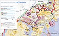 Barrier near Bethlehem 2011.jpg 5,288 × 3,273; 3.4 MB
-
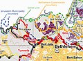
 Barrier north Jerusalem.jpg 809 × 834; 362 KB
-
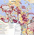
 Barrier route July 2011.png 2,748 × 7,554; 2.48 MB
-
 Barrieredesecurite.png 358 × 594; 21 KB
-
 BarrierFeb2005.png 358 × 592; 18 KB
-
 BarrierMay2005 no.png 358 × 592; 7 KB
-
 BarrierMay2005-ar.png 358 × 592; 28 KB
-
 BarrierMay2005.png 358 × 592; 7 KB
-
 BarrierMay2005Hebrew.png 358 × 592; 18 KB
-
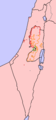
 East Jerusalem enclaves.jpg 703 × 925; 325 KB
-
 Israel 2004.png 700 × 1,506; 34 KB
-
 Jerusalem separation wall.svg 1,609 × 1,397; 724 KB
-
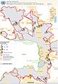 Jerusalem-barrier July 2011-OCHAoPt.jpeg 1,253 × 1,826; 293 KB
-
 Jerusalem-barrier June 2007-OCHAoPt.jpeg 1,159 × 1,092; 190 KB
-
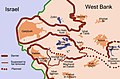
 Location of Rachel's tomb.png 784 × 590; 389 KB
-
 Qalqiliya Security Wall.png 606 × 606; 189 KB
-
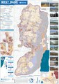
 Separation Barrier Map Eng PNG 2.png 4,186 × 6,644; 6.21 MB
-
 Separation Barrier Map Eng PNG.png 5,581 × 8,859; 2.95 MB
-
 Walaja Barrier 2011.jpg 1,657 × 1,213; 695 KB
-
 WBEnclaves.jpg 644 × 426; 58 KB
-
 West Bank Access Restrictions June 2020.pdf 4,964 × 7,020; 15.18 MB
-
 Westbank barrier.png 500 × 947; 274 KB


