Category:Maps of Palestine
Jump to navigation
Jump to search
Wikimedia category | |||||
| Upload media | |||||
| Instance of | |||||
|---|---|---|---|---|---|
| Category combines topics | |||||
| Palestine | |||||
geographic region in western Asia | |||||
| Pronunciation audio | |||||
| Instance of |
| ||||
| Part of |
| ||||
| Location | West Asia | ||||
| Different from | |||||
| Said to be the same as | Land of Israel, Holy Land in Islam | ||||
| Partially coincident with | |||||
 | |||||
Maps of the region of Palestine before 1948 are in Category:Maps of the history of Palestine. See also the Atlas of Palestine here on the Wikimedia Commons, for an organized and commented collection of geographical, political and historical maps of this historic region, split and disputed today between the State of Israel and the State of Palestine (Palestinian territories).
Subcategories
This category has the following 16 subcategories, out of 16 total.
!
"
*
D
H
- Maps of the Herodian Kingdom (23 F)
L
M
- Maps of El Majdal (11 F)
- Maps of Naharayim (9 F)
O
P
S
- Maps of Palestine on stamps (14 F)
T
Pages in category "Maps of Palestine"
This category contains only the following page.
Media in category "Maps of Palestine"
The following 88 files are in this category, out of 88 total.
-
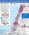
20240502 DM UCPM EU humanitarian aid response(1).pdf 1,350 × 1,625; 609 KB
-
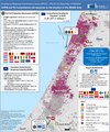
20240627 DM UCPM EU humanitarian aid response.pdf 1,350 × 1,625; 648 KB
-
20240703 DM EHRC operations.pdf 1,625 × 1,125; 487 KB
-
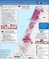
20240725 DM UCPM EU humanitarian aid response.pdf 1,350 × 1,625; 671 KB
-
20240823 DM UCPM EU humanitarian aid response ME.pdf 1,350 × 1,625; 602 KB
-
20241003 DM UCPM EU humanitarian aid response MEv2(2).pdf 1,350 × 1,625; 606 KB
-
20241025 DM EHRC operations2.pdf 1,625 × 1,125; 498 KB
-
20241129 DM UCPM EU humanitarian aid response Gaza.pdf 1,347 × 1,622; 12.7 MB
-
20241213 DM Gaza EG Medevac(2).pdf 1,752 × 1,239; 476 KB
-
CanadaParkCropped.jpg 828 × 656; 92 KB
-
Carte nabatene ret 0.jpg 1,398 × 1,440; 201 KB
-
Descriptio Palestinæ nova per Matheum Paganum Venetiisad insigne fidei. RRA 3= 72. Pièce 51.jpg 17,850 × 12,746; 47.69 MB
-
ECDM 20140728 World Events.pdf 1,625 × 1,125; 748 KB
-
ECDM 20140814 World Events.pdf 1,625 × 1,125; 386 KB
-
ECDM 20231016 PalestineIsrael repatriations update.pdf 1,752 × 1,239; 630 KB
-
ECDM 20240418 DM EHRC operations.pdf 1,625 × 1,125; 458 KB
-
ECHO Palestine Editable A4 Landscape.pdf 1,754 × 1,239; 291 KB
-
EmekHefer1937.png 7,111 × 5,629; 1.14 MB
-
Ethno-Confessional groups of Israel and Palestinian territories.png 3,484 × 2,985; 11.87 MB
-
Hulata 1945.jpg 447 × 392; 117 KB
-
Is-wb-gs-gh v3-ar.png 1,428 × 2,289; 737 KB
-
Is-wb-gs-gh v3.png 1,428 × 2,289; 259 KB
-
Israel and occupied territories map.png 1,428 × 2,289; 266 KB
-
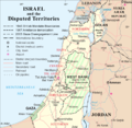
Israel and the Disputed Territories map (cropped).png 1,350 × 1,317; 908 KB
-
Israel Blank Map (de facto borders).png 1,812 × 2,209; 344 KB
-
Israel de facto territories.png 1,428 × 2,289; 703 KB
-
Israel with occupied territories.gif 254 × 607; 9 KB
-
Israelmap001.jpg 450 × 824; 41 KB
-
Jerusalem map Green Line.png 328 × 370; 35 KB
-
JezreelZionistMap1925-bright.jpg 3,100 × 1,987; 966 KB
-
JordanRiver-ar.png 474 × 599; 60 KB
-
Key Map of JG Project.jpg 4,959 × 3,506; 3.85 MB
-
Kvish HaHof map.svg 614 × 1,141; 174 KB
-
Lajjun Sanjak Map.png 1,130 × 1,064; 631 KB
-
Latrun Salient.png 2,360 × 2,814; 778 KB
-
Map Ancient Palestine 1928-1940 - Touring Club Italiano CART-TRC-36.jpg 4,196 × 6,414; 2.61 MB
-
Map of Abd al-Ghani al-Nabulsi's travels in Palestine.jpg 1,640 × 2,360; 170 KB
-
Map of Palestine.svg 512 × 1,024; 17 KB
-
Map of pre-Nakba Palestine framed صورة لخارطة لفلسطين ما قبل النكبة.jpg 1,280 × 1,920; 956 KB
-
Mapa de Cisjordània.png 575 × 600; 150 KB
-
Mapa línea de armisticio 1949.png 301 × 301; 14 KB
-
October 2023 Gaza−Israel conflict - as of Oct 27.svg 3,763 × 3,258; 7.92 MB
-
Osmanlı borçlarını ödeyen ülkeler.png 4,252 × 3,403; 1.02 MB
-
Palestine - DPLA - 1f3639d995e3b88a91606cb1c2fe6ca9.jpg 3,288 × 4,784; 1.55 MB
-
Palestine - DPLA - 2a237714530533f25536b6db310d574b.jpg 3,151 × 4,746; 1.42 MB
-
Palestine - DPLA - 62f870736a5aa9174d4acf5ec6a2a6c2.jpg 4,200 × 6,336; 3.29 MB
-
Palestine - DPLA - 80c1fea6a863a86ef067f0684d1ceef5.jpg 11,969 × 7,010; 4.37 MB
-
Palestine - DPLA - cdd38a37d45c8f86b678c926c9e54562.jpg 3,300 × 4,744; 1.69 MB
-
Palestine - DPLA - f3eb8a2bbfd9dfd90013ba8032ae44ba (page 1).jpg 6,748 × 12,220; 7.7 MB
-
Palestine - DPLA - f3eb8a2bbfd9dfd90013ba8032ae44ba (page 2).jpg 6,160 × 11,590; 7.37 MB
-
Palestine -All Claims Administrative Divisions - eu - Colored.png 708 × 825; 153 KB
-
Palestine and Levant grids.png 500 × 400; 91 KB
-
Palestine disputed w1 countrymap.svg 1,000 × 1,000; 13 KB
-
Palestine flag in historical Palestine 🇵🇸.jpg 800 × 1,207; 79 KB
-
Palestine in 1721.jpg 1,308 × 1,238; 268 KB
-
Palestine Index to Villages & Settlements - DPLA - 825a85b136fa6a56a8e884c0f180c3c7.jpg 7,100 × 12,401; 9.24 MB
-
Palestine Jewish Agency Proposal - DPLA - 9f665add532a976c3caf3872220ff2e0.jpg 3,211 × 5,733; 2.17 MB
-
Palestine Mean Annual Rainfall - DPLA - a55f208cb0b3484e4b51730318385829.jpg 4,020 × 7,816; 4.71 MB
-
Palestine Population by Areas - DPLA - 35e350b1b1ee363e779f0ac5b8f6e368.jpg 3,162 × 5,714; 2.12 MB
-
Palestine Proposed Plans for Administration - DPLA - 8c573864c8505d666b8f362066b04c2b.jpg 4,952 × 3,457; 1.47 MB
-
Palestinian Authority and Gaza Strip.png 965 × 1,107; 606 KB
-
Palestinian Authority.png 969 × 1,108; 608 KB
-
Palestinian casualties in Gaza since January 1, 2008.jpg 986 × 702; 73 KB
-
PalestinianEmiratesPlan.svg 450 × 500; 123 KB
-
Philister Süd.jpg 1,115 × 958; 335 KB
-
Philister Zentrum.jpg 934 × 921; 322 KB
-
Philistäa zur Assyrerzeit.jpg 1,078 × 915; 158 KB
-
Philistäa.jpg 1,044 × 915; 248 KB
-
Plan de l'ONU de 1947 pour le partage de la Palestine.jpg 320 × 586; 55 KB
-
Proposed Israel-Palestine Conflict Solutions.svg 512 × 698; 374 KB
-
Shod za mir in v podporo Palestini v Ljubljani 13. oktobra 2023 18.jpg 1,600 × 1,067; 406 KB
-
Solución de dos Estados.png 2,336 × 4,424; 481 KB
-
Solución de tres Estados renovado.png 4,656 × 4,424; 1,004 KB
-
Solución de tres Estados.png 2,264 × 4,424; 472 KB
-
Solución de un Estado.png 2,336 × 4,424; 470 KB
-
SVG example accuracy right 2.svg 200 × 200; 8 KB
-
Syrian, Iraqi, and Lebanese insurgencies REAL.png 800 × 612; 323 KB
-
Terra sancta sive promissionis olim Palestina per Fredericum de Wit. (1610-1698).jpg 9,000 × 7,500; 45.79 MB
-
The Land of the Hebrews, H. G. Wells' Outline of History, page 126.jpg 1,420 × 2,312; 540 KB
-
Yarkon Park and 1947 land ownership.png 663 × 302; 134 KB
-
Yekaterinburg Synagogue 25.jpg 6,936 × 9,248; 9.07 MB
-
Yusuf Sayfa Territorial Zenith.png 856 × 1,204; 252 KB
-
خريطة الجمامة.jpg 1,200 × 1,600; 53 KB


