Category:Maps of the history of Schleswig-Holstein
Jump to navigation
Jump to search
Federal states of Germany:
Use the appropriate category for maps showing all or a large part of Schleswig-Holstein. See subcategories for smaller areas:
| If the map shows | Category to use |
|---|---|
| Schleswig-Holstein on a recently created map | Category:Maps of Schleswig-Holstein or its subcategories |
| Schleswig-Holstein on a map created more than 70 years ago | Category:Old maps of Schleswig-Holstein or its subcategories |
| the history of Schleswig-Holstein on a recently created map | Category:Maps of the history of Schleswig-Holstein or its subcategories |
| the history of Schleswig-Holstein on a map created more than 70 years ago | Category:Old maps of the history of Schleswig-Holstein or its subcategories |
Subcategories
This category has the following 8 subcategories, out of 8 total.
Media in category "Maps of the history of Schleswig-Holstein"
The following 45 files are in this category, out of 45 total.
-
Abstimmung-schleswig-1920.png 3,403 × 2,315; 193 KB
-
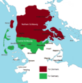
Plebiszit in Nordschleswig.svg 1,119 × 752; 357 KB
-
Plébiscites du Schleswig (1920).png 2,626 × 1,760; 819 KB
-
Slaget ved Bov 1848.jpg 749 × 599; 85 KB
-
AreasSettlementSchleswig-Holstein.png 1,260 × 1,440; 270 KB
-
AreasSettlementSchleswig-HolsteinText.png 1,260 × 1,440; 321 KB
-
BosætningsområderSlesvig-Holsten.png 1,260 × 1,440; 270 KB
-
BosætningsområderSlesvig-HolstenTekst.png 1,260 × 1,440; 322 KB
-
Danish Conquest of Holstein 1201.png 1,280 × 1,280; 1.01 MB
-
Danish Empire and campaigns 1168-1227.png 2,048 × 1,536; 1.1 MB
-
Duchy of Slesvig.png 298 × 341; 25 KB
-
Herzogtum Sachsen 1000.PNG 785 × 763; 262 KB
-
Herzogtümer.png 2,000 × 2,395; 791 KB
-
Karte Deutsch-Dänischer Krieg Gebietsveränderungen.svg 1,860 × 2,227; 696 KB
-
Karte Deutsch-Dänischer Krieg Militärereignisse.png 1,861 × 2,228; 708 KB
-
Karte Deutsch-Dänischer Krieg no.svg 1,860 × 2,178; 389 KB
-
Karte Deutsch-Dänischer Krieg-es.svg 1,984 × 2,324; 910 KB
-
Karte Deutsch-Dänischer Krieg-fr.svg 1,860 × 2,178; 297 KB
-
Karte Deutsch-Dänischer Krieg.png 2,083 × 2,439; 348 KB
-
Karte Deutsch-Dänischer Krieg.svg 1,860 × 2,178; 389 KB
-
Limes.saxoniae.wmt.png 795 × 515; 55 KB
-
Karte-Oldenburg-Ex.png 518 × 1,047; 20 KB
-
Map Barber-Lyaschenko contract.png 797 × 1,090; 49 KB
-
Map SLH-1650 EN.png 900 × 895; 384 KB
-
Map SLH-1650.png 900 × 895; 345 KB
-
Map SLH-1650dansk.png 900 × 895; 317 KB
-
Map SLH-1650leer.png 900 × 895; 299 KB
-
Nordalbingia locator map (1000).svg 1,500 × 1,500; 5.62 MB
-
Osterwall-Østervold.png 1,247 × 671; 160 KB
-
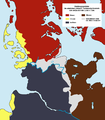
Schleswig referendum, results by zone, 1920.png 1,413 × 1,436; 339 KB
-
Scandinavia 1219.gif 1,500 × 1,754; 51 KB
-
Scandinavia 1814.gif 1,500 × 1,754; 45 KB
-
Scandinavia1219-HE.png 1,500 × 1,754; 123 KB
-
Scandinavia1219.png 1,500 × 1,754; 41 KB
-
SchleisperrwerkSlispærring.png 1,162 × 538; 174 KB
-
Schleswig-Holstein innerhalb der britischen Besatzungszone 1946.svg 512 × 624; 454 KB
-
SiedlungsgebieteSchleswig-Holstein.png 1,260 × 1,440; 272 KB
-
SiedlungsgebieteSchleswig-HolsteinText.png 1,260 × 1,440; 156 KB
-
SiedlungsgebieteSchleswig-HolsteinTextDanewerk.png 1,260 × 1,440; 324 KB
-
SprachlicheVerhältnisseSchleswig.png 824 × 889; 262 KB
-
Sproggrænsen.png 1,247 × 1,267; 135 KB
-
Swedish Empire Map-es.svg 1,456 × 1,678; 253 KB
-
Swedish Empire Map-hu.svg 1,456 × 1,678; 192 KB
-
Vendit.png 847 × 587; 165 KB
-
VitalienbruederNordsee.png 1,633 × 1,622; 1.19 MB


