Category:Maps of the history of Lower Saxony
Jump to navigation
Jump to search
Federal states of Germany:
Use the appropriate category for maps showing all or a large part of Lower Saxony. See subcategories for smaller areas:
| If the map shows | Category to use |
|---|---|
| Lower Saxony on a recently created map | Category:Maps of Lower Saxony or its subcategories |
| Lower Saxony on a map created more than 70 years ago | Category:Old maps of Lower Saxony or its subcategories |
| the history of Lower Saxony on a recently created map | Category:Maps of the history of Lower Saxony or its subcategories |
| the history of Lower Saxony on a map created more than 70 years ago | Category:Old maps of the history of Lower Saxony or its subcategories |
Subcategories
This category has the following 24 subcategories, out of 24 total.
Media in category "Maps of the history of Lower Saxony"
The following 49 files are in this category, out of 49 total.
-
Hanse-Departments.png 2,362 × 1,709; 1.28 MB
-
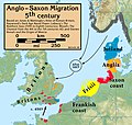
Anglo.Saxon.migration.5th.cen.jpg 1,800 × 1,703; 875 KB
-
JadeWeser-arngast.png 478 × 476; 19 KB
-
Bakker Schut-plan.PNG 664 × 466; 23 KB
-
Braunschweig 1932-1945.png 5,155 × 4,000; 2.47 MB
-
Corvey possessions.svg 461 × 396; 876 KB
-
1811k Aller ok.JPG 1,177 × 889; 171 KB
-
Die Freien vor dem Nordwalde.png 704 × 535; 41 KB
-
Friesische Seelande Brookmerland.PNG 1,191 × 666; 259 KB
-
Graafschap Pyrmont.png 198 × 229; 14 KB
-
Countships of Schaumburg.png 1,713 × 2,362; 314 KB
-
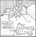
Guelf c12.jpg 600 × 614; 76 KB
-
Hannover innerhalb der britischen Besatzungszone 1946.svg 512 × 624; 454 KB
-
Annexations of France North 1795-1811 -es.svg 932 × 832; 622 KB
-
Annexations of France North 1795-1811 -nl.svg 957 × 838; 921 KB
-
Departments of French Empire North 1811-ex.svg 957 × 838; 947 KB
-
Herzogtum Sachsen 1000.PNG 785 × 763; 262 KB
-
HRR 1400, Ausschnitt Grafschaft Hohnstein.jpg 398 × 399; 68 KB
-
JadeWeser.png 3,365 × 3,231; 655 KB
-
Karte - Britisch-Kanadischer Vormarsch, April 1945.png 1,164 × 577; 214 KB
-
Karte Stammesherzogtum Sachsen um 1000-es.svg 1,500 × 1,500; 5.35 MB
-
Karte Stammesherzogtum Sachsen um 1000.png 1,090 × 1,124; 1.16 MB
-
Locator County of Bentheim (1560).svg 3,821 × 3,455; 374 KB
-
Locator Prince-Bishopric of Osnabrück (1560).svg 3,821 × 3,455; 375 KB
-
Loingau19042012.jpg 1,465 × 1,760; 233 KB
-
Map-WR-Oldenburg.svg 1,185 × 1,007; 541 KB
-
NDS Kreise + Backsteingotik.png 1,686 × 1,423; 329 KB
-
Nordwestblock.png 632 × 435; 113 KB
-
Ostfalia locator map (1000).svg 1,500 × 1,500; 5.62 MB
-
Saxe primitive.JPG 576 × 551; 103 KB
-
Saxon.emigration.5th.cen.jpg 2,301 × 2,140; 1,000 KB
-
Saxony locator map (1000).svg 4,431 × 3,875; 4.7 MB
-
Schuchardt Atlas Nds (6).jpg 3,048 × 1,543; 2.06 MB
-
Seelandeauricherland.png 1,191 × 666; 241 KB
-
Seelandeemsigerland.png 1,191 × 666; 242 KB
-
Seelandefedergo.png 1,191 × 666; 241 KB
-
Seelandeharlingerland.png 1,191 × 666; 254 KB
-
Seelandelengen.png 1,191 × 666; 254 KB
-
Seelandenorden.png 1,191 × 666; 254 KB
-
Seelandeoestringen.png 1,191 × 666; 254 KB
-
Seelanderheiderland.png 1,191 × 666; 254 KB
-
Seelandeverledingen.png 1,191 × 666; 254 KB
-
Spruner-Menke Handatlas 1880 Karte 33 (Leinegau).jpg 1,319 × 1,614; 1.07 MB
-
Spruner-Menke Handatlas 1880 Karte 33 (Liesgau).jpg 1,472 × 1,642; 1.16 MB
-
Swedish Bremen-Verden.svg 1,800 × 1,800; 305 KB
-
TerritoriosGüelfosEnriqueElLeón5.svg 1,337 × 1,339; 421 KB
-
Thidrekssaga Karte.jpg 532 × 608; 131 KB
-
VitalienbruederNordsee.png 1,633 × 1,622; 1.19 MB


