Category:Maps of the history of Lübeck
Jump to navigation
Jump to search
Media in category "Maps of the history of Lübeck"
The following 15 files are in this category, out of 15 total.
-
Deutsches Reich (Karte) Lübeck.svg 650 × 545; 1.04 MB
-
HRR 1648 Hst Lübeck.png 681 × 613; 226 KB
-
Karte - Lübecker Bucht - Lübecker-Bucht-Fall - 2.png 896 × 687; 115 KB
-
Karte - Lübecker Bucht - Lübecker-Bucht-Fall - 3.png 896 × 687; 116 KB
-
Karte - Lübecker Bucht - Lübecker-Bucht-Fall.png 896 × 687; 96 KB
-
Karte Lübecker Landgraben.svg 1,053 × 936; 1.89 MB
-
Limes.saxoniae.wmt.png 795 × 515; 55 KB
-
Lubeck in the German Reich (1871).svg 1,425 × 1,133; 1,014 KB
-
Map-DR-Luebeck.png 1,741 × 1,444; 64 KB
-
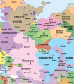
Northwestern Germany 1250.svg 700 × 796; 1.54 MB
-
Północno-wschodnie Niemcy ok 1250-es.svg 1,759 × 2,000; 1.48 MB
-
Północno-wschodnie Niemcy ok 1250.svg 700 × 796; 1.7 MB
-
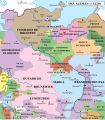
Północno-wschodnie Niemcy ok 1300-es.svg 1,759 × 2,000; 1.78 MB
-
Północno-wschodnie Niemcy ok 1300.svg 700 × 796; 2.15 MB
-
Strassenbahn luebeck 1934.png 899 × 713; 248 KB


