Category:Maps of the history of Bremen (state)
Jump to navigation
Jump to search
Federal states of Germany:
Use the appropriate category for maps showing all or a large part of Category:Bremen (state). See subcategories for smaller areas:
| If the map shows | Category to use |
|---|---|
| Category:Bremen (state) on a recently created map | Category:Maps of Bremen (state) or its subcategories |
| Category:Bremen (state) on a map created more than 70 years ago | Category:Old maps of Bremen (state) or its subcategories |
| the history of Category:Bremen (state) on a recently created map | Category:Maps of the history of Bremen (state) or its subcategories |
| the history of Category:Bremen (state) on a map created more than 70 years ago | Category:Old maps of the history of Bremen (state) or its subcategories |
Subcategories
This category has the following 2 subcategories, out of 2 total.
B
Media in category "Maps of the history of Bremen (state)"
The following 11 files are in this category, out of 11 total.
-
Karte-Bremen.png 472 × 766; 30 KB
-
Bremen 1905-1939.png 472 × 766; 16 KB
-
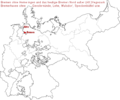
Bremen in the German Reich (1871).svg 1,425 × 1,133; 1,014 KB
-
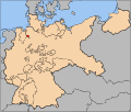
Bremen in the German Reich (1925).svg 1,425 × 1,133; 967 KB
-
Bremer Staatsgebiet seit 1800.png 656 × 1,056; 33 KB
-
Bremerhaven2010.jpg 604 × 593; 80 KB
-
Deutsches R Bremen.png 624 × 519; 69 KB
-
Deutsches Reich (Karte) Bremen.svg 650 × 545; 1.04 MB
-
Landgebiete der Freien Stadt Bremen.png 918 × 1,316; 76 KB
-
Map-WR-Bremen.svg 1,185 × 1,007; 541 KB
-
Swedish Bremen-Verden.svg 1,800 × 1,800; 305 KB


