Category:Maps of the history of Berlin
Jump to navigation
Jump to search
Federal states of Germany:
Use the appropriate category for maps showing all or a large part of Berlin. See subcategories for smaller areas:
| If the map shows | Category to use |
|---|---|
| Berlin on a recently created map | Category:Maps of Berlin or its subcategories |
| Berlin on a map created more than 70 years ago | Category:Old maps of Berlin or its subcategories |
| the history of Berlin on a recently created map | Category:Maps of the history of Berlin or its subcategories |
| the history of Berlin on a map created more than 70 years ago | Category:Old maps of the history of Berlin or its subcategories |
Subcategories
This category has the following 5 subcategories, out of 5 total.
1
H
O
Media in category "Maps of the history of Berlin"
The following 45 files are in this category, out of 45 total.
-
 1945 Berlin Zones (30249103203).jpg 1,762 × 1,330; 1.46 MB
-
 1946 Greater Berlin City Council election.svg 836 × 562; 408 KB
-
 Ausführungsplan 1927.jpg 945 × 668; 145 KB
-
 Berlin 1700 (Medaille R Falz).jpg 791 × 787; 307 KB
-
 Berlin and Cölln circa 1300.jpg 1,677 × 1,539; 1.18 MB
-
 Berlin Blockade-map.svg 774 × 593; 64 KB
-
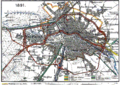
 Berlin vor 1920.png 2,637 × 2,267; 345 KB
-
 Berlin, April 2016 - 111.jpg 1,280 × 960; 441 KB
-
 Berlin, April 2016 - 112.jpg 1,280 × 960; 444 KB
-
 Berlin-Railways-in-1846.png 2,970 × 2,110; 752 KB
-
 Berlin-Railways-in-1851.png 2,970 × 2,110; 760 KB
-
 Berlin-Railways-in-1867.png 2,972 × 2,110; 836 KB
-
 Berlin-Railways-in-1871.png 2,970 × 2,110; 891 KB
-
 Berlin-Railways-in-1877.png 2,970 × 2,110; 923 KB
-
 Berlin-Railways-in-1882.png 2,970 × 2,110; 1.05 MB
-
 Berlin-Railways-in-1891.png 2,970 × 2,110; 1,012 KB
-
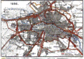 Berlin-Railways-in-1896.png 2,970 × 2,110; 1.17 MB
-
 Berliner Rieselfelder Karte.png 1,200 × 1,080; 411 KB
-
 BerlinerBlockadeLuftwege.png 977 × 1,024; 355 KB
-
 Bln11 divided.jpg 251 × 214; 38 KB
-

-

-
 Die Erweiterung Berlins durch das Groß-Berlin-Gesetz von 1920 (Karte) RUS.png 1,840 × 1,569; 559 KB
-
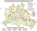 Die Erweiterung Berlins durch das Groß-Berlin-Gesetz von 1920 (Karte).png 1,840 × 1,569; 609 KB
-
 Generalszug Berlin Namensgebung.png 1,270 × 635; 53 KB
-
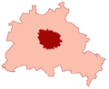 Groß-Berlin.png 631 × 521; 25 KB
-
 Historischer Atlas von Berlin 1835 - Lehmgasse.jpg 2,129 × 1,625; 1.2 MB
-
 Historischer Atlas von Berlin 1835 p2 (1415).jpg 2,670 × 2,118; 2.65 MB
-
 Karte berlin akzisemauer.png 1,200 × 864; 337 KB
-
 Karte havellandzaucheteltow.png 1,000 × 763; 149 KB
-
 Karte havellandzaucheteltowspandau.jpg 967 × 645; 155 KB
-
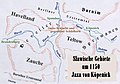 Karte Jaxa.jpg 647 × 454; 75 KB
-
 Lunapark 1931.jpg 970 × 592; 203 KB
-
 Medieval Cölln-Berlin in a Current Map of Berlin.png 10,361 × 8,336; 56.02 MB
-
 Medieval Cölln-Berlin in a Current Map of the Center of Berlin.png 567 × 472; 471 KB
-
 Occupied Germany and Berlin.png 452 × 409; 10 KB
-
 Occupiedberlin.png 570 × 482; 19 KB
-
 Settlements of the Slavic tribes in the Nordmark about 1150 ru.png 1,000 × 763; 323 KB
-
 Templehofap-dotmap.jpg 741 × 600; 54 KB
-
 Templehofplanemap.png 726 × 589; 296 KB
-
 WegeUmGatowBeiSchmettau.png 4,000 × 5,598; 1.09 MB
-
 Weimar Republic - Prussia - Berlin (1925).svg 976 × 818; 697 KB
-
 West & East Berlin (1945-1990).png 1,400 × 1,018; 299 KB
-
 동베를린.png 1,434 × 697; 55 KB
-
 서베를린.png 1,434 × 711; 167 KB
.jpg)


.jpg)


_RUS.png)
.png)


.jpg)


.svg)
.png)

