Category:Old maps of the history of Schleswig-Holstein
Jump to navigation
Jump to search
Federal states of Germany:
Use the appropriate category for maps showing all or a large part of Schleswig-Holstein. See subcategories for smaller areas:
| If the map shows | Category to use |
|---|---|
| Schleswig-Holstein on a recently created map | Category:Maps of Schleswig-Holstein or its subcategories |
| Schleswig-Holstein on a map created more than 70 years ago | Category:Old maps of Schleswig-Holstein or its subcategories |
| the history of Schleswig-Holstein on a recently created map | Category:Maps of the history of Schleswig-Holstein or its subcategories |
| the history of Schleswig-Holstein on a map created more than 70 years ago | Category:Old maps of the history of Schleswig-Holstein or its subcategories |
Subcategories
This category has only the following subcategory.
Media in category "Old maps of the history of Schleswig-Holstein"
The following 28 files are in this category, out of 28 total.
-
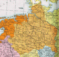
Herzogtum Sachsen 1000.PNG 785 × 763; 262 KB
-
Saxe primitive.JPG 576 × 551; 103 KB
-
"Dithmarsia Tabula - Joh. Meyer Anno 1559" (22258060415).jpg 4,036 × 2,842; 3 MB
-
Administrative division of denmark in medieval times-detail utlande.jpg 658 × 1,208; 134 KB
-
Administrative division of denmark in medieval times.jpg 5,952 × 4,336; 15.8 MB
-
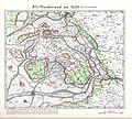
Alt Nordstrand 1634.jpg 11,329 × 10,200; 14.31 MB
-
Alt Nordstrand um 1240.jpg 5,274 × 4,163; 7.8 MB
-
AngelHerreder.jpg 700 × 620; 338 KB
-
Dithmarsiæ - no-nb krt 00530.jpg 5,187 × 3,600; 6.6 MB
-
WP Dithmarschen.jpg 1,276 × 899; 808 KB
-
Fohr-kort.gif 930 × 697; 163 KB
-
GøsHerreder.jpg 800 × 860; 500 KB
-
Historische Karte von den Nordfriesischen Inseln - Franz Geerz 1888-2 (cropped Föhr).jpg 1,812 × 1,407; 3.45 MB
-
Historische Karte von den Nordfriesischen Inseln - Franz Geerz 1888-2.jpg 7,552 × 10,288; 65.69 MB
-
Historische Karte von den Nordfriesischen Inseln - Franz Geerz 1888.jpg 7,552 × 10,288; 15.6 MB
-
Historische Karte von den Nordfriesischen Inseln - Franz Geerz 1888.tif 7,552 × 10,288; 167.68 MB
-
Holstein 1477.png 454 × 466; 325 KB
-
Holstein 1500.png 528 × 500; 433 KB
-
Kartenausschnitt Hostein 1850 - Mühlen an der Schwartau.jpeg 1,272 × 1,635; 985 KB
-
Nordens Historie - Sønderjylland.gif 600 × 596; 190 KB
-
Nordfriesische Küste 13. Jh..jpg 712 × 1,598; 629 KB
-
Nordfriesland Karte 1823.jpg 6,152 × 5,221; 3.5 MB
-
Nordfriesland um 1240.jpg 3,944 × 5,176; 8.33 MB
-
Rungholt.jpg 503 × 303; 56 KB
-
SprogSlesvig.png 840 × 504; 922 KB
-
Spruner-Menke Handatlas 1880 Karte 31 Nebenkarte 1.jpg 2,432 × 1,846; 394 KB
-
Sønderjylland i middelalderen.png 1,046 × 1,413; 3.84 MB


