Category:Maps of the history of Mecklenburg-Vorpommern
Jump to navigation
Jump to search
Federal states of Germany:
Wikimedia category | |||||
| Upload media | |||||
| Instance of | |||||
|---|---|---|---|---|---|
| Category combines topics | |||||
| Q1516530 | |||||
aspect of history | |||||
| Instance of |
| ||||
| Facet of | |||||
| Location |
| ||||
| |||||
Use the appropriate category for maps showing all or a large part of Mecklenburg-Western Pomerania. See subcategories for smaller areas:
| If the map shows | Category to use |
|---|---|
| Mecklenburg-Western Pomerania on a recently created map | Category:Maps of Mecklenburg-Vorpommern or its subcategories |
| Mecklenburg-Western Pomerania on a map created more than 70 years ago | Category:Old maps of Mecklenburg-Vorpommern or its subcategories |
| the history of Mecklenburg-Western Pomerania on a recently created map | Category:Maps of the history of Mecklenburg-Vorpommern or its subcategories |
| the history of Mecklenburg-Western Pomerania on a map created more than 70 years ago | Category:Old maps of the history of Mecklenburg-Vorpommern or its subcategories |
Subcategories
This category has the following 4 subcategories, out of 4 total.
Media in category "Maps of the history of Mecklenburg-Vorpommern"
The following 35 files are in this category, out of 35 total.
-
Kreis Anklam im Bezirk Neubrandenburg.png 418 × 568; 157 KB
-
Map Barber-Lyaschenko contract.png 797 × 1,090; 49 KB
-
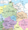
Central Europe, 919-1125, snippet North.PNG 1,354 × 681; 1.92 MB
-
DDR-Bezirk-Schwerin.png 1,500 × 2,036; 53 KB
-
DDR-Bezirk-Neubrandenburg-Kreis-Demmin.png 418 × 568; 157 KB
-
Fluchtverlauf Wilhelm Ulenoge.jpg 2,067 × 1,413; 236 KB
-
Landkreise Mecklenburg-Vorpommern.svg 859 × 607; 93 KB
-
Lutizenbund-es.svg 1,134 × 997; 1.31 MB
-
DDR-Bezirk-Neubrandenburg-Kreis-Malchin.png 418 × 568; 157 KB
-
Map-DB-Mecklenburg-Schwerin.svg 1,793 × 1,571; 1.67 MB
-
Map-DB-Mecklenburg-Strelitz.svg 1,793 × 1,571; 1.67 MB
-
Mecklenburg in German Democratic Republic 1949 - 1952.svg 618 × 789; 574 KB
-
DDR-Bezirk-Neubrandenburg-Kreis-Neubrandenburg.png 418 × 568; 157 KB
-
Bezirk Neubrandenburg in East Germany.svg 554 × 727; 215 KB
-
Bezirk Neubrandenburg.png 1,500 × 2,036; 76 KB
-
DDR-Bezirk-NBB.png 1,093 × 1,583; 62 KB
-
DDR-Bezirk-Neubrandenburg-Kreis-Altentreptow.png 418 × 568; 157 KB
-
DDR-Bezirk-Neubrandenburg-Kreis-Neustrelitz.png 418 × 568; 157 KB
-
Kreis Pasewalk im Bezirk Neubrandenburg.png 418 × 568; 157 KB
-
Polabian Slavs.png 550 × 664; 141 KB
-
Pommern um 1150.PNG 400 × 414; 17 KB
-
Powiaty Meklemburgii-Pomorza Przedniego.svg 859 × 607; 92 KB
-
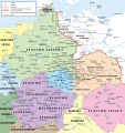
Północno-wschodnie Niemcy ok 1000-es.svg 1,787 × 1,894; 1.93 MB
-
Północno-wschodnie Niemcy ok 1000.svg 700 × 742; 3.96 MB
-
DDR-Bezirk-Neubrandenburg-Kreis-Röbel.png 418 × 568; 157 KB
-
Kreis Schwerin-Land im Bezirk Schwerin.png 418 × 587; 8 KB
-
Kreis Sternberg im Bezirk Schwerin.png 418 × 587; 8 KB
-
Kreis Strasburg im Bezirk Neubrandenburg.png 418 × 568; 158 KB
-
Swedish Pomerania.svg 1,100 × 1,100; 309 KB
-
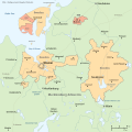
Swedish Wismar map.svg 1,000 × 1,000; 154 KB
-
TribusEslavasOccidentalesAño1000-es.svg 1,420 × 1,230; 1.88 MB
-
Kreis Ueckermünde im Bezirk Neubrandenburg.png 418 × 568; 157 KB
-
Vendit.png 847 × 587; 165 KB
-
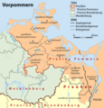
Vorpommern.png 1,000 × 1,041; 578 KB
-
DDR-Bezirk-Neubrandenburg-Kreis-Waren.png 418 × 568; 156 KB


