Category:Maps of the history of Bavaria
Jump to navigation
Jump to search
Federal states of Germany:
Use the appropriate category for maps showing all or a large part of Bavaria. See subcategories for smaller areas:
| If the map shows | Category to use |
|---|---|
| Bavaria on a recently created map | Category:Maps of Bavaria or its subcategories |
| Bavaria on a map created more than 70 years ago | Category:Old maps of Bavaria or its subcategories |
| the history of Bavaria on a recently created map | Category:Maps of the history of Bavaria or its subcategories |
| the history of Bavaria on a map created more than 70 years ago | Category:Old maps of the history of Bavaria or its subcategories |
Subcategories
This category has the following 11 subcategories, out of 11 total.
Media in category "Maps of the history of Bavaria"
The following 62 files are in this category, out of 62 total.
-
1568 Schloss Ortenburg map Ortenburger Land 445.jpg 2,048 × 1,536; 2.11 MB
-
Bavarian Circle-2005-10-15-de.png 727 × 714; 67 KB
-
Ansbach-Bayreuth 1792.png 1,180 × 825; 590 KB
-
Ansbach-Bayreuth 1805.png 1,180 × 825; 498 KB
-
Austria locator map (1000).svg 1,875 × 1,815; 5.74 MB
-
Baiern unter den Agilolfingern im Jahre 772.jpg 2,953 × 2,362; 2.24 MB
-
Baiern unter den Carolingern im Jahre 900.jpg 2,953 × 2,362; 2.45 MB
-
Baiern unter den Welfen im Jahre 1156.jpg 2,953 × 2,362; 2.21 MB
-
Baiern unter den Wittelsbachern im Jahre 1345.jpg 2,953 × 2,362; 2.13 MB
-
Bajuwarische Funde.jpg 695 × 557; 260 KB
-
Bavaria 1789 to 1950 map.svg 940 × 760; 644 KB
-
Bavaria in the German Reich (1925).svg 1,425 × 1,133; 967 KB
-
Bavaria locator map (1000).svg 4,431 × 3,875; 4.7 MB
-
Baviera-Monaco & Baviera-Landshut.jpg 1,376 × 1,604; 171 KB
-
Bayern im 10.Jh.png 663 × 368; 100 KB
-
Bayern nach der Teilung 1392.png 1,500 × 1,196; 570 KB
-
Bayern um 788.png 663 × 368; 106 KB
-
Bayern-Straubing nach der Teilung 1392.png 1,200 × 723; 311 KB
-
Beieren in de Frankische tijd.jpg 705 × 963; 252 KB
-
Beiren 600AD.jpg 182 × 162; 35 KB
-
Das Straubinger Erbe.png 1,200 × 723; 329 KB
-
Fraenkischer Reichskreis.png 2,360 × 1,650; 1.42 MB
-
Franconian Circle.png 2,360 × 1,650; 1.41 MB
-
Frankish empire 768 - 814 and bavaria.png 1,735 × 1,343; 580 KB
-
FRK 1789 de.png 2,360 × 1,650; 1.24 MB
-
FRK 1789 en.png 2,360 × 1,650; 1.22 MB
-
Fsm-Bayreuth 1791.png 1,180 × 825; 448 KB
-
Fsm-Bt-Oberland 1791.png 1,180 × 825; 464 KB
-
Fsm-Bt-Unterland 1791.png 1,180 × 825; 463 KB
-
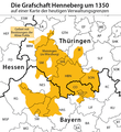
Grafschaft Henneberg um 1350.svg 516 × 551; 84 KB
-
Grafschaft Lebenau.png 2,874 × 2,161; 797 KB
-
Guelf c12.jpg 600 × 614; 76 KB
-
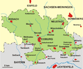
Henneberg-Franken heute.png 691 × 664; 114 KB
-
HRR 1648 Bayern.png 1,973 × 1,513; 648 KB
-
Image-Map Bavaria-Straubing - Karte Straubing-Holland empty.png 1,000 × 984; 140 KB
-
Karte Bayern-Ingolstadt.png 1,200 × 1,140; 385 KB
-
Karte Herrschaft Eisenburg.png 1,200 × 869; 249 KB
-
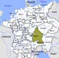
Karte Herzogtum Bayern im 10. Jahrhundert.png 2,844 × 3,008; 13.67 MB
-
Karte Niederbayern-Landshut und Oberbayern.png 1,200 × 1,140; 361 KB
-
Karte-HSC-Ex.png 675 × 571; 32 KB
-
Karte-HSC.png 2,343 × 1,951; 379 KB
-
Lagekarte Grafschaft Henneberg um 1350.png 706 × 767; 123 KB
-
Locator Bavaria within the Holy Roman Empire (1618).svg 2,769 × 2,524; 1,024 KB
-
Map Bavaria-Straubing - Karte Straubing-Holland.png 1,000 × 984; 256 KB
-
Map of Bavaria by Abraham Ortelius.jpeg 1,578 × 1,185; 654 KB
-
Map-WR-Bavaria.svg 1,185 × 1,007; 541 KB
-
March of Austria-Duchy of Bavaria.png 663 × 368; 247 KB
-
Nordgau locator map (1000).svg 1,875 × 1,815; 5.74 MB
-
Principado de Bayreuth.png 1,180 × 825; 443 KB
-
Principality of Bayreuth.png 1,180 × 825; 450 KB
-
Principato di Bayreuth.png 1,180 × 825; 447 KB
-
Principaute de Bayreuth.png 1,180 × 825; 451 KB
-
Ratisbon and vicinity, 17 - 19 April, 1809.jpg 1,260 × 965; 209 KB
-
Reiseroute von Johanna von Bayern 1370.png 1,000 × 983; 263 KB
-
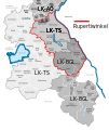
Rupertiwinkel.svg 897 × 1,066; 2.22 MB
-
Bavaria.png 1,500 × 1,500; 290 KB
-
Succession-landshut.png 2,785 × 1,625; 322 KB
-
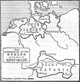
TerritoriosGüelfosEnriqueElLeón5.svg 1,337 × 1,339; 421 KB
-
Vogtland 1350.png 800 × 966; 174 KB
-
Vorstendom Bayreuth.png 1,180 × 825; 449 KB

