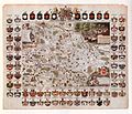
Category:Maps of the Principality of Lüneburg
Jump to navigation
Jump to search
Subcategories
This category has only the following subcategory.
Media in category "Maps of the Principality of Lüneburg"
The following 7 files are in this category, out of 7 total.
-
Blaeu 1645 - Ducatus Luneburgensis adiacentiumque regionum delineatio.jpg 2,915 × 2,260; 2.05 MB
-
Das Fürstentum Lüneburg Nördliche Ämter 9090.jpg 4,116 × 2,979; 2.67 MB
-
Das Fürstentum Lüneburg westliche Ämter 9091.jpg 4,226 × 3,028; 2.63 MB
-
GiffhornSchlossStadt1699 1.jpeg 2,772 × 1,995; 1.73 MB
-
Herzogthum Lüneburg Schreiber 9069.jpg 4,047 × 2,970; 3.16 MB
-
Kartefuerstentumlueneburg1708.jpg 2,120 × 1,828; 3.29 MB
-
Mellinger1593fuerstentumlueneburg.jpg 2,428 × 1,810; 7.23 MB


