Category:Maps of territories in the Lower Rhenish-Westphalian Circle
Jump to navigation
Jump to search
Subcategories
This category has the following 16 subcategories, out of 16 total.
Media in category "Maps of territories in the Lower Rhenish-Westphalian Circle"
The following 100 files are in this category, out of 100 total.
-
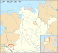
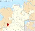
Duchy of Wesphalia and other states, circa 1645-es.svg 800 × 516; 178 KB
-
Duchy of Wesphalia and other states, circa 1645.svg 800 × 516; 176 KB
-
Herzogtum Westfalen und Umland etwa 1645.svg 704 × 459; 213 KB
-
Lower Rhenish-Westphalian Circle-2005-10-15-en.png 727 × 714; 67 KB
-
1450 Sayn Map.jpg 349 × 262; 32 KB
-
1640 CIRCVLVS WESTPHALICUS Blaeu.jpg 2,500 × 1,937; 4.5 MB
-
"Circulus Westphalicus sive Germaniae inferioris" (22257858795).jpg 3,888 × 3,072; 2.51 MB
-
Atlas Cosmographicae (Mercator) 155.jpg 2,655 × 2,065; 2.09 MB
-
Low Countries Locator Bentheim.svg 1,550 × 2,000; 381 KB
-
Low Countries Locator Berg.svg 1,550 × 2,000; 381 KB
-
Karte geldern.jpg 800 × 1,054; 198 KB
-
Hanover in 1720 in Spanish.svg 2,500 × 2,120; 106 KB
-
HArenberg1806.jpg 232 × 258; 26 KB
-
Hochstift Osnabrück 1786.jpg 346 × 446; 58 KB
-
Hoya 1400.png 341 × 256; 265 KB
-
HRR 1789 EN detail.png 600 × 450; 153 KB
-
Low Countries Locator Duchy of Julich.svg 1,550 × 2,000; 381 KB
-
Low Countries Locator Cleves.svg 1,550 × 2,000; 381 KB
-
Kornelimunster 1400.png 240 × 180; 116 KB
-
Landgebiete der Freien Stadt Bremen.png 918 × 1,316; 76 KB
-
Locator Abbey of Herford (1560).svg 3,821 × 3,455; 375 KB
-
Locator County of Bentheim (1560).svg 3,821 × 3,455; 374 KB
-
Locator County of Cleves (1350).svg 2,818 × 3,608; 427 KB
-
Locator County of Dalhem (1350).svg 2,818 × 3,608; 427 KB
-
Locator County of Delmenhorst (1560).svg 3,821 × 3,455; 375 KB
-
Locator County of East Frisia (1560).svg 3,821 × 3,455; 375 KB
-
Locator County of Hoya (1560).svg 3,821 × 3,455; 375 KB
-
Locator County of Lingen (1560).svg 3,821 × 3,455; 374 KB
-
Locator County of Lippe (1560).svg 3,821 × 3,455; 376 KB
-
Locator County of Mark (1560).svg 5,029 × 3,330; 575 KB
-
Locator County of Oldenburg & Delmenhorst (1560).svg 3,821 × 3,455; 375 KB
-
Locator County of Oldenburg (1560).svg 3,821 × 3,455; 374 KB
-
Locator County of Pyrmont (1560).svg 3,821 × 3,455; 376 KB
-
Locator County of Ravensberg (1560).svg 3,821 × 3,455; 374 KB
-
Locator County of Rietberg (1560).svg 3,821 × 3,455; 374 KB
-
Locator County of Schaumburg (1560).svg 3,821 × 3,455; 374 KB
-
Locator County of Spiegelberg (1560).svg 3,821 × 3,455; 375 KB
-
Locator County of Steinfurt (1560).svg 3,821 × 3,455; 374 KB
-
Locator County of Tecklenburg (1560).svg 3,821 × 3,455; 374 KB
-
Locator Duchies of Jülich and Berg (1560).svg 5,029 × 3,330; 575 KB
-
Locator Duchy of Berg (1560).svg 5,029 × 3,330; 575 KB
-
Locator Duchy of Cleves (1560).svg 5,029 × 3,330; 575 KB
-
Locator Duchy of Jülich (1560).svg 5,029 × 3,330; 570 KB
-
Locator Harlingerland (1560).svg 3,821 × 3,455; 374 KB
-
Locator Land Hadeln (1560).svg 3,821 × 3,455; 374 KB
-
Locator Lands of Overmaas (1350).svg 2,818 × 3,608; 399 KB
-
Locator Lordship of Anholt (1560).svg 3,821 × 3,455; 375 KB
-
Locator Lordship of Borculo (1560).svg 3,821 × 3,455; 374 KB
-
Locator Lordship of Hertogenrade (1350).svg 2,818 × 3,608; 428 KB
-
Locator Lordship of Horne (1350).svg 2,818 × 3,608; 427 KB
-
Locator Lordship of Jever (1560).svg 3,821 × 3,455; 374 KB
-
Locator Lordship of Kniphausen (1560).svg 3,821 × 3,455; 375 KB
-
Locator Lordship of Mechelen (1350).svg 2,818 × 3,608; 422 KB
-
Locator Lorships of Horne and Weert (1350).svg 2,818 × 3,608; 427 KB
-
Locator map of the Duchy of Bouillon (1560).svg 5,029 × 3,330; 576 KB
-
Locator Nedersticht of Utrecht (1350).svg 2,818 × 3,608; 422 KB
-
Locator Oversticht of Urecht (1350).svg 2,818 × 3,608; 427 KB
-
Locator Prince-Bishopric of Cambrai (1350).svg 2,818 × 3,608; 422 KB
-
Locator Prince-Bishopric of Liège (1350).svg 2,818 × 3,608; 427 KB
-
Locator Prince-Bishopric of Liège (1560).svg 5,029 × 3,330; 575 KB
-
Locator Prince-Bishopric of Minden (1560).svg 3,821 × 3,455; 376 KB
-
Locator Prince-Bishopric of Münster (1560).svg 3,821 × 3,455; 377 KB
-
Locator Prince-Bishopric of Osnabrück (1560).svg 3,821 × 3,455; 375 KB
-
Locator Prince-Bishopric of Paderborn (1560).svg 5,029 × 3,330; 575 KB
-
Locator Prince-Bishopric of Verden (1560).svg 3,821 × 3,455; 376 KB
-
Locator Principality of Stavelot-Malmedy (1560).svg 5,029 × 3,330; 575 KB
-
Locator United Duchies of Jülich-Cleves-Berg (1560).svg 5,029 × 3,330; 577 KB
-
Locator Westphalian Circle.svg 1,165 × 1,140; 193 KB
-
Karte der alten Herrschaft Lohn.png 2,264 × 1,552; 558 KB
-
GraafschapLohn.gif 844 × 516; 46 KB
-
Lohn kaartje.png 799 × 396; 114 KB
-
Lohn kaartje.svg 799 × 396; 141 KB
-
Low Countries Locator Prince-Bischopric of Liege.svg 1,550 × 2,000; 381 KB
-
Low Countries Locator Prince-Bischopric Utrecht.svg 1,550 × 2,000; 381 KB
-
Lower Rhenish-Westphalian Circle-hu.PNG 610 × 599; 210 KB
-
Map of Lippe in 1580.svg 1,056 × 744; 309 KB
-
Map of the Imperial Circles (1560)-NL cropped.svg 613 × 558; 341 KB
-
Map Waldeck.png 749 × 1,034; 34 KB
-
Electorat de Cologne.jpg 326 × 258; 23 KB
-
Hochstift Minden 1500.png 299 × 187; 130 KB
-
BmMuenster 1786.jpg 346 × 446; 70 KB
-
Oldenburg 1500.png 371 × 409; 411 KB
-
Ostfriesland um 1300.png 1,500 × 1,063; 454 KB
-
Reichskreis Niederrhein-Westfalen 1710.jpg 1,978 × 2,400; 2.09 MB
-
Reifferscheid 1400.png 289 × 217; 162 KB
-
S. R. I. Circulus Westphalicus.jpg 7,253 × 6,166; 16.53 MB
-
Niedersalm 1400.png 289 × 217; 195 KB
-
Spanish Netherlands.svg 750 × 900; 232 KB
-
Stavelot-Malmedy.png 400 × 475; 402 KB
-
UBBasel Map Niederrheinisch-Westfälischer Reichskreis Niedersächsischer Reichskreis 1626 Kartenslg Mappe 244-1.tif 7,265 × 9,226, 2 pages; 191.79 MB
-
Bremen-Verden1655.jpg 1,644 × 1,398; 3.14 MB
-
Hanover in 1720 ru.svg 2,500 × 2,120; 35 KB
-
Hanover1720-pt.svg 2,500 × 2,120; 24 KB
-
Hanover1720.png 2,500 × 2,120; 537 KB
-
Hanovro1720.png 2,500 × 2,120; 1.17 MB
-
J. B. Homann Ducatus Bremae et Ferdae.jpg 1,982 × 1,700; 993 KB
-
Vereinigte Herzogtuemer.JPG 626 × 530; 137 KB


