Category:Maps of the Duchy of Saxony
Jump to navigation
Jump to search
Federal states of Germany:
English: Maps of the Duchy of Saxony
Media in category "Maps of the Duchy of Saxony"
The following 9 files are in this category, out of 9 total.
-
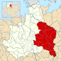
Angaria locator map (1000).svg 1,500 × 1,500; 5.62 MB
-
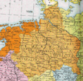
Herzogtum Sachsen 1000.PNG 785 × 763; 262 KB
-
Karte Stammesherzogtum Sachsen um 1000-es.svg 1,500 × 1,500; 5.35 MB
-
Karte Stammesherzogtum Sachsen um 1000.png 1,090 × 1,124; 1.16 MB
-
Ostfalia locator map (1000).svg 1,500 × 1,500; 5.62 MB
-
Saxe primitive.JPG 576 × 551; 103 KB
-
Saxony locator map (1000).svg 4,431 × 3,875; 4.7 MB
-
Spruner-Menke Handatlas 1880 Karte 33.jpg 10,433 × 8,577; 18.37 MB
-
Westfalia locator map (1000).svg 1,500 × 1,500; 5.62 MB


