Category:Maps of Togoland
Jump to navigation
Jump to search
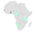
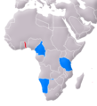
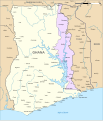
- Maps of the German colony of Togo — in present day Ghana, West Africa.
Subcategories
This category has only the following subcategory.
Media in category "Maps of Togoland"
The following 33 files are in this category, out of 33 total.
-
092 togo.png 1,146 × 1,750; 1.25 MB
-
Karte des deutschen Gebietes an der Sklavenküste.png 3,322 × 2,215; 10.51 MB
-
Das Gebiet der Ewe-Stämme und die deutschen Erwerbungen im Togo-Land.png 2,243 × 2,589; 8.8 MB
-
1921 map of the Gold Coast by the War Office.jpg 15,362 × 21,161; 48.7 MB
-
Baumwollkarte Togo 1909.jpg 2,136 × 3,347; 777 KB
-
Colonial Africa 1913 Togoland map.svg 1,390 × 1,295; 560 KB
-
Deutsch-Westafrika 1912.png 500 × 550; 89 KB
-
Deutschen Kolonie Afrika - Deutsch-Ostafrika.png 336 × 371; 50 KB
-
Deutschen Kolonie Afrika - Togoland.png 336 × 371; 50 KB
-
Ewe-Gebiet 1888.jpg 3,323 × 3,820; 2.37 MB
-
Kautschukkarte von Togo.jpg 1,304 × 2,521; 3.45 MB
-
Lange diercke sachsen afrika ehemalige schutzgebiete kamerun.jpg 1,064 × 824; 518 KB
-
Lome Map 1896 (Togo).jpg 1,030 × 719; 440 KB
-
Map of Togoland, 1914.jpg 411 × 675; 81 KB
-
Nigèria - Colonizacion en 1914.png 716 × 411; 65 KB
-
Salagagebiet1897 003.jpg 1,508 × 1,535; 374 KB
-
Togo Deutsches Koloniallexikon, Verlag von Quelle & Meyer Leipzig.jpg 1,628 × 1,692; 597 KB
-
Togo land 1885.jpg 1,365 × 879; 126 KB
-
Flag map of German Togoland (1884 - 1914).png 692 × 1,352; 11 KB
-
Togo1885.jpg 1,365 × 879; 220 KB
-
Togoland 1914.svg 488 × 488; 5.45 MB
-
Togoland, 1914.jpg 877 × 1,087; 217 KB
-
Togoland-No-Akosombo-Dam-plain.svg 730 × 1,201; 159 KB
-
Togoland.png 278 × 598; 45 KB
-
Togoland.svg 730 × 1,201; 212 KB
-
Western Togoland.svg 1,153 × 1,345; 257 KB
-
Wirtschafts-Atlas der deutschen Kolonien - 14.jpg 2,446 × 3,351; 790 KB
-
Wirtschafts-Atlas der deutschen Kolonien - 18.jpg 2,504 × 3,351; 791 KB
-
Deutscher Kolonialatlas mit Jahrbuch 1910 (133566309).jpg 7,028 × 7,214; 54.49 MB


