Category:Maps of rivers of the Central African Republic
Jump to navigation
Jump to search
Countries of Africa: Algeria · Angola · Benin · Burkina Faso · Burundi · Central African Republic · Chad · Democratic Republic of the Congo · Republic of the Congo · Equatorial Guinea · Ethiopia · Gabon · Ghana · Guinea · Guinea-Bissau · Ivory Coast · Kenya · Lesotho · Madagascar · Mali · Morocco · Mozambique · Namibia · Niger · Nigeria · Rwanda · Senegal · South Africa · South Sudan · Sudan · Togo · Tunisia · Uganda · Zambia · Zimbabwe
Media in category "Maps of rivers of the Central African Republic"
The following 15 files are in this category, out of 15 total.
-
 Carte du voyage de Mgr Carrie de Loango à l'Ubanghi.jpg 1,289 × 1,054; 299 KB
-
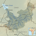 Charirivermap.png 1,001 × 1,000; 1.46 MB
-
 Congo-Mubangi-1908.jpg 472 × 760; 89 KB
-
 Les Abiras.jpg 473 × 264; 27 KB
-
 Mambere.jpg 538 × 620; 82 KB
-
 Map Ubangi-Uelle 1888.png 3,980 × 3,144; 2.62 MB
-
 OSM-LaSangha.png 974 × 712; 249 KB
-
 OSM-LeChari.png 974 × 709; 356 KB
-
 Pende çayı 2014-04-21 17-54.png 300 × 300; 176 KB
-
 Sangha Basin OSM.png 3,728 × 5,007; 33.19 MB
-
 Sangha OSM.png 3,469 × 3,339; 20.86 MB
-
 Sanghabasinmap.png 1,441 × 1,793; 1.97 MB
-
 Sudan FrenchWestAfrica Border 1922.png 815 × 1,134; 153 KB
-
 Ubangirivermap.png 996 × 767; 1.16 MB
-
 Zentralafrikanische-republik-karte-politisch.png 567 × 411; 162 KB


