Category:Maps of rivers of Guinea
Jump to navigation
Jump to search
Countries of Africa: Algeria · Angola · Benin · Burkina Faso · Burundi · Central African Republic · Chad · Democratic Republic of the Congo · Republic of the Congo · Equatorial Guinea · Ethiopia · Gabon · Ghana · Guinea · Guinea-Bissau · Ivory Coast · Kenya · Lesotho · Madagascar · Mali · Morocco · Mozambique · Namibia · Niger · Nigeria · Rwanda · Senegal · South Africa · South Sudan · Sudan · Togo · Tunisia · Uganda · Zambia · Zimbabwe
Subcategories
This category has the following 2 subcategories, out of 2 total.
C
- Maps of Cavally (4 F)
G
Media in category "Maps of rivers of Guinea"
The following 21 files are in this category, out of 21 total.
-
 GRAY(1825) p024 MAP OF WESTAFRICA (shewing the route of the Gray's expedition).jpg 5,447 × 2,297; 6.38 MB
-

-
 Admiralty Chart No 1562 Rivers Nunez and Componi, Published 1844, Revisions to 1899.jpg 11,074 × 8,072; 25.22 MB
-
 Fouta Djallon.png 2,435 × 1,787; 8.01 MB
-
 Geba Corubal OSM.png 3,319 × 1,769; 8.09 MB
-
 Great Scarcies Basin OSM.svg 354 × 443; 3.23 MB
-
 Guinea Bisau OSM.png 3,311 × 1,752; 8.45 MB
-
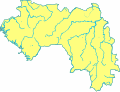 Guinea blank map with rivers.svg 543 × 413; 395 KB
-
 Guinea Coast OSM.jpg 705 × 496; 127 KB
-
 Konkouré Bassin OSM.png 1,034 × 1,282; 2.97 MB
-
 Liberia Lofa River.png 515 × 475; 136 KB
-
 Liberia Moa River.png 515 × 475; 134 KB
-
 Liberia St John River.png 515 × 475; 136 KB
-
 Liberia St Paul River.png 515 × 475; 135 KB
-
 Milo (rivière) OSM.png 255 × 524; 90 KB
-
 Moa Basin OSM.svg 638 × 673; 3.07 MB
-
 Praecipua Guineae flumina.GIF 1,281 × 972; 78 KB
-
 Saint Paul River Location Map.svg 1,382 × 945; 894 KB
-
 Sankarani river map.png 200 × 667; 59 KB
-
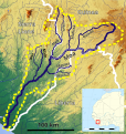
 Upper Niger Guinea OSM klein.png 2,137 × 2,200; 8.06 MB
-
 Upper Niger OSM.png 5,781 × 5,256; 41.85 MB
_p024_MAP_OF_WESTAFRICA_(shewing_the_route_of_the_Gray%27s_expedition).jpg)
.jpg)


_OSM.png)


