Category:Maps of rivers of South Africa
Jump to navigation
Jump to search
Countries of Africa: Algeria · Angola · Benin · Burkina Faso · Burundi · Cameroon · Central African Republic · Chad · Democratic Republic of the Congo · Republic of the Congo · Equatorial Guinea · Eswatini · Ethiopia · Gabon · Ghana · Guinea · Guinea-Bissau · Ivory Coast · Kenya · Lesotho · Liberia · Madagascar · Mali · Morocco · Mozambique · Namibia · Niger · Nigeria · Rwanda · Senegal · Sierra Leone · South Africa · South Sudan · Sudan · Togo · Tunisia · Uganda · Zambia · Zimbabwe
Subcategories
This category has the following 3 subcategories, out of 3 total.
Media in category "Maps of rivers of South Africa"
The following 67 files are in this category, out of 67 total.
-
10 of 'History of the Boers in South Africa ... with three maps' (11189449154), crop.jpg 1,253 × 1,026; 216 KB
-
10 of 'History of the Boers in South Africa ... with three maps' (11189449154).jpg 1,457 × 2,254; 586 KB
-
11 of 'History of the Boers in South Africa ... with three maps' (11191958004).jpg 1,415 × 2,256; 779 KB
-
1809 Pinkerton Map of Southern Africa - Geographicus - SouthernAfrica-pinkerton-1809.jpg 4,000 × 2,935; 1.73 MB
-
1827 Finley Map of Africa - Geographicus - Africa-finley-1827.jpg 2,332 × 3,000; 1.97 MB
-
1855 Colton Map of Southern Africa - Geographicus - AfricaSouth-c-1855.jpg 4,000 × 3,257; 2.26 MB
-
LINDLEY(1873) Adamantia p041.jpg 3,083 × 2,421; 3.09 MB
-
Map of Zululand, Natal, Transvaal (1879), crop.jpg 2,026 × 1,990; 1.04 MB
-
227 of 'History of the Boers in South Africa ... with three maps' (11188782773).jpg 2,256 × 1,415; 601 KB
-
275 of 'History of the Boers in South Africa ... with three maps' (11189780013).jpg 2,150 × 1,406; 577 KB
-
Africa (1878) (14589740028).jpg 1,488 × 2,932; 1.27 MB
-
Afrique du Sud Embouchre de la Chalumna river.jpg 1,049 × 899; 113 KB
-
Berg River Dam catchment map.svg 615 × 651; 1.68 MB
-
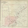
British bechuanaland 1887.jpg 1,644 × 1,627; 181 KB
-
Buffeljasriver.jpg 1,769 × 2,836; 1.54 MB
-
Cape Colony 1836.jpg 4,854 × 3,281; 3.15 MB
-
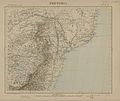
Carte de l'Afrique, Pretoria (région australe).jpeg 3,472 × 2,928; 2.06 MB
-
German South-West Africa, Orange River area, 1914.jpg 940 × 642; 143 KB
-
Gouritsrivier location map.svg 846 × 691; 1.97 MB
-
History of the war in South Africa, 1899-1902 (1906) (14772379035).jpg 2,970 × 2,086; 465 KB
-
Interval de discontinuïtat Escarpament Drakensberg.jpg 917 × 682; 399 KB
-
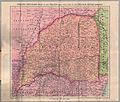
Karte der Neuen Republik.jpg 2,526 × 2,242; 2.24 MB
-
Kleinbrakrivier.jpg 252 × 216; 15 KB
-
LA2-NSRW Cape of Good Hope.jpg 680 × 793; 316 KB
-
Map on wall at Kei Mouth.jpg 1,200 × 1,600; 487 KB
-
Battle of Modder River Map.png 768 × 512; 52 KB
-
Munhumutapa.jpg 642 × 706; 512 KB
-
Oranje River Basin OSM.png 8,805 × 7,709; 74.49 MB
-
Philips' detailed map of the Transvaal with part of the Orange River Colony.jpg 4,643 × 3,938; 7.65 MB
-
Rivers of Cape Region RSA OSM.png 1,647 × 1,226; 2.37 MB
-
Rivers of Eastern Cape.png 4,135 × 2,540; 14.44 MB
-
Rivers of south KwaZulu-Natal.png 2,803 × 2,803; 11.43 MB
-
Rivers of south Mozambique OSM.png 3,720 × 4,890; 22.61 MB
-
Rivers of West Cape RSA OSM.png 4,275 × 3,434; 18.71 MB
-
Sketch map of East Griqualand and Pondoland with concession of Emil Nagel.jpg 2,640 × 3,782; 4.51 MB
-
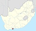
South Africa location map.svg 2,031 × 1,741; 644 KB
-
SouthAfricaOMC.png 1,367 × 1,511; 128 KB
-
Southern Africa Comprising Cape Colony, Natal, & c. by Keith Johnston, F.R.S.E.jpg 6,261 × 3,966; 21.25 MB
-
Steenbras Dam catchment map.svg 678 × 688; 1.58 MB
-
The Cape Colony - 1878.jpg 1,987 × 1,606; 1.02 MB
-
Theewaterskloof catchment area.png 796 × 550; 425 KB
-
Theewaterskloof Dam catchment map.svg 1,709 × 1,329; 5.73 MB
-
Topographic map of the Transkei.svg 1,039 × 962; 2.26 MB
-
Transkei Cape frontier - 1875-1890.jpg 686 × 938; 133 KB
-
Tugela.png 300 × 317; 31 KB
-
Voëlvlei dam system map.svg 520 × 1,280; 1.7 MB
-
Wemmershoek Dam catchment map.svg 815 × 677; 2.01 MB
-
Western Cape Topology and boundary.jpg 8,000 × 6,372; 9.2 MB


