
Category:Maps of rivers of Nigeria
Countries of Africa: Algeria · Angola · Benin · Burkina Faso · Burundi · Cameroon · Central African Republic · Chad · Democratic Republic of the Congo · Republic of the Congo · Equatorial Guinea · Eswatini · Ethiopia · Gabon · Ghana · Guinea · Guinea-Bissau · Ivory Coast · Kenya · Lesotho · Liberia · Madagascar · Mali · Morocco · Mozambique · Namibia · Niger · Nigeria · Rwanda · Senegal · Sierra Leone · South Africa · South Sudan · Sudan · Tanzania · Togo · Tunisia · Uganda · Zambia · Zimbabwe
Subcategories
This category has the following 2 subcategories, out of 2 total.
K
- Maps of Komadougou Yobé (8 F)
M
Media in category "Maps of rivers of Nigeria"
The following 19 files are in this category, out of 19 total.
-
 Benin River Basin OSM.png 1,261 × 1,577; 3.6 MB
-
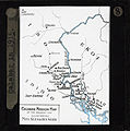 Calabar in 1915 (imp-cswc-GB-237-CSWC47-LS2-008).jpg 4,856 × 4,878; 1.99 MB
-
 Course of the Oba River.svg 500 × 630; 159 KB
-
 Cross River Estuary̞ OSM.png 473 × 515; 423 KB
-
 Cross River OSM.png 1,857 × 1,927; 7.27 MB
-
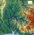
 Gongola River Basin OSM.png 2,803 × 1,682; 7.02 MB
-
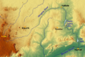 Gongola River.png 637 × 431; 627 KB
-
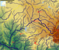
 Gurara and Gbako River OSM.png 1,402 × 1,296; 3.36 MB
-
 Hydrology of the Jos Plateau.png 1,892 × 1,752; 6.12 MB
-
 Kaduna.png 2,348 × 1,997; 7.78 MB
-
 Lake Kainji Tributary OSM.png 1,822 × 1,997; 5.68 MB
-
 Mouths in the Niger Delta 1874.png 3,644 × 3,252; 4.05 MB
-
 Nigeria blank with rivers.svg 525 × 428; 281 KB
-
 Otamiri river map.png 379 × 815; 41 KB
-
 Rivers of west Nigeria OSM.svg 4,713 × 5,457; 90.58 MB
-
 Sokoto River system.png 306 × 225; 23 KB
-
 SW Nigeria OSM.png 1,647 × 1,822; 5.27 MB
-
 Yewa River OSM.png 701 × 876; 974 KB
-
 Кросс-ривер.png 279 × 216; 17 KB

.jpg)


