Category:Maps of rivers of Ivory Coast
Jump to navigation
Jump to search
Countries of Africa: Algeria · Angola · Benin · Burkina Faso · Burundi · Cameroon · Central African Republic · Chad · Democratic Republic of the Congo · Republic of the Congo · Equatorial Guinea · Eswatini · Ethiopia · Gabon · Ghana · Guinea · Guinea-Bissau · Ivory Coast · Kenya · Lesotho · Liberia · Madagascar · Mali · Morocco · Mozambique · Namibia · Niger · Nigeria · Rwanda · Senegal · Sierra Leone · South Africa · South Sudan · Sudan · Togo · Tunisia · Uganda · Zambia · Zimbabwe
Media in category "Maps of rivers of Ivory Coast"
The following 12 files are in this category, out of 12 total.
-
Bandama OSM.png 2,185 × 3,422; 12.53 MB
-
Comoe OSM.jpg 318 × 688; 71 KB
-
Comoe River Basin OSM.png 1,997 × 3,784; 12.35 MB
-
Laguneébrié.png 394 × 184; 27 KB
-
Liberia Cestos River.png 515 × 475; 169 KB
-
Map Comoe-Leraba MS 4512.jpg 4,272 × 2,848; 3.38 MB
-
Principaux cours d'eau de Côte d'Ivoire (MédiHAL 2391529).pdf 1,752 × 2,479; 581 KB
-
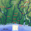
Rivers of Ivory Coast East coast.png 1,664 × 1,696; 4.42 MB
-
Rivers of Ivory Coast OSM.png 4,222 × 4,152; 28.6 MB
-
Rivers of Ivory Coast OSM.svg 4,270 × 4,199; 88.74 MB
-
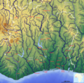
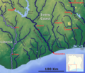
Rivers of Ivory Coast West coast.png 1,857 × 1,598; 4.73 MB
-
Sassandra.png 2,015 × 3,048; 11.11 MB


