Category:Maps of Orange River
Jump to navigation
Jump to search
Media in category "Maps of Orange River"
The following 11 files are in this category, out of 11 total.
-
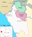
Map Richtersveld Municipality and Parks de.svg 585 × 680; 58 KB
-
Admiralty Chart No 1013 Africa west coast Cape Lopez to Cape of Good Hope, Published 1887.jpg 8,725 × 15,127; 12.31 MB
-
Admiralty Chart No 578 Orange River to Cape of Good Hope, Published 1941.jpg 11,032 × 16,206; 30.83 MB
-
Admiralty Chart No 632 Africa west coast Walfisch Bay to Orange River, Published 1881.jpg 8,229 × 12,291; 12.51 MB
-
Admiralty Chart No 897 Africa west coast Milkbosch point to Orange River, Published 1879.jpg 6,242 × 8,359; 4.68 MB
-
Basutoland WDL657.png 1,333 × 1,024; 2.39 MB
-
Great Trek map full.png 4,636 × 3,973; 2.53 MB
-
LHWP map resized.jpg 3,555 × 5,000; 10.06 MB
-
Malibamatso1.png 464 × 980; 52 KB
-
Mokhotlong Dist Rivers1.png 3,016 × 3,116; 409 KB


