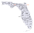
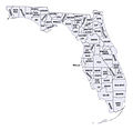
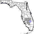
Category:Maps of counties of Florida
Jump to navigation
Jump to search
States of the United States: Alabama · Alaska · Arizona · Arkansas · California · Colorado · Connecticut · Delaware · Florida · Georgia · Hawaii · Idaho · Illinois · Indiana · Iowa · Kansas · Kentucky · Louisiana · Maine · Maryland · Massachusetts · Michigan · Minnesota · Mississippi · Missouri · Montana · Nebraska · Nevada · New Hampshire · New Jersey · New Mexico · New York · North Carolina · North Dakota · Ohio · Oklahoma · Oregon · Pennsylvania · Rhode Island · South Carolina · South Dakota · Tennessee · Texas · Utah · Vermont · Virginia · Washington · West Virginia · Wisconsin · Wyoming
Counties of Florida: Alachua · Baker · Bay · Bradford · Brevard · Broward · Calhoun · Charlotte · Citrus · Clay · Collier · Columbia · DeSoto · Dixie · Duval · Escambia · Flagler· Franklin · Gadsden · Gilchrist · Glades · Gulf · Hamilton · Hardee · Hendry · Hernando · Highlands · Hillsborough · Holmes · Indian River · Jackson · Jefferson · Lafayette · Lake · Lee · Leon · Levy · Liberty · Madison · Manatee · Marion · Martin · Miami-Dade · Monroe · Nassau · Okaloosa · Okeechobee · Orange · Osceola · Palm Beach · Pasco · Pinellas · Polk · Putnam · Santa Rosa · Sarasota · Seminole · St. Johns · St. Lucie · Sumter · Suwannee · Taylor · Union · Volusia · Wakulla · Walton · Washington
Subcategories
This category has the following 68 subcategories, out of 68 total.
*
A
B
- Maps of Bay County, Florida (41 F)
C
D
E
F
G
- Maps of Gulf County, Florida (14 F)
H
I
J
L
M
N
O
P
S
T
U
V
W
Media in category "Maps of counties of Florida"
The following 41 files are in this category, out of 41 total.
-
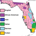
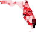
Ancestry-Florida-by county-2010.png 601 × 599; 71 KB
-
Blank map subdivisions Florida.svg 166 × 142; 36 KB
-
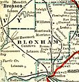
Bloxham County Proposed Boundary.jpg 863 × 900; 315 KB
-
Condados de Corazon de Florida.jpg 2,000 × 2,138; 247 KB
-
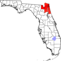
Condados de Florida do Norte Central.png 2,000 × 1,707; 174 KB
-
Corazón de Florida.jpg 601 × 599; 56 KB
-
Fist Coast Florida.png 601 × 599; 89 KB
-
Fl am2.JPG 640 × 480; 43 KB
-
FL ethnicity.GIF 645 × 593; 15 KB
-
Florida Circuit Courts map.gif 473 × 442; 11 KB
-
Florida counties and cities with domestic partnership.svg 1,279 × 1,086; 36 KB
-
Florida counties and cities with domestic partnerships.svg 323 × 286; 68 KB
-
Florida counties map.png 865 × 841; 102 KB
-
Florida Counties with Names.svg 990 × 765; 260 KB
-
Florida counties.jpg 865 × 841; 223 KB
-
Florida do Norte Central.gif 300 × 291; 8 KB
-
Florida population map.png 600 × 600; 165 KB
-
Florida positioning map.png 865 × 841; 71 KB
-
Florida Sun Coast.png 307 × 292; 28 KB
-
Florida-aaf-map-north.jpg 520 × 636; 58 KB
-
Florida-aaf-map-panhandle.jpg 864 × 378; 41 KB
-
Florida-aaf-map-south.jpg 462 × 616; 44 KB
-
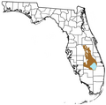
Florida-heartland.jpg 601 × 599; 65 KB
-
Florida2StateSolution2014.png 910 × 808; 8 KB
-
FloridaCountiesPopulation.png 910 × 808; 16 KB
-
Geo Map of Income by Location in Florida.png 759 × 882; 174 KB
-
Kissimmee-Okeecobee Lowland.png 1,010 × 1,000; 189 KB
-
Location of Big Cypress Indian Reservation.png 500 × 499; 48 KB
-
Map of Florida counties numbered.png 300 × 295; 6 KB
-
Map of Florida counties numbered.svg 301 × 292; 123 KB
-
Map of Florida counties.png 150 × 146; 14 KB
-
North Florida map.png 520 × 500; 63 KB
-
NRHP Florida Map.svg 990 × 765; 11.03 MB
-
Rexion de Red Hills aproximado.png 904 × 1,393; 266 KB
-
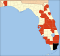
Swine Flu Florida.PNG 491 × 464; 9 KB
-
Swine Flu Florida2.PNG 491 × 464; 14 KB
-
USA Florida location map.png 619 × 599; 60 KB
-
UTC hue4map USA-FL.svg 7,342 × 7,321; 310 KB


