Category:Locator maps of counties of Florida
Jump to navigation
Jump to search

States of the United States: Alabama · Alaska · Arizona · Arkansas · California · Colorado · Connecticut · Delaware · Florida · Georgia · Hawaii · Idaho · Illinois · Indiana · Iowa · Kansas · Kentucky · Louisiana · Maine · Maryland · Massachusetts · Michigan · Minnesota · Mississippi · Missouri · Montana · Nebraska · Nevada · New Hampshire · New Jersey · New Mexico · New York · North Carolina · North Dakota · Ohio · Oklahoma · Oregon · Pennsylvania · Rhode Island · South Carolina · South Dakota · Tennessee · Texas · Utah · Vermont · Virginia · Washington · West Virginia · Wisconsin · Wyoming
| NO WIKIDATA ID FOUND! Search for Locator maps of counties of Florida on Wikidata | |
| Upload media |
English: Locator maps for counties in Florida.
Subcategories
This category has only the following subcategory.
Media in category "Locator maps of counties of Florida"
The following 145 files are in this category, out of 145 total.
-
Alachua County Florida exploding 600px.png 520 × 500; 86 KB
-
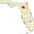
Alachua County Florida.png 300 × 295; 10 KB
-
Baker County Florida.png 300 × 295; 10 KB
-
BankAtlantic footprint 2010-07.png 551 × 586; 48 KB
-
BankAtlantic footprint 2011-06.png 562 × 831; 67 KB
-
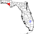
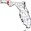
Bay County Florida.png 300 × 295; 10 KB
-
Bradford County Florida.png 300 × 295; 10 KB
-
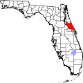
Brevard County Florida.png 300 × 295; 10 KB
-
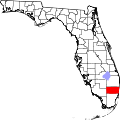
Broward County Florida.png 300 × 295; 10 KB
-
Calhoun County Florida.png 300 × 295; 10 KB
-
Charlotte County Florida.png 300 × 295; 10 KB
-
Citrus County FL location.png 520 × 500; 87 KB
-
Citrus County Florida exploding 500px.png 520 × 500; 79 KB
-
Citrus County Florida.png 300 × 295; 10 KB
-
Clay County Florida.png 300 × 295; 10 KB
-
Collier County Florida.png 300 × 295; 10 KB
-
Columbia County Florida.png 300 × 295; 10 KB
-
Desoto County Florida.png 300 × 295; 10 KB
-
Dixie County Florida.png 300 × 295; 10 KB
-
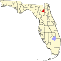
Duval County Florida.png 300 × 295; 10 KB
-
Escambia County Florida.png 300 × 295; 10 KB
-
Franklin County Florida.png 300 × 295; 10 KB
-
Gadsden County Florida.png 300 × 295; 10 KB
-
Gilchrist County Florida exploding 600px.png 520 × 500; 85 KB
-
Gilchrist County Florida.png 300 × 295; 10 KB
-
Glades County Florida.png 300 × 295; 10 KB
-
Gulf County Florida.png 300 × 295; 10 KB
-
Hamilton County Florida.png 300 × 295; 10 KB
-
Hardee County Florida.png 300 × 295; 10 KB
-
Hendry County Florida.png 300 × 295; 10 KB
-
Hernando County Florida.png 300 × 295; 10 KB
-
Highlands County Florida.png 300 × 295; 10 KB
-
Hillsborough County Florida.png 300 × 295; 10 KB
-
Holmes County Florida.png 300 × 295; 10 KB
-
Indian River County Florida.png 300 × 295; 10 KB
-
Jefferson County Florida exploding 600px.png 510 × 500; 88 KB
-
Jefferson County Florida.png 300 × 295; 10 KB
-
Lafayette County Florida.png 300 × 295; 10 KB
-
Lake County Florida.png 300 × 295; 10 KB
-
Lee County Florida.png 300 × 295; 10 KB
-
Leon County Florida.png 300 × 295; 10 KB
-
Levy County Florida.png 300 × 295; 10 KB
-
Liberty County Florida.png 300 × 295; 10 KB
-
Madison County Florida.png 300 × 295; 10 KB
-
Manatee County Florida.png 300 × 295; 10 KB
-
Map of Florida highlighting Alachua County.svg 1,130 × 1,126; 179 KB
-
Map of Florida highlighting Baker County.svg 1,130 × 1,126; 179 KB
-
Map of Florida highlighting Bay County.svg 1,130 × 1,126; 179 KB
-
Map of Florida highlighting blank.jpeg 601 × 599; 37 KB
-
Map of Florida highlighting Bradford County.svg 1,130 × 1,126; 179 KB
-
Map of Florida highlighting Brevard County.svg 1,130 × 1,126; 179 KB
-
Map of Florida highlighting Broward County.svg 1,130 × 1,126; 179 KB
-
Map of Florida highlighting Calhoun County.svg 1,130 × 1,126; 179 KB
-
Map of Florida highlighting Charlotte County.svg 1,130 × 1,126; 179 KB
-
Map of Florida highlighting Citrus County.svg 1,130 × 1,126; 179 KB
-
Map of Florida highlighting Clay County.svg 1,130 × 1,126; 179 KB
-
Map of Florida highlighting Collier County.svg 1,130 × 1,126; 179 KB
-
Map of Florida highlighting Columbia County.svg 1,130 × 1,126; 179 KB
-
Map of Florida highlighting DeSoto County.svg 1,130 × 1,126; 179 KB
-
Map of Florida highlighting Dixie County.svg 1,130 × 1,126; 179 KB
-
Map of Florida highlighting Duval County.svg 1,130 × 1,126; 179 KB
-
Map of Florida highlighting Escambia County.svg 1,130 × 1,126; 179 KB
-
Map of Florida highlighting Flagler County.svg 1,130 × 1,126; 179 KB
-
Map of Florida highlighting Franklin County.svg 1,130 × 1,126; 179 KB
-
Map of Florida highlighting Gadsden County.svg 1,130 × 1,126; 179 KB
-
Map of Florida highlighting Gilchrist County.svg 1,130 × 1,126; 179 KB
-
Map of Florida highlighting Glades County.svg 1,130 × 1,126; 179 KB
-
Map of Florida highlighting Gulf County.svg 1,130 × 1,126; 179 KB
-
Map of Florida highlighting Hamilton County.svg 1,130 × 1,126; 179 KB
-
Map of Florida highlighting Hardee County.svg 1,130 × 1,126; 179 KB
-
Map of Florida highlighting Hendry County.svg 1,130 × 1,126; 179 KB
-
Map of Florida highlighting Hernando County.svg 1,130 × 1,126; 179 KB
-
Map of Florida highlighting Highlands County.svg 1,130 × 1,126; 179 KB
-
Map of Florida highlighting Hillsborough County.svg 1,130 × 1,126; 179 KB
-
Map of Florida highlighting Holmes County.svg 1,130 × 1,126; 179 KB
-
Map of Florida highlighting Indian River County.svg 1,130 × 1,126; 179 KB
-
Map of Florida highlighting Jackson County.svg 1,130 × 1,126; 179 KB
-
Map of Florida highlighting Jefferson County.svg 1,130 × 1,126; 179 KB
-
Map of Florida highlighting Lafayette County.svg 1,130 × 1,126; 179 KB
-
Map of Florida highlighting Lake County.svg 1,130 × 1,126; 179 KB
-
Map of Florida highlighting Lee County.svg 1,130 × 1,126; 179 KB
-
Map of Florida highlighting Leon County.svg 1,130 × 1,126; 179 KB
-
Map of Florida highlighting Levy County.svg 1,130 × 1,126; 179 KB
-
Map of Florida highlighting Liberty County.svg 1,130 × 1,126; 179 KB
-
Map of Florida highlighting Madison County.svg 1,130 × 1,126; 179 KB
-
Map of Florida highlighting Manatee County.svg 1,130 × 1,126; 179 KB
-
Map of Florida highlighting Marion County.svg 1,130 × 1,126; 179 KB
-
Map of Florida highlighting Martin County.svg 1,130 × 1,126; 179 KB
-
Map of Florida highlighting Miami-Dade County.svg 1,130 × 1,126; 179 KB
-
Map of Florida highlighting Monroe County.svg 1,130 × 1,126; 179 KB
-
Map of Florida highlighting Nassau County.svg 1,130 × 1,126; 179 KB
-
Map of Florida highlighting Okaloosa County.svg 1,130 × 1,126; 179 KB
-
Map of Florida highlighting Okeechobee County.svg 1,130 × 1,126; 179 KB
-
Map of Florida highlighting Orange County.svg 1,130 × 1,126; 179 KB
-
Map of Florida highlighting Osceola County.svg 1,130 × 1,126; 179 KB
-
Map of Florida highlighting Pasco County.svg 1,130 × 1,126; 179 KB
-
Map of Florida highlighting Pinellas County.svg 1,130 × 1,126; 179 KB
-
Map of Florida highlighting Polk County.svg 1,130 × 1,126; 179 KB
-
Map of Florida highlighting Putnam County.svg 1,130 × 1,126; 179 KB
-
Map of Florida highlighting Santa Rosa County.svg 1,130 × 1,126; 179 KB
-
Map of Florida highlighting Sarasota County.svg 1,130 × 1,126; 179 KB
-
Map of Florida highlighting Seminole County.svg 1,130 × 1,126; 179 KB
-
Map of Florida highlighting St. Johns County.svg 1,130 × 1,126; 179 KB
-
Map of Florida highlighting St. Lucie County.svg 1,130 × 1,126; 179 KB
-
Map of Florida highlighting Sumter County.svg 1,130 × 1,126; 179 KB
-
Map of Florida highlighting Suwannee County.svg 1,130 × 1,126; 179 KB
-
Map of Florida highlighting Taylor County.svg 1,130 × 1,126; 179 KB
-
Map of Florida highlighting Union County.svg 1,130 × 1,126; 179 KB
-
Map of Florida highlighting Volusia County.svg 1,130 × 1,126; 179 KB
-
Map of Florida highlighting Wakulla County.svg 1,130 × 1,126; 179 KB
-
Map of Florida highlighting Walton County.svg 1,130 × 1,126; 179 KB
-
Map of Florida highlighting Washington County.svg 1,130 × 1,126; 179 KB
-
Map of Monroe County Florida.svg 984 × 756; 368 KB
-
Marion County Florida.png 300 × 295; 10 KB
-
Martin County Florida.png 300 × 295; 10 KB
-
Miami-Dade County Florida.png 300 × 295; 10 KB
-
Monroe County Florida.png 300 × 295; 10 KB
-
Nassau County Florida.png 300 × 295; 10 KB
-
National Weather Service Miami, Florida county warning area.svg 7,342 × 7,321; 320 KB
-
National Weather Service Tampa, Florida county warning area.svg 7,342 × 7,321; 320 KB
-
Okaloosa County Florida.png 300 × 295; 10 KB
-
Okeechobee County Florida 400px.png 400 × 634; 11 KB
-
Okeechobee County Florida.png 300 × 295; 10 KB
-
Orange County Florida exploding 500px.png 520 × 500; 75 KB
-
Orange County Florida.png 300 × 295; 10 KB
-
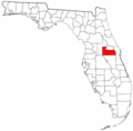
Osceola County Florida.png 300 × 295; 10 KB
-
Palm Beach County Florida.png 300 × 295; 10 KB
-
Pasco County Florida.png 300 × 295; 10 KB
-
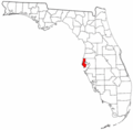
Pinellas County Florida.png 300 × 295; 10 KB
-
Polk County Florida exploding 550px.png 555 × 550; 84 KB
-
Polk County Florida.png 300 × 295; 10 KB
-
Putnam County Florida.png 300 × 295; 10 KB
-
Santa Rosa County Florida.svg 301 × 292; 112 KB
-
Sarasota County Florida.png 300 × 295; 10 KB
-
Seminole County Florida.png 300 × 295; 10 KB
-
St Johns County Florida.png 300 × 295; 10 KB
-
Sumter County Florida.png 300 × 295; 10 KB
-
Suwannee County Florida exploding 600px.png 520 × 500; 105 KB
-
Suwannee County Florida.png 300 × 295; 10 KB
-
Tallahassee-Leon County Metro Area.png 608 × 550; 137 KB
-
Taylor County Florida.png 300 × 295; 10 KB
-
Union County Florida.png 300 × 295; 10 KB
-
Wakulla County Florida.png 300 × 295; 10 KB
-
Walton County Florida.png 300 × 295; 10 KB
-
Washington County Florida.png 300 × 295; 10 KB

