Category:Maps of counties of Minnesota
Appearance
States of the United States: Alabama · Alaska · Arizona · Arkansas · California · Colorado · Connecticut · Delaware · Florida · Georgia · Hawaii · Idaho · Illinois · Indiana · Iowa · Kansas · Kentucky · Louisiana · Maine · Maryland · Massachusetts · Michigan · Minnesota · Mississippi · Missouri · Montana · Nebraska · Nevada · New Hampshire · New Jersey · New Mexico · New York · North Carolina · North Dakota · Ohio · Oklahoma · Oregon · Pennsylvania · Rhode Island · South Carolina · South Dakota · Tennessee · Texas · Utah · Vermont · Virginia · Washington · West Virginia · Wisconsin · Wyoming
Counties of Minnesota: Aitkin · Anoka · Becker · Beltrami · Benton · Big Stone · Blue Earth · Brown · Carlton · Carver · Cass · Chippewa · Chisago · Clay · Clearwater · Cook · Cottonwood · Crow Wing · Dakota · Dodge · Douglas · Faribault · Fillmore · Freeborn · Goodhue · Grant · Hennepin · Houston · Hubbard · Isanti · Itasca · Jackson · Kanabec · Kandiyohi · Kittson · Koochiching · Lac qui Parle · Lake · Lake of the Woods · Le Sueur · Lincoln · Lyon · Mahnomen · Marshall · Martin · McLeod · Meeker · Mille Lacs · Morrison · Mower · Murray · Nicollet · Nobles · Norman · Olmsted · Otter Tail · Pennington · Pine · Pipestone · Polk · Pope · Ramsey · Red Lake · Redwood · Renville · Rice · Rock · Roseau · St. Louis · Scott · Sherburne · Sibley · Stearns · Steele · Stevens · Swift · Todd · Traverse · Wabasha · Wadena · Waseca · Washington · Watonwan · Wilkin · Winona · Wright · Yellow Medicine
Subcategories
This category has the following 89 subcategories, out of 89 total.
A
B
C
D
F
G
H
I
J
K
L
M
N
O
P
R
S
T
W
Media in category "Maps of counties of Minnesota"
The following 15 files are in this category, out of 15 total.
-
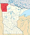
Arrowhead-Region, Minnesota.jpg 399 × 426; 54 KB
-
Blank map subdivisions Minnesota.svg 120 × 134; 33 KB
-
Conceal and Carry Ownership in MN.pdf 1,275 × 1,650; 75 KB
-
June17 2010 tornadoes.jpg 416 × 476; 53 KB
-
Map of Minnesota highlighting Iron Range.png 500 × 569; 57 KB
-
Minneapolis-St. Paul-Bloomington, MN-WI Metro Area.svg 512 × 566; 72 KB
-
Minnesota Locator Map with US.PNG 403 × 430; 21 KB
-
Minnesota Locator Map.PNG 399 × 426; 14 KB
-
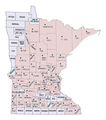
Minnesota SD-1.jpg 200 × 233; 41 KB
-
Minnesota Watersheds.png 522 × 589; 40 KB
-
Minnesota-counties-disaster-200708.png 765 × 865; 154 KB
-
Minnesota-counties-map.png 765 × 865; 42 KB
-
MN Ecosystems Map ECS Provinces Wiki Version.JPG 3,952 × 4,320; 1.07 MB
-
Mnchippewamap.png 800 × 800; 315 KB
-
Twin Cities.png 262 × 300; 33 KB


