Category:Maps of counties of Texas
Jump to navigation
Jump to search
States of the United States: Alabama · Alaska · Arizona · Arkansas · California · Colorado · Connecticut · Delaware · Florida · Georgia · Hawaii · Idaho · Illinois · Indiana · Iowa · Kansas · Kentucky · Louisiana · Maine · Maryland · Massachusetts · Michigan · Minnesota · Mississippi · Missouri · Montana · Nebraska · Nevada · New Hampshire · New Jersey · New Mexico · New York · North Carolina · North Dakota · Ohio · Oklahoma · Oregon · Pennsylvania · Rhode Island · South Carolina · South Dakota · Tennessee · Texas · Utah · Vermont · Virginia · Washington · West Virginia · Wisconsin · Wyoming
Counties of Texas: Anderson · Andrews · Angelina · Aransas · Archer · Armstrong · Atascosa · Austin · Bailey · Bandera · Bastrop · Baylor · Bee · Bell · Bexar · Blanco · Borden · Bosque · Bowie · Brazoria · Brazos · Brewster · Briscoe · Brooks · Brown · Buchel · Burleson · Burnet · Caldwell · Calhoun · Callahan · Cameron · Camp · Carson · Cass · Castro · Chambers · Cherokee · Childress · Clay · Cochran · Coke · Coleman · Collin · Collingsworth · Colorado · Comal · Comanche · Concho · Cooke · Coryell · Cottle · Crane · Crockett · Crosby · Culberson · Dallam · Dallas · Dawson · Deaf Smith · Delta · Denton · DeWitt · Dickens · Dimmit · Donley · Duval · Eastland · Ector · Edwards · El Paso · Ellis · Erath · Falls · Fannin · Fayette · Fisher · Floyd · Foard · Foley · Fort Bend · Franklin · Freestone · Frio · Gaines · Galveston · Garza · Gillespie · Glasscock · Goliad · Gonzales · Gray · Grayson · Gregg · Grimes · Guadalupe · Hale · Hall · Hamilton · Hansford · Hardeman · Hardin · Harris · Harrison · Hartley · Haskell · Hays · Hemphill · Henderson · Hidalgo · Hill · Hockley · Hood · Hopkins · Houston · Howard · Hudspeth · Hunt · Hutchinson · Irion · Jack · Jackson · Jasper · Jeff Davis · Jefferson · Jim Hogg · Jim Wells · Johnson · Jones · Karnes · Kaufman · Kendall · Kenedy · Kent · Kerr · Kimble · King · Kinney · Kleberg · Knox · La Salle · Lamar · Lamb · Lampasas · Lavaca · Lee · Leon · Liberty · Limestone · Lipscomb · Live Oak · Llano · Loving · Lubbock · Lynn · Madison · Marion · Martin · Mason · Matagorda · Maverick · McCulloch · McLennan · McMullen · Medina · Menard · Midland · Milam · Mills · Mitchell · Montague · Montgomery · Moore · Morris · Motley · Nacogdoches · Navarro · Newton · Nolan · Nueces · Ochiltree · Oldham · Orange · Palo Pinto · Panola · Parker · Parmer · Pecos · Polk · Potter · Presidio · Rains · Randall · Reagan · Real · Red River · Reeves · Refugio · Roberts · Robertson · Rockwall · Runnels · Rusk · Sabine · San Augustine · San Jacinto · San Patricio · San Saba · Schleicher · Scurry · Shackelford · Shelby · Sherman · Smith · Somervell · Starr · Stephens · Sterling · Stonewall · Sutton · Swisher · Tarrant · Taylor · Terrell · Terry · Throckmorton · Titus · Tom Green · Travis · Trinity · Tyler · Upshur · Upton · Uvalde · Val Verde · Van Zandt · Victoria · Walker · Waller · Ward · Washington · Webb · Wharton · Wheeler · Wichita · Wilbarger · Willacy · Williamson · Wilson · Winkler · Wise · Wood · Worth · Yoakum · Young · Zapata · Zavala
Subcategories
This category has the following 200 subcategories, out of 258 total.
(previous page) (next page)*
A
- Maps of Archer County, Texas (11 F)
- Maps of Austin County, Texas (14 F)
B
- Maps of Bee County, Texas (11 F)
- Maps of Bell County, Texas (15 F)
- Maps of Bexar County, Texas (36 F)
- Maps of Bowie County, Texas (14 F)
- Maps of Burnet County, Texas (11 F)
C
D
- Maps of Dawson County, Texas (10 F)
E
- Maps of Ellis County, Texas (18 F)
F
- Maps of Fannin County, Texas (15 F)
- Maps of Frio County, Texas (15 F)
G
- Maps of Gregg County, Texas (11 F)
H
- Maps of Hays County, Texas (13 F)
- Maps of Hunt County, Texas (12 F)
I
J
K
L
M
- Maps of McMullen County, Texas (empty)
N
O
P
- Maps of Parker County, Texas (19 F)
R
Media in category "Maps of counties of Texas"
The following 16 files are in this category, out of 16 total.
-
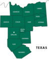 13 counties.png 380 × 458; 22 KB
-
 2010 Texas gubernatorial election results map by county.svg 810 × 769; 104 KB
-
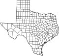
 Blank map subdivisions Texas.svg 255 × 249; 90 KB
-
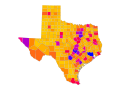
 Geo Map of Income by Location in Texas (2014).png 802 × 882; 246 KB
-
 H1N1 Texas map.svg 12,473 × 11,855; 309 KB
-
 Majority minority counties in Texas based on 2020 Census data.png 2,737 × 2,190; 1.08 MB
-
 Map NRHP Texas nolabel.svg 785 × 584; 571 KB
-
 Map of texoma area.jpg 913 × 435; 134 KB
-
 NRHP Texas map.svg 990 × 765; 36.15 MB
-
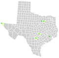 Texas counties and cities with domestic partnerships.svg 322 × 315; 144 KB
-

-
 Texas counties blank map.png 2,000 × 1,682; 393 KB
-
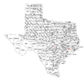
 Texas counties map.gif 978 × 899; 105 KB
-
 Texas counties map.png 1,010 × 964; 49 KB
-
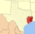 Texas Map-SETX.PNG 447 × 437; 18 KB
-
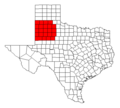 Texas south plains counties.png 534 × 480; 7 KB


.png)


