Category:Maps of counties of New Mexico
Jump to navigation
Jump to search
States of the United States: Alabama · Alaska · Arizona · Arkansas · California · Colorado · Connecticut · Delaware · Florida · Georgia · Hawaii · Idaho · Illinois · Indiana · Iowa · Kansas · Kentucky · Louisiana · Maine · Maryland · Massachusetts · Michigan · Minnesota · Mississippi · Missouri · Montana · Nebraska · Nevada · New Hampshire · New Jersey · New Mexico · New York · North Carolina · North Dakota · Ohio · Oklahoma · Oregon · Pennsylvania · Rhode Island · South Carolina · South Dakota · Tennessee · Texas · Utah · Vermont · Virginia · Washington · West Virginia · Wisconsin · Wyoming
Counties of New Mexico: Bernalillo · Catron · Chaves · Cibola · Colfax · Curry · De Baca · Doña Ana · Eddy · Grant · Guadalupe · Harding · Hidalgo · Lea · Lincoln · Los Alamos · Luna · McKinley · Mora · Otero · Quay · Rio Arriba · Roosevelt · San Juan · San Miguel · Sandoval · Santa Fe · Sierra · Socorro · Taos · Torrance · Union · Valencia
Subcategories
This category has the following 35 subcategories, out of 35 total.
*
B
C
E
L
O
Q
R
S
T
U
V
Media in category "Maps of counties of New Mexico"
The following 7 files are in this category, out of 7 total.
-
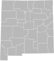
Blank Map of New Mexico.svg 5,686 × 6,321; 38 KB
-
Blank map subdivisions New Mexico.svg 128 × 132; 19 KB
-
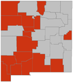
Native americans in new mexico counties.PNG 241 × 232; 5 KB
-
New Mexico counties map.png 787 × 865; 61 KB
-
New-mexico-counties-map.gif 760 × 830; 33 KB
-
NewMexicoH1N1.PNG 581 × 653; 17 KB
-
State-Government-Northern-New-Mexico.gif 787 × 865; 37 KB


