
Category:Maps of counties of Missouri
States of the United States: Alabama · Alaska · Arizona · Arkansas · California · Colorado · Connecticut · Delaware · Florida · Georgia · Hawaii · Idaho · Illinois · Indiana · Iowa · Kansas · Kentucky · Louisiana · Maine · Maryland · Massachusetts · Michigan · Minnesota · Mississippi · Missouri · Montana · Nebraska · Nevada · New Hampshire · New Jersey · New Mexico · New York · North Carolina · North Dakota · Ohio · Oklahoma · Oregon · Pennsylvania · Rhode Island · South Carolina · South Dakota · Tennessee · Texas · Utah · Vermont · Virginia · Washington · West Virginia · Wisconsin · Wyoming
Counties of Missouri: Adair · Andrew · Atchison · Audrain · Barry · Barton · Bates · Benton · Bollinger · Boone · Buchanan · Butler · Caldwell · Callaway · Cape Girardeau · Carroll · Carter · Cass · Chariton · Christian · Clark · Clay · Clinton · Cole · Cooper · Crawford · Dade · Dallas · Daviess · DeKalb · Dent · Douglas · Dunklin · Franklin · Gasconade · Gentry · Greene · Grundy · Harrison · Henry · Hickory · Holt · Howard · Howell · Iron · Jackson · Jasper · Jefferson · Johnson · Knox · Laclede · Lafayette · Lawrence · Lewis · Lincoln · Linn · Livingston · Macon · Madison · Maries · Marion · McDonald · Miller · Mississippi · Moniteau · Monroe · Montgomery · Morgan · New Madrid · Newton · Nodaway · Oregon · Osage · Ozark · Pemiscot · Perry · Pettis · Phelps · Pike · Platte · Polk · Pulaski · Putnam · Ralls · Randolph · Ray · Reynolds · Ripley · Saline · Schuyler · Scotland · Scott · Shannon · Shelby · St. Charles · St. Clair · St. Francois · St. Louis · Ste. Genevieve · Stoddard · Stone · Sullivan · Taney · Texas · Vernon · Warren · Washington · Wayne · Webster · Worth · Wright · Independent city: St. Louis
Subcategories
This category has the following 115 subcategories, out of 115 total.
*
A
B
C
D
F
G
H
I
J
K
L
M
N
O
P
R
S
T
V
W
Media in category "Maps of counties of Missouri"
The following 31 files are in this category, out of 31 total.
-
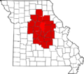 682px-Map of Missouri highlighting Mid-Missouri.png 682 × 600; 83 KB
-
 Blank map of Missouri with counties.svg 990 × 765; 661 KB
-
 Blank map subdivisions Missouri.svg 122 × 105; 40 KB
-
 EDMO division jurisdictions (2009).png 734 × 610; 156 KB
-
 EDMO division jurisdictions (2012).png 768 × 683; 265 KB
-
 EDMo.PNG 387 × 336; 7 KB
-
 H1N1 Missouri map by county-2009-19-05.svg 5,812 × 5,110; 130 KB
-
 H1N1 Missouri map by county.svg 5,812 × 5,110; 145 KB
-
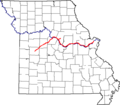
 Katy Trail State Park Missouri.svg 850 × 798; 252 KB
-
 Katytrail1.png 640 × 561; 8 KB
-
 KS-MO County map.svg 145 × 100; 120 KB
-
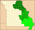
 Little Dixie Missouri.svg 6,252 × 5,551; 162 KB
-
 Map of Missouri highlighting Bootheel.gif 1,429 × 1,153; 103 KB
-
 Map of Missouri highlighting the Lead Belt.gif 1,429 × 1,153; 105 KB
-
 Map of Missouri highlighting the Lincoln Hills.gif 1,429 × 1,153; 105 KB
-
 Map of Missouri highlighting the Loess Hills.gif 1,429 × 1,153; 105 KB
-
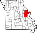 Map of Missouri highlighting Westplex.svg 5,812 × 5,110; 236 KB
-
 Missouri Area Code 573 Map.png 387 × 336; 8 KB
-
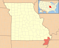 Missouri Bootheel locator v1.svg 436 × 354; 265 KB
-

-
 Missouri counties map.png 865 × 769; 142 KB
-
 Missouri counties.gif 1,429 × 1,153; 105 KB
-
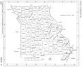
 Missouri counties.jpg 535 × 437; 33 KB
-
 Missouri Dept of Conservation Regions 2010.svg 660 × 594; 388 KB
-
 Missouri DNR lands 20080807.svg 1,126 × 876; 232 KB
-
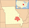 Missouri Lead Belt counties locator v1.svg 478 × 446; 313 KB
-
 Missouri Locator Map with US.PNG 391 × 340; 18 KB
-
 Missouri Locator Map.PNG 387 × 336; 14 KB
-
 NRHP Missouri Map.svg 1,056 × 816; 15.9 MB
-
 Stout29.png 865 × 769; 63 KB
-
 WDMo.png 387 × 336; 11 KB

.png)
.png)


