
Category:Maps of Santa Rosa County, Florida
Wikimedia category | |||||
| Upload media | |||||
| Instance of | |||||
|---|---|---|---|---|---|
| Category combines topics | |||||
| Santa Rosa County | |||||
county in Florida, United States .JPG)    | |||||
| Instance of | |||||
| Location | Florida | ||||
| Capital | |||||
| Inception |
| ||||
| Population |
| ||||
| Area |
| ||||
| official website | |||||
 | |||||
Media in category "Maps of Santa Rosa County, Florida"
The following 60 files are in this category, out of 60 total.
-

-

-

-

-
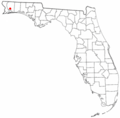 FLMap-doton-Bagdad.PNG 300 × 295; 12 KB
-
 FLMap-doton-GulfBreeze.PNG 300 × 295; 12 KB
-
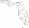 FLMap-doton-Jay.PNG 300 × 295; 12 KB
-
 FLMap-doton-Milton.PNG 300 × 295; 12 KB
-
 FLMap-doton-Pace.PNG 300 × 295; 12 KB
-
 Florida -Hamilton County - Sarasota County (part)- - NARA - 17474775 (page 1689).jpg 1,688 × 2,152; 454 KB
-
 Florida -Hamilton County - Sarasota County (part)- - NARA - 17474775 (page 1690).jpg 3,400 × 4,792; 1.74 MB
-
 Florida -Hamilton County - Sarasota County (part)- - NARA - 17474775 (page 1694).jpg 3,576 × 4,290; 2.55 MB
-
 Florida -Hamilton County - Sarasota County (part)- - NARA - 17474775 (page 1696).jpg 2,520 × 3,416; 1.13 MB
-
 Florida -Hamilton County - Sarasota County (part)- - NARA - 17474775 (page 1697).jpg 3,688 × 4,568; 2.14 MB
-
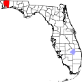 Map of Florida highlighting Santa Rosa County.svg 1,130 × 1,126; 179 KB
-
 Pensacola-Ferry Pass-Brent Metropolitan Area.png 511 × 499; 25 KB
-

-

-
-

-

-

-

-

-

-

-

-

-

-

-
-

-

-

-
-

-

-

-

-
-

-

-

-

-

-

-

-

-

-

-

-

-

-
-

-

-
 Santa Rosa County Florida.svg 301 × 292; 112 KB
-

-
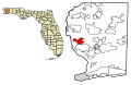
 SantaRosaCountyFloridaMapNavarreHightlighted.jpg 525 × 600; 46 KB
-
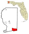
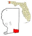 SantaRosaCountyNavarreHighlighted.jpg 525 × 600; 46 KB
.jpg)
.jpg)
.jpg)
_-_Santa_Rosa_County_-_Santa_Rosa_County_-_ED_57-1_to_25_-_NARA_-_12007960.jpg)


-_-_NARA_-_17474775_(page_1689).jpg)
-_-_NARA_-_17474775_(page_1690).jpg)
-_-_NARA_-_17474775_(page_1694).jpg)
-_-_NARA_-_17474775_(page_1696).jpg)
-_-_NARA_-_17474775_(page_1697).jpg)


