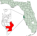
Category:Maps of Pinellas County, Florida
Jump to navigation
Jump to search
Counties of Florida: Alachua · Baker · Bay · Bradford · Brevard · Broward · Calhoun · Charlotte · Citrus · Clay · Collier · Columbia · DeSoto · Dixie · Duval · Escambia · Flagler · Franklin · Gadsden · Gilchrist · Glades · Gulf · Hamilton · Hardee · Hendry · Hernando · Highlands · Hillsborough · Holmes · Indian River · Jackson · Jefferson · Lafayette · Lake · Lee · Leon · Levy · Liberty · Madison · Manatee · Marion · Martin · Miami-Dade · Monroe · Nassau · Okaloosa · Okeechobee · Orange · Osceola · Palm Beach · Pasco · Pinellas · Polk · Putnam · Santa Rosa · Sarasota · Seminole · St. Johns · St. Lucie · Sumter · Suwannee · Taylor · Union · Volusia · Wakulla · Walton · Washington
Wikimedia category | |||||
| Upload media | |||||
| Instance of | |||||
|---|---|---|---|---|---|
| Category combines topics | |||||
| Pinellas County | |||||
county in Florida, United States | |||||
| Instance of | |||||
| Location | Florida | ||||
| Capital | |||||
| Inception |
| ||||
| Population |
| ||||
| Area |
| ||||
| official website | |||||
 | |||||
Subcategories
This category has the following 4 subcategories, out of 4 total.
Media in category "Maps of Pinellas County, Florida"
The following 56 files are in this category, out of 56 total.
-
Cities of Pinellas County.svg 10,639 × 20,379; 3.72 MB
-
FLMap-doton-BayPines.PNG 300 × 295; 12 KB
-
FLMap-doton-PalmHarbor.PNG 300 × 295; 12 KB
-
FLMap-doton-RedingtonBeach.PNG 300 × 295; 12 KB
-
FLMap-doton-Ridgecrest.PNG 300 × 295; 12 KB
-
FLMap-doton-TierraVerde.PNG 300 × 295; 12 KB
-
FLMap-doton-WestAndEastLealman.PNG 300 × 295; 12 KB
-
Florida -Hamilton County - Sarasota County (part)- - NARA - 17474775 (page 1229).jpg 3,144 × 4,792; 1.76 MB
-
Florida -Hamilton County - Sarasota County (part)- - NARA - 17474775 (page 1233).jpg 5,352 × 2,936; 2.02 MB
-
Florida -Hamilton County - Sarasota County (part)- - NARA - 17474775 (page 1235).jpg 2,744 × 3,752; 1.38 MB
-
Florida -Hamilton County - Sarasota County (part)- - NARA - 17474775 (page 1240).jpg 4,216 × 3,704; 1.64 MB
-
Florida -Hamilton County - Sarasota County (part)- - NARA - 17474775 (page 1241).jpg 4,168 × 3,656; 1.74 MB
-
Florida -Hamilton County - Sarasota County (part)- - NARA - 17474775 (page 1242).jpg 3,752 × 9,299; 3.32 MB
-
Florida -Hamilton County - Sarasota County (part)- - NARA - 17474775 (page 1247).jpg 1,491 × 2,056; 526 KB
-
Florida -Hamilton County - Sarasota County (part)- - NARA - 17474775 (page 1254).jpg 2,113 × 3,026; 1.02 MB
-
Florida -Hamilton County - Sarasota County (part)- - NARA - 17474775 (page 1288).jpg 3,778 × 2,288; 1.05 MB
-
Florida -Hamilton County - Sarasota County (part)- - NARA - 17474775 (page 1317).jpg 1,903 × 4,590; 1.31 MB
-
Florida -Hamilton County - Sarasota County (part)- - NARA - 17474775 (page 1347).jpg 1,390 × 2,706; 429 KB
-
Florida -Hamilton County - Sarasota County (part)- - NARA - 17474775 (page 1364).jpg 4,312 × 3,320; 1.97 MB
-
Florida -Hamilton County - Sarasota County (part)- - NARA - 17474775 (page 1399).jpg 1,224 × 3,321; 487 KB
-
Florida -Hamilton County - Sarasota County (part)- - NARA - 17474775 (page 1400).jpg 1,007 × 2,814; 389 KB
-
Gateway Express Map.jpg 14,400 × 9,300; 12.08 MB
-
HillsboroughCountySubdivisions.png 566 × 408; 8 KB
-
Map of Florida highlighting Belleair Beach.svg 450 × 429; 1.23 MB
-
Map of Florida highlighting Belleair Bluffs.svg 450 × 429; 1.23 MB
-
Map of Florida highlighting Belleair Shore.svg 512 × 429; 1.36 MB
-
Map of Florida highlighting Belleair.svg 450 × 429; 1.23 MB
-
Map of Florida highlighting Gulfport.svg 450 × 429; 1.23 MB
-
Map of Florida highlighting Indian Rocks Beach.svg 450 × 429; 1.23 MB
-
Map of Florida highlighting Indian Shores.svg 450 × 429; 1.23 MB
-
Map of Florida highlighting Kenneth City.svg 450 × 429; 1.23 MB
-
Map of Florida highlighting Largo.svg 450 × 429; 1.23 MB
-
Map of Florida highlighting Madeira Beach.svg 450 × 429; 1.23 MB
-
Map of Florida highlighting North Redlington Beach.svg 450 × 429; 1.23 MB
-
Map of Florida highlighting Oldsmar.svg 450 × 429; 1.23 MB
-
Map of Florida highlighting Pinellas County.svg 1,130 × 1,126; 179 KB
-
Map of Florida highlighting Pinellas Park.svg 450 × 429; 1.23 MB
-
Map of Florida highlighting Redlington Beach.svg 450 × 429; 1.23 MB
-
Map of Florida highlighting Redlington Shores.svg 450 × 429; 1.23 MB
-
Map of Florida highlighting Safety Harbor.svg 450 × 429; 1.23 MB
-
Map of Florida highlighting Seminole.svg 450 × 429; 1.23 MB
-
Map of Florida highlighting South Pasadena.svg 450 × 429; 1.23 MB
-
Map of Florida highlighting St Pete Beach.svg 450 × 429; 1.23 MB
-
Map of Florida highlighting St Petersburg.svg 450 × 429; 1.23 MB
-
Map of Florida highlighting Tarpon Springs.svg 450 × 429; 1.23 MB
-
Map of Florida highlighting Treasure Island.svg 450 × 429; 1.23 MB
-
Racial deed restriction.gif 1,139 × 1,100; 318 KB
-
Pinellas Muni.svg 10,639 × 20,379; 3.71 MB


