
Category:Maps of Miami-Dade County, Florida
Counties of Florida: Alachua · Baker · Bay · Bradford · Brevard · Broward · Calhoun · Charlotte · Citrus · Clay · Collier · Columbia · DeSoto · Dixie · Duval · Escambia · Flagler · Franklin · Gadsden · Gilchrist · Glades · Gulf · Hamilton · Hardee · Hendry · Hernando · Highlands · Hillsborough · Holmes · Indian River · Jackson · Jefferson · Lafayette · Lake · Lee · Leon · Levy · Liberty · Madison · Manatee · Marion · Martin · Miami-Dade · Monroe · Nassau · Okaloosa · Okeechobee · Orange · Osceola · Palm Beach · Pasco · Pinellas · Polk · Putnam · Santa Rosa · Sarasota · Seminole · St. Johns · St. Lucie · Sumter · Suwannee · Taylor · Union · Volusia · Wakulla · Walton · Washington
Wikimedia category | |||||
| Upload media | |||||
| Instance of | |||||
|---|---|---|---|---|---|
| Category combines topics | |||||
| Miami-Dade County | |||||
county in Florida, United States      | |||||
| Instance of | |||||
| Named after |
| ||||
| Location | Florida | ||||
| Capital | |||||
| Head of government |
| ||||
| Inception |
| ||||
| Population |
| ||||
| Area |
| ||||
| Different from | |||||
| official website | |||||
 | |||||
Subcategories
This category has the following 4 subcategories, out of 4 total.
E
M
Media in category "Maps of Miami-Dade County, Florida"
The following 85 files are in this category, out of 85 total.
-
 1986 FBI Miami shootout relative positions of vehicles edited.jpg 743 × 1,057; 106 KB
-
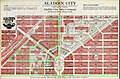 Aladdin City Florida Land Boom Map 1927.jpg 1,009 × 667; 274 KB
-
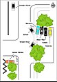
 Aladdin City Layout.jpg 638 × 518; 40 KB
-
 Aventura.png 575 × 425; 51 KB
-
 Bal Harbour.png 575 × 425; 20 KB
-
 Biscayne Park.png 575 × 425; 59 KB
-
 Brownsville.png 575 × 425; 77 KB
-
 Coral Gables.png 575 × 425; 32 KB
-
 Coral Terrace.png 575 × 425; 80 KB
-
 Country Club.png 575 × 425; 60 KB
-
 Country Walk.png 575 × 425; 42 KB
-
 Cutler Bay.png 575 × 425; 62 KB
-
 Dade County Florida.png 800 × 933; 14 KB
-
 El Portal.png 575 × 425; 64 KB
-
 FLMap-doton-BalHarbour.PNG 300 × 295; 12 KB
-
 Florida City.gif 575 × 425; 56 KB
-
 Fountainbleau.gif 575 × 425; 76 KB
-
 Gladeview.gif 575 × 425; 83 KB
-
 Glenvar Heights.gif 575 × 425; 87 KB
-
 Golden Beach.gif 575 × 425; 30 KB
-
 Golden Glades.gif 575 × 425; 84 KB
-
 Goulds.gif 575 × 425; 66 KB
-
 Homestead Base.gif 575 × 425; 47 KB
-
 Homestead.gif 575 × 425; 65 KB
-
 Indian Creek.gif 575 × 425; 30 KB
-
 Islandia.gif 575 × 425; 11 KB
-
 Ives Estates.gif 575 × 425; 77 KB
-
 Karibik 07.png 1,352 × 811; 694 KB
-
 Kendale Lakes.gif 575 × 425; 79 KB
-
 Kendall West.gif 575 × 425; 57 KB
-
 Kendall.gif 575 × 425; 34 KB
-
 Key Biscayne.gif 575 × 425; 10 KB
-
 Lakes by the Bay.gif 575 × 425; 50 KB
-
 Leisure City.gif 575 × 425; 62 KB
-
 Map of Biscayne National Park.jpg 3,983 × 4,535; 2.34 MB
-
 Map of Florida highlighting Miami-Dade County.svg 1,130 × 1,126; 179 KB
-
 Map of the USA highlighting South Florida.gif 4,200 × 3,105; 1.64 MB
-
 Medley town.gif 575 × 425; 68 KB
-
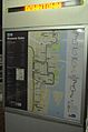
 Metromover map sign 2.jpg 3,264 × 4,928; 3.88 MB
-
 Metromover map sign.jpg 4,928 × 3,264; 3.76 MB
-
 Miami Beach.gif 575 × 425; 29 KB
-
 Miami Lakes.gif 575 × 425; 69 KB
-
 Miami River Map.JPG 268 × 254; 14 KB
-
 Miami Shores.gif 575 × 425; 72 KB
-
 Miami Springs.gif 575 × 425; 76 KB
-
 Miami-Dade County Florida Test.svg 841 × 1,006; 132 KB
-
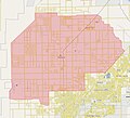
 Miami-Dade County Map.png 1,310 × 1,123; 506 KB
-
 Miami-Dade county outline.svg 180 × 230; 22 KB
-
 MM map sign.jpg 3,264 × 4,928; 3.61 MB
-
 Naranja.gif 575 × 425; 57 KB
-
 North Bay Village.gif 575 × 425; 21 KB
-
 North Miami Beach.gif 575 × 425; 78 KB
-
 North Miami.gif 575 × 425; 80 KB
-
 Ojus.gif 575 × 425; 73 KB
-
 Olympia Heights.gif 575 × 425; 81 KB
-
 Opa-locka.gif 575 × 425; 81 KB
-
 Palm Springs North.gif 575 × 425; 57 KB
-
 Palmetto Bay Florida.gif 575 × 425; 59 KB
-
 Palmetto Estates.gif 575 × 425; 74 KB
-
 Pinecrest.gif 575 × 425; 75 KB
-
 Pinewood.gif 575 × 425; 80 KB
-
 Princeton.gif 575 × 425; 60 KB
-
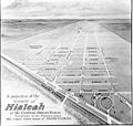 Projection of Hialeah in 1922.jpg 600 × 569; 53 KB
-
 Redland Map.jpg 1,022 × 929; 147 KB
-
 Richmond Heights.gif 575 × 425; 76 KB
-
 Richmond West.gif 575 × 425; 63 KB
-
 South Miami Heights.gif 575 × 425; 73 KB
-
 South Miami.gif 575 × 425; 83 KB
-
 Sunny Isles Beach.gif 575 × 425; 41 KB
-
 Sunset.gif 575 × 425; 79 KB
-
 Surfside.gif 575 × 425; 28 KB
-
 Sweetwater.gif 575 × 425; 54 KB
-
 Tamiami.gif 575 × 425; 64 KB
-
 The Crossings.gif 575 × 425; 72 KB
-
 The Hammocks.gif 575 × 425; 55 KB
-
 Three Lakes.gif 575 × 425; 69 KB
-
 Towns of Miami-Dade County Florida 800px.png 800 × 933; 35 KB
-
 Towns of Miami-Dade County Florida closer.gif 630 × 930; 36 KB
-
 West Little River.gif 575 × 425; 86 KB
-
 West Miami.gif 575 × 425; 68 KB
-
 West Perrine.gif 575 × 425; 70 KB
-
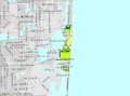
 Westchester CDP (2020).jpg 875 × 542; 76 KB
-
 Westchester.gif 575 × 425; 85 KB
-
 Westview.gif 575 × 425; 82 KB
-
 Westwood Lakes.gif 575 × 425; 81 KB


.jpg)


