Category:Maps of Georgia (U.S. state)
Jump to navigation
Jump to search
States of the United States: Alabama · Alaska · Arizona · Arkansas · California · Colorado · Connecticut · Delaware · Florida · Georgia · Hawaii · Idaho · Illinois · Indiana · Iowa · Kansas · Kentucky · Louisiana · Maine · Maryland · Massachusetts · Michigan · Minnesota · Mississippi · Missouri · Montana · Nebraska · Nevada · New Hampshire · New Jersey · New Mexico · New York · North Carolina · North Dakota · Ohio · Oklahoma · Oregon · Pennsylvania · Rhode Island · South Carolina · South Dakota · Tennessee · Texas · Utah · Vermont · Virginia · Washington · West Virginia · Wisconsin · Wyoming – Washington, D.C.
insular area of the United States: American Samoa · Guam · Northern Mariana Islands · Puerto Rico · United States Virgin Islands – United States Minor Outlying Islands: Baker Island · Howland Island · Jarvis Island · Johnston Atoll · Kingman Reef · Midway Atoll · Navassa Island · Palmyra Atoll · Wake Island
insular area of the United States: American Samoa · Guam · Northern Mariana Islands · Puerto Rico · United States Virgin Islands – United States Minor Outlying Islands: Baker Island · Howland Island · Jarvis Island · Johnston Atoll · Kingman Reef · Midway Atoll · Navassa Island · Palmyra Atoll · Wake Island
Wikimedia category | |||||
| Upload media | |||||
| Instance of | |||||
|---|---|---|---|---|---|
| Category combines topics | |||||
| Georgia | |||||
state of the United States of America | |||||
| Pronunciation audio | |||||
| Instance of | |||||
| Part of |
| ||||
| Named after |
| ||||
| Location |
| ||||
| Located in or next to body of water | |||||
| Capital | |||||
| Legislative body | |||||
| Executive body | |||||
| Highest judicial authority | |||||
| Official language | |||||
| Anthem |
| ||||
| Head of government |
| ||||
| Inception |
| ||||
| Highest point | |||||
| Population |
| ||||
| Area |
| ||||
| Elevation above sea level |
| ||||
| Replaces | |||||
| Different from | |||||
| Maximum temperature record |
| ||||
| Minimum temperature record |
| ||||
| official website | |||||
 | |||||

Subcategories
This category has the following 30 subcategories, out of 30 total.
*
A
C
E
G
H
L
O
P
R
S
Media in category "Maps of Georgia (U.S. state)"
The following 117 files are in this category, out of 117 total.
-
18th c. Map of French Florida (8571302605).jpg 732 × 1,040; 221 KB
-
2016 GA-03.svg 186 × 223; 1.47 MB
-
2016 GA-04.svg 260 × 223; 1.03 MB
-
2022 GA-01.svg 240 × 297; 2.8 MB
-
2022 GA-08.svg 103 × 180; 2.12 MB
-
203433W sm.png 895 × 716; 33 KB
-
Athens GA Downtown Street Sign Map 1.jpg 3,024 × 4,032; 2.81 MB
-
Atlanta Central.png 589 × 687; 500 KB
-
Bulletin (1922) (19802858393).jpg 6,820 × 5,116; 5.18 MB
-
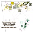
C-ONF Map.jpg 800 × 721; 253 KB
-
Central Savannah River Area.png 2,048 × 1,684; 525 KB
-
Cgs05193 (9716272729).jpg 3,604 × 1,627; 3.8 MB
-
Cgs05247 (9716175077).jpg 2,769 × 3,595; 5.81 MB
-
Columbus, Georgia Area.png 749 × 853; 182 KB
-
COVID-19 Cases in Georgia (state) by counties, 2020-03-18.png 454 × 522; 96 KB
-
COVID-19 Georgia (state) by counties 2020-03-14.png 584 × 574; 124 KB
-
Demorest-Auction-Land-Plat-1890-original.jpg 2,448 × 3,264; 2.56 MB
-
Demorest-Auction-Land-Plat-1890-restore.jpg 1,842 × 2,992; 2.83 MB
-
Distribution of various shell gorgets at Mound C,Etowah.JPG 826 × 588; 91 KB
-
Druid Hills CDP.pdf 5,404 × 4,950; 268 KB
-
ElijahClarklocator.PNG 258 × 300; 19 KB
-
FDR state park locator.png 258 × 300; 52 KB
-
Fort Walton and Leon-Jefferson cultures map HRoe 2012.jpg 600 × 435; 191 KB
-
G - NARA - 34381989 (page 2).jpg 9,630 × 13,253; 24.04 MB
-
GA - Troop Map.png 506 × 586; 215 KB
-
GA National Forest.png 3,027 × 1,734; 204 KB
-
GDOT districts.png 424 × 503; 39 KB
-
GEFA Map.gif 90 × 92; 3 KB
-
General coffee park locator.png 258 × 300; 52 KB
-
George L. Smith locator.png 258 × 300; 52 KB
-
Georgia - NARA - 26335498.jpg 6,176 × 8,631; 8.57 MB
-
Georgia 1845.jpg 3,696 × 4,630; 2.12 MB
-
Georgia 1865 county map with roads and railroads.png 816 × 1,056; 154 KB
-
Georgia 90.jpg 1,092 × 1,280; 644 KB
-
Georgia ancestry map.png 1,332 × 880; 110 KB
-
Georgia Congressional Districts 113th Congress-9th District-by county.tif 1,346 × 1,042; 659 KB
-
Georgia counties NRHP June 2018.jpg 531 × 532; 297 KB
-
Georgia Counties.gif 1,142 × 1,428; 116 KB
-
Georgia Counties.png 1,545 × 2,000; 663 KB
-
Georgia judicial districts and circuits map.png 1,000 × 1,159; 228 KB
-
Georgia Köppen.png 6,300 × 9,238; 370 KB
-
Georgia Landuse Map.png 3,086 × 3,450; 1.5 MB
-
Georgia Level IV ecoregions small.pdf 3,450 × 4,350; 1.29 MB
-
Georgia Level IV ecoregions.pdf 6,300 × 5,100; 1.45 MB
-
Georgia Midland Railroad route map.png 2,000 × 2,327; 640 KB
-
Georgia POI.png 458 × 532; 18 KB
-
Georgia Population Density by Census Tract 2018.png 2,486 × 2,486; 1.14 MB
-
Georgia population map.png 600 × 600; 255 KB
-
Georgia ref 2001.jpg 600 × 688; 217 KB
-
Georgia-plantmaps-hardiness-zones.png 243 × 264; 161 KB
-
GeorgiaDistricts8and10.png 479 × 394; 246 KB
-
GeorgiaGoldBelt.jpg 416 × 394; 69 KB
-
GeorgiaSpeedLimitsMap.png 765 × 888; 228 KB
-
Gray's Reef NMS map.jpg 1,550 × 2,000; 582 KB
-
January 2017 Georgia tornado outbreak.png 1,097 × 842; 266 KB
-
Kelleybarnesdammap.jpg 900 × 673; 378 KB
-
Lyon Counties Georgia.png 258 × 300; 23 KB
-
Macon Bibb Consolidated Outline.png 250 × 183; 36 KB
-
Maconlocationbibbcounty.JPG 1,004 × 713; 86 KB
-
Majority minority counties in Georgia US Census 2020.png 4,639 × 3,479; 2.43 MB
-
Map Falls Bartram.jpg 600 × 395; 95 KB
-
Map of Georgia (US state).jpg 2,922 × 3,455; 2.65 MB
-
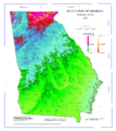
Map of Georgia elevations.png 3,131 × 3,500; 1.99 MB
-
Map of Georgia highlighting Southern Rivers.gif 1,142 × 1,428; 115 KB
-
Map of Georgia highlighting the Historic South.gif 1,142 × 1,428; 114 KB
-
Map of Georgia highlighting the North Georgia mountains.gif 1,142 × 1,428; 115 KB
-
Map of the State of Georgia - NARA - 78117044 (page 1).jpg 8,353 × 9,517; 13.46 MB
-
Map of the State of Georgia - NARA - 78117044 (page 2).jpg 8,356 × 9,567; 13.73 MB
-
Map of the State of Georgia - NARA - 78117044 (page 3).jpg 8,372 × 9,531; 13.79 MB
-
Map of the State of Georgia - NARA - 78117044 (page 4).jpg 8,381 × 9,548; 16.74 MB
-
Map of the State of Georgia - NARA - 78117670 (page 1).jpg 8,732 × 14,021; 15.36 MB
-
Map of the State of Georgia - NARA - 78117670 (page 2).jpg 8,764 × 14,086; 13.41 MB
-
Map of USA highlighting Georgia.png 280 × 183; 35 KB
-
Map riverwalk3000.jpg 885 × 316; 40 KB
-
Mirror Lake Highlighted inside the City of Villa Rica.pdf 2,260 × 1,906; 274 KB
-
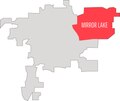
Mirror Lake Highlighted.png 4,343 × 3,664; 205 KB
-
Mountain Park Fulton.png 1,080 × 850; 51 KB
-
Muscogee Creek Nation.jpg 1,275 × 1,650; 389 KB
-
North Druid Hills.jpg 1,105 × 1,378; 545 KB
-
NWS Atlanta Irma rainfall totals in Georgia.jpg 1,200 × 800; 217 KB
-
NWS Atlanta Irma wind gusts in Georgia.jpg 1,200 × 800; 215 KB
-
NWS Atlanta Irma wind sustained vs gusts infographic.jpg 960 × 720; 180 KB
-
NWS Tallahassee Irma preliminary wind gusts.jpg 1,200 × 675; 158 KB
-
OldFourthWardInEastCentralAtlanta.jpg 535 × 573; 192 KB
-
Parish Map EDio of Atlanta.jpg 508 × 582; 32 KB
-
Personal Memoirs of Ulysses S. Grant Volume II (page 364 crop).jpg 2,304 × 1,376; 908 KB
-
Physiographic provinces of Georgia and South Carolina (26846323091).jpg 1,694 × 2,181; 1.87 MB
-
PittsburghInSouthwestAtlanta.jpg 682 × 792; 254 KB
-
Polygons of Georgia Districts 8 and 10.png 479 × 394; 200 KB
-
Population density of Georgia counties (2020).jpg 3,706 × 3,637; 1.17 MB
-
Range-map-of-hamiota-subangulata.png 857 × 814; 101 KB
-
Regions of Georgia (U.S. state).png 500 × 579; 86 KB
-
Regions of Georgia (US state).png 2,056 × 2,512; 19.74 MB
-
Regions of Georgia.jpg 2,056 × 2,512; 737 KB
-
South Georgia NRHP project progress.jpg 352 × 230; 114 KB
-
Southeast Georgia.png 2,056 × 2,512; 524 KB
-
Southgeorgia.gif 1,142 × 1,428; 113 KB
-
Swift Creek culture map HRoe 2010.jpg 600 × 465; 227 KB
-
The Georgia Negro LCCN2013650424.jpg 2,668 × 3,332; 599 KB
-
The Georgia Negro LCCN2013650425.jpg 2,658 × 3,336; 816 KB
-
The Georgia Negro LCCN2013650439.jpg 2,412 × 3,020; 810 KB
-
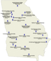
University of Georgia Campuses with Student Housing.gif 500 × 598; 25 KB
-
UpperSavannahRiverGA1795.jpg 590 × 458; 58 KB
-
US Southeastern Plains Map.jpg 3,300 × 2,550; 6.8 MB
-
US Southern Coastal Plain Map.jpg 3,300 × 2,550; 6.6 MB
-
US State georgia grey.png 400 × 432; 5 KB
-
Valdosta MSA.png 400 × 441; 10 KB
-
Villa Rica, GA.pdf 2,925 × 3,004; 298 KB
-
Wtty48dbu.JPG 605 × 599; 98 KB
-
Yazoo-land-fraud-grants.webp 477 × 556; 44 KB


