Category:Maps of Michigan
Jump to navigation
Jump to search
States of the United States: Alabama · Alaska · Arizona · Arkansas · California · Colorado · Connecticut · Delaware · Florida · Georgia · Hawaii · Idaho · Illinois · Indiana · Iowa · Kansas · Kentucky · Louisiana · Maine · Maryland · Massachusetts · Michigan · Minnesota · Mississippi · Missouri · Montana · Nebraska · Nevada · New Hampshire · New Jersey · New Mexico · New York · North Carolina · North Dakota · Ohio · Oklahoma · Oregon · Pennsylvania · Rhode Island · South Carolina · South Dakota · Tennessee · Texas · Utah · Vermont · Virginia · Washington · West Virginia · Wisconsin · Wyoming – Washington, D.C.
insular area of the United States: American Samoa · Guam · Northern Mariana Islands · Puerto Rico · United States Virgin Islands – United States Minor Outlying Islands: Baker Island · Howland Island · Jarvis Island · Johnston Atoll · Kingman Reef · Midway Atoll · Navassa Island · Palmyra Atoll · Wake Island
insular area of the United States: American Samoa · Guam · Northern Mariana Islands · Puerto Rico · United States Virgin Islands – United States Minor Outlying Islands: Baker Island · Howland Island · Jarvis Island · Johnston Atoll · Kingman Reef · Midway Atoll · Navassa Island · Palmyra Atoll · Wake Island
Wikimedia category | |||||
| Upload media | |||||
| Instance of | |||||
|---|---|---|---|---|---|
| Category combines topics | |||||
| Michigan | |||||
state of the United States of America | |||||
| Pronunciation audio | |||||
| Instance of | |||||
| Part of | |||||
| Named after | |||||
| Location |
| ||||
| Located in or next to body of water | |||||
| Capital | |||||
| Legislative body | |||||
| Executive body | |||||
| Highest judicial authority |
| ||||
| Anthem |
| ||||
| Head of government |
| ||||
| Headquarters location | |||||
| Has part(s) |
| ||||
| Inception |
| ||||
| Coastline |
| ||||
| Highest point | |||||
| Population |
| ||||
| Area |
| ||||
| Elevation above sea level |
| ||||
| Different from | |||||
| Maximum temperature record |
| ||||
| Minimum temperature record |
| ||||
| official website | |||||
 | |||||
Subcategories
This category has the following 39 subcategories, out of 39 total.
5
A
- Area code maps of Michigan (13 F)
B
- Blank maps of Michigan (2 F)
C
- Census maps of Michigan (63 F)
F
- Flag maps of Michigan (4 F)
G
H
I
L
M
N
O
P
R
- Maps of rivers in Michigan (47 F)
S
T
U
- Maps of the Upper Peninsula (23 F)
Media in category "Maps of Michigan"
The following 108 files are in this category, out of 108 total.
-
1842TreatyOfLaPointe.jpg 1,650 × 1,200; 1.2 MB
-
40,000 trash trucks stopped (5370054789).jpg 500 × 294; 88 KB
-
Ada Covered Bridge TIGER map.png 422 × 359; 15 KB
-
AnnArborRailroadMap.png 709 × 1,000; 1.5 MB
-
AntrimShaleMap.JPG 600 × 765; 88 KB
-
Appeals.png 1,496 × 1,653; 186 KB
-
ATCMap.jpg 792 × 612; 516 KB
-
Backbonedialin1996 for wikipedia.png 534 × 657; 93 KB
-
BCS League Geographic Footprint Map.png 1,993 × 2,117; 429 KB
-
BelknapLookoutBoundary.jpg 250 × 300; 48 KB
-
Benzie County, Michigan municipalities map.png 2,050 × 700; 126 KB
-
Blair Township, Michigan.png 446 × 604; 27 KB
-
Blue Water Michigan Map.jpg 119 × 164; 30 KB
-
Budd Lake, Michigan.png 399 × 313; 13 KB
-
Camp Custer Key Map.jpg 2,160 × 1,669; 857 KB
-
Central Upper Peninsula within Michigan's Upper Peninsula.jpg 1,280 × 720; 48 KB
-
Cheese League Training Camp Map.png 3,301 × 2,551; 3.23 MB
-
Clinton-kalamazoo canal map.png 3,162 × 989; 130 KB
-
Copper City, MI.png 2,136 × 2,136; 140 KB
-
Croton Dam locatorMap.png 420 × 360; 9 KB
-
Flint Tornado 1953.jpg 600 × 700; 44 KB
-
Gaastra, MI.png 1,320 × 1,110; 87 KB
-
Hart-Montague Bike Trail Map.jpg 4,000 × 3,000; 3.05 MB
-
Higgins Lake county map.jpg 1,234 × 646; 96 KB
-
Hollandmichigan.PNG 330 × 259; 4 KB
-
Houghton Lake State Airport map.png 700 × 800; 121 KB
-
Indian & Gard Islands in North Maumee Bay map.png 1,213 × 641; 32 KB
-
IsleRoyaleAgreement.jpg 1,100 × 800; 567 KB
-
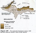
Jacobsville Sandstone Thickness.jpeg 373 × 346; 116 KB
-
Keweenaw County, Michigan map.png 1,200 × 829; 222 KB
-
KeweenawCountyLabels.png 1,200 × 829; 178 KB
-
LeelanauPeninsulaMap.png 2,803 × 2,894; 4.4 MB
-
Leggett Bay Map.jpg 3,024 × 4,032; 2.85 MB
-
LMC Map.gif 640 × 600; 25 KB
-
Lower Michigan Region Map.png 476 × 600; 141 KB
-
Lower Peninsula of Michigan map.png 500 × 630; 112 KB
-
Lower St. Marys shipping channels.jpg 843 × 721; 78 KB
-
Mackinac Island topo.png 718 × 358; 494 KB
-
MackinacCountyLabels.png 1,471 × 551; 100 KB
-
Map of Michigan Highlighting the Thumb.gif 713 × 818; 151 KB
-
Map of Michigan Highlighting the Thumb.png 1,200 × 1,344; 73 KB
-
Map of Michigan, Indiana, and Ohio.jpg 1,710 × 2,090; 308 KB
-
Map of South Michigan as defined by Michigander901.png 1,374 × 1,375; 60 KB
-
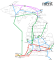
Merit Network's Backbone Map.png 400 × 436; 33 KB
-
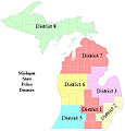
MI - State Police Districts.jpg 482 × 501; 114 KB
-
MI-Map---bottomland.png 318 × 300; 43 KB
-
Michiana, MI location.png 2,400 × 1,100; 167 KB
-
Michiana.jpg 197 × 347; 40 KB
-
Michigan 114 map.png 2,255 × 1,333; 180 KB
-
Michigan 90.jpg 1,397 × 1,573; 436 KB
-
Michigan ancestry map.png 235 × 120; 19 KB
-
Michigan AntShortnose.png 1,201 × 745; 58 KB
-
Michigan AVAs.png 944 × 966; 41 KB
-
Michigan Basin 2.jpg 357 × 360; 47 KB
-
Michigan Basin.jpg 350 × 416; 36 KB
-
Michigan Boy Scout Councils.jpg 588 × 534; 151 KB
-
Michigan BSA Councils.png 896 × 896; 50 KB
-
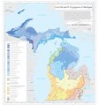
Michigan EPA ecoregions Levels III and IV.pdf 4,500 × 4,800; 4.35 MB
-
Michigan Hardiness Zone Map.webp 530 × 680; 45 KB
-
Michigan highways map.png 1,191 × 1,286; 58 KB
-
Michigan Köppen.png 6,300 × 8,638; 437 KB
-
Michigan Lower Peninsula Regions.png 292 × 278; 30 KB
-
Michigan population map.png 600 × 600; 189 KB
-
Michigan Regions highlighting Lower Peninsula.PNG 229 × 303; 13 KB
-
Michigan Regions.png 416 × 466; 43 KB
-
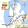
Michigan Services map.png 540 × 535; 51 KB
-
Michigan wind resource map 50m 800.jpg 850 × 1,100; 686 KB
-
Michigan's Indian trails.png 629 × 725; 183 KB
-
Michigan-1837.png 264 × 290; 52 KB
-
Michigan-2020-population-density.png 2,659 × 3,082; 1.08 MB
-
Michigan-territory-1805-1818.png 186 × 310; 41 KB
-
Michigan.png 500 × 600; 41 KB
-
Michiganancestry.png 800 × 600; 90 KB
-
MichiganCities.png 569 × 612; 64 KB
-
MichiganDNRmap.GIF 709 × 721; 20 KB
-
MichNetBackboneMap-March2004.gif 591 × 771; 55 KB
-
MichnetDialinMap-October1996.jpg 534 × 657; 72 KB
-
MSU campus map rev2.png 996 × 846; 193 KB
-
MSU Campus Map small rev3.png 888 × 598; 96 KB
-
Nanfan.jpg 994 × 768; 543 KB
-
National Parks of Michigan (ee75c9fe-1dd8-b71b-0b61-bf356f793d40).jpg 3,300 × 2,550; 3.7 MB
-
NationalForestsofMichigan.png 539 × 612; 67 KB
-
North Woods.gif 720 × 480; 17 KB
-
Palmsundayalltornadoes.jpg 1,024 × 768; 181 KB
-
Physiographic provinces of Wisconsin and Michigan (26846284281).jpg 2,180 × 1,684; 1.67 MB
-
Pleiness Lake.jpg 1,324 × 1,511; 114 KB
-
Population density of Michigan counties (2020).png 3,953 × 3,944; 1.3 MB
-
Radar-algorithme eng.gif 383 × 473; 320 KB
-
Radar-algorithme fr.gif 383 × 473; 46 KB
-
Saginaw-cession.jpg 500 × 702; 73 KB
-
Map of Sleeping Bear Dunes National Lakeshore.png 2,073 × 3,676; 906 KB
-
Sleeping Bear NLS map.jpg 580 × 854; 67 KB
-
Smile FM stations.png 1,568 × 1,808; 262 KB
-
Thornapple TIGER Irving dam area map3c.PNG 422 × 359; 7 KB
-
Thunder Bay NMS map.jpg 1,549 × 2,000; 442 KB
-
Tobicomap.gif 499 × 665; 96 KB
-
Toledo Strip.png 629 × 436; 17 KB
-
TorMay2004-Michigan.jpg 433 × 586; 35 KB
-
Txu-pclmaps-topo-us-marquette-1958.jpg 5,788 × 4,419; 6.28 MB
-
Upper Midwest ecoregions.gif 585 × 343; 29 KB
-
Upper Midwest ecoregions.png 585 × 343; 125 KB
-
USGS Toledo Strip Topo.jpg 548 × 171; 37 KB
-
Waugoshance Island, Michigan.png 575 × 408; 28 KB
-
Waugoshance.png 575 × 408; 57 KB
-
Wisconsin Arch and Michigan Basin.jpg 1,925 × 2,150; 1.19 MB


