Category:Maps of the history of Georgia (U.S. state)
Jump to navigation
Jump to search
States of the United States: Alabama · Alaska · Arizona · Arkansas · California · Colorado · Connecticut · Delaware · Florida · Georgia · Hawaii · Idaho · Illinois · Indiana · Iowa · Kansas · Kentucky · Louisiana · Maine · Maryland · Massachusetts · Michigan · Minnesota · Mississippi · Missouri · Montana · Nebraska · Nevada · New Hampshire · New Jersey · New Mexico · New York · North Carolina · North Dakota · Ohio · Oklahoma · Oregon · Pennsylvania · Rhode Island · South Carolina · South Dakota · Tennessee · Texas · Utah · Vermont · Virginia · Washington · West Virginia · Wisconsin · Wyoming – Washington, D.C.
Puerto Rico
Puerto Rico
Subcategories
This category has the following 6 subcategories, out of 6 total.
H
M
S
Media in category "Maps of the history of Georgia (U.S. state)"
The following 39 files are in this category, out of 39 total.
-
(Savannah and its environs. LOC gm71000880.jpg 4,704 × 2,920; 1.91 MB
-
Battle of Taliwa Campaign Box.png 315 × 622; 200 KB
-
Carolinacolony.png 1,000 × 1,048; 419 KB
-
Charter boundaries of Georgia.jpg 851 × 637; 196 KB
-
Cherokeenation1830map.jpg 576 × 426; 74 KB
-
Clyde d hollingsworth 1953 map battle of brier creek-cropped & resized-1280.jpg 1,280 × 934; 340 KB
-
Counties of Georgia 1784 En.jpg 2,231 × 2,972; 337 KB
-
Counties of Georgia 1784.png 2,231 × 2,972; 523 KB
-
Creek Cessions of the Treaty of Indian Springs (1821).jpg 600 × 692; 115 KB
-
Creek Cessions of the Treaty of Indian Springs (1825).jpg 600 × 692; 114 KB
-
DeSoto Map Leg 1 HRoe 2008.jpg 600 × 463; 204 KB
-
DeSoto Map Leg 2 HRoe 2008.jpg 600 × 470; 290 KB
-
EB9 United States - historical maps (top).jpg 2,488 × 1,803; 997 KB
-
Flauves.jpg 900 × 898; 538 KB
-
Fort Hull map.jpg 1,384 × 735; 153 KB
-
Frederica, St. Simons Island, Georgia.jpg 2,584 × 1,920; 2.72 MB
-
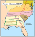
Gacolony.png 500 × 524; 43 KB
-
King Site Aerial HRoe 2018.jpg 380 × 253; 117 KB
-
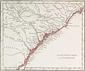
Map of Georgia province 1768.jpg 1,667 × 1,407; 584 KB
-
Map of Land Ceded by Treaty of Fort Jackson.png 320 × 336; 25 KB
-
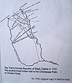
Map of Trans-Oconee Republic of Elijah Clarke.jpg 831 × 960; 88 KB
-
Midtown Atlanta 1895.jpeg 1,507 × 1,415; 1.07 MB
-
Mocama-People-Map.png 2,571 × 1,699; 204 KB
-
Parishes of Georgia, 1765.jpg 563 × 829; 85 KB
-
Railroads of Georgia 1860.jpg 570 × 763; 124 KB
-
Savannah, 1779 RCIN 734052.jpg 2,000 × 1,574; 1.08 MB
-
Settlement of Georgia Colony 1732-1763.jpg 861 × 546; 100 KB
-
Siege of Savannah map.jpg 1,759 × 2,008; 1.02 MB
-
Siege ville de Savannah 1779.jpg 2,049 × 1,415; 421 KB
-
South GA NRHP illustrated counties Jan 2016.png 346 × 220; 315 KB
-
Timucua-And-Surrounding-Groups.png 6,000 × 4,800; 1.65 MB
-
TimucuaTerritory.gif 268 × 260; 18 KB
-
Trails of Tears en.png 2,025 × 1,547; 3.04 MB
-
United States 1798-1800-07-04.png 1,000 × 677; 103 KB
-
United States Central map 1784-05-12 to 1787-07-13.png 2,000 × 1,320; 249 KB
-
Yazoo-Georgia Controversy.png 909 × 572; 232 KB


