Category:Maps of Montana
Jump to navigation
Jump to search
States of the United States: Alabama · Alaska · Arizona · Arkansas · California · Colorado · Connecticut · Delaware · Florida · Georgia · Hawaii · Idaho · Illinois · Indiana · Iowa · Kansas · Kentucky · Louisiana · Maine · Maryland · Massachusetts · Michigan · Minnesota · Mississippi · Missouri · Montana · Nebraska · Nevada · New Hampshire · New Jersey · New Mexico · New York · North Carolina · North Dakota · Ohio · Oklahoma · Oregon · Pennsylvania · Rhode Island · South Carolina · South Dakota · Tennessee · Texas · Utah · Vermont · Virginia · Washington · West Virginia · Wisconsin · Wyoming – Washington, D.C.
insular area of the United States: American Samoa · Guam · Northern Mariana Islands · Puerto Rico · United States Virgin Islands – United States Minor Outlying Islands: Baker Island · Howland Island · Jarvis Island · Johnston Atoll · Kingman Reef · Midway Atoll · Navassa Island · Palmyra Atoll · Wake Island
insular area of the United States: American Samoa · Guam · Northern Mariana Islands · Puerto Rico · United States Virgin Islands – United States Minor Outlying Islands: Baker Island · Howland Island · Jarvis Island · Johnston Atoll · Kingman Reef · Midway Atoll · Navassa Island · Palmyra Atoll · Wake Island
Wikimedia category | |||||
| Upload media | |||||
| Instance of | |||||
|---|---|---|---|---|---|
| Category combines topics | |||||
| Montana | |||||
state of the United States of America | |||||
| Pronunciation audio | |||||
| Instance of | |||||
| Part of | |||||
| Named after | |||||
| Location |
| ||||
| Located in or next to body of water | |||||
| Capital | |||||
| Legislative body | |||||
| Executive body | |||||
| Highest judicial authority | |||||
| Official language | |||||
| Anthem |
| ||||
| Head of government |
| ||||
| Inception |
| ||||
| Highest point | |||||
| Population |
| ||||
| Area |
| ||||
| Elevation above sea level |
| ||||
| Replaces | |||||
| Different from | |||||
| Maximum temperature record |
| ||||
| Minimum temperature record |
| ||||
| official website | |||||
 | |||||
Subcategories
This category has the following 34 subcategories, out of 34 total.
*
A
B
- Blackfoot maps (3 F)
C
- Crow maps (12 F)
F
- Flag maps of Montana (3 F)
G
H
L
- Location maps of Montana (4 F)
N
O
P
R
- Maps of rivers in Montana (23 F)
S
T
Media in category "Maps of Montana"
The following 91 files are in this category, out of 91 total.
-
2022 08 02-15.23.06.424-CDT.jpg 2,200 × 1,700; 713 KB
-
Area code MT.png 420 × 270; 12 KB
-
BeaverheadDeerlodgeNFMap.jpg 1,912 × 2,299; 2.31 MB
-
BeaverheadDeerlodgeNorthNFMap.jpg 3,994 × 2,812; 5.11 MB
-
Blackfeet Indian Reservation map.PNG 553 × 382; 14 KB
-
Bridger Range.JPG 629 × 335; 89 KB
-
Central Montana Alkalic Province.jpg 2,100 × 1,500; 166 KB
-
Charles M Russell National Wildlife Refuge Map.jpg 800 × 392; 57 KB
-
Conservationatlas.png 1,996 × 1,292; 3.45 MB
-
Crazies2.png 374 × 230; 43 KB
-
Crazy Montains in Montana.png 2,689 × 2,000; 20.55 MB
-
Crazy Mountains location.JPG 629 × 335; 89 KB
-
Crow territory (1 of 5), Fort Laramie 1851.png 1,470 × 1,783; 5.34 MB
-
Crow territory (2 of 5), 1868.png 1,470 × 1,783; 5.4 MB
-
Crow territory (3 of 5), 1880.png 1,470 × 1,783; 5.41 MB
-
Crow territory (4 of 5), 1891.png 1,470 × 1,783; 5.42 MB
-
Crow territory (5 of 5), 1904.png 1,470 × 1,783; 5.43 MB
-
CrowIRmap.png 500 × 403; 75 KB
-
Custer Battlefield in the Crow Reservation, MT, established May 7, 1868.png 3,864 × 2,120; 15.47 MB
-
East Fork Fire map.jpg 979 × 634; 792 KB
-
Elkhorns Map.png 374 × 230; 43 KB
-
EPAmap.jpg 790 × 925; 90 KB
-
FortpeckIRmap.png 500 × 402; 74 KB
-
Geothermal resources of Montana.pdf 5,662 × 4,110; 2.35 MB
-
Glac gttsr map with structures.png 4,096 × 2,751; 926 KB
-
Green River Country BHoU-p24.png 3,346 × 3,533; 211 KB
-
High Rockies SRTM30.JPG 500 × 607; 64 KB
-
Indianerreservate in Montana.png 630 × 367; 14 KB
-
Karte von Montana.jpg 892 × 518; 87 KB
-
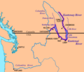
Kootenay & Kootenai River map.png 794 × 683; 129 KB
-
Map of domestic flights from Bozeman, Montana.png 1,443 × 938; 323 KB
-
Map of Flathead Indian Reservation - DPLA - d43d5f66abb982bbd1f5b3a00209dcfe.jpg 4,832 × 6,351; 5.17 MB
-
Map of Montana highlighting Billings Metro Area.png 801 × 468; 69 KB
-
Map of Pryor Mountains Wild Horse Range - 2009.jpg 724 × 1,016; 225 KB
-
Map of World War II Japanese American internment camps.png 896 × 744; 105 KB
-
Map with site of Forts Kipp and Stewart in Montana.png 725 × 703; 852 KB
-
Map with the route of a Crow Indian camp and Francois-Antoine Larocque in 1805.png 1,716 × 1,045; 952 KB
-
Map with trading posts built for trade with the Crows, 1807-1867.png 1,331 × 826; 1.98 MB
-
Military Reservation of Fort Benton.png 1,401 × 2,423; 2.56 MB
-
Military Reservation of Fort Ellis.png 1,420 × 2,418; 3.43 MB
-
Montana House District 100.jpg 349 × 276; 42 KB
-
Montana Indian Reservations.svg 744 × 460; 296 KB
-
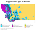
Montana Köppen.png 8,400 × 7,200; 515 KB
-
Montana National Forest Map.gif 499 × 323; 24 KB
-
Montana population map.png 700 × 400; 100 KB
-
Montana Relief 1.jpg 500 × 345; 70 KB
-
Montana rivers and lakes.jpg 745 × 470; 168 KB
-
Montana wind resource map 50m 800.jpg 1,100 × 850; 977 KB
-
Popi map.jpg 1,021 × 781; 163 KB
-
MT - MHP Districts.jpg 1,014 × 600; 175 KB
-
MT RRocks Location.pdf 4,450 × 3,331; 481 KB
-
MT RRocks Location.png 8,900 × 6,662; 38.95 MB
-
MTMap-doton-Belfry.PNG 300 × 175; 12 KB
-
MTMap-doton-FortBenton.PNG 300 × 175; 12 KB
-
NEPEmap1.jpg 1,090 × 819; 266 KB
-
Pend Oreille River Map.png 899 × 727; 123 KB
-
Photograph of "Map of the St. Mary's Lake Region, Montana." - NARA - 282364.jpg 1,880 × 3,000; 7.21 MB
-
Photograph of "Map of the St. Mary's Lake Region, Montana." - NARA - 282364.tif 1,880 × 3,000; 16.14 MB
-
Physiographic provinces of Montana (26309645523).jpg 2,200 × 1,700; 2.16 MB
-
Plan of Camp Baker.png 1,410 × 2,409; 2.86 MB
-
Plan of Fort Benton.png 1,406 × 2,414; 2.75 MB
-
Plan of Fort Ellis.png 1,415 × 2,404; 2.99 MB
-
Population density of Montana counties (2020).png 5,350 × 3,395; 1.18 MB
-
Provisional Government of Oregon map.png 487 × 315; 33 KB
-
Shonkin Sag map.jpg 763 × 512; 209 KB
-
Territory of some plateau tribes in Montana at the time they got the first horses.png 1,274 × 1,400; 1.09 MB
-
Teton area perspective map.PNG 1,100 × 793; 109 KB
-
The Bridgers.JPG 374 × 230; 92 KB
-
The country of the 'Blackfeet' Indians. A.jpg 1,536 × 1,261; 307 KB
-
The story of Montana (1916) (14793954683).jpg 3,136 × 2,300; 728 KB
-
TobaccoRoots.gif 349 × 230; 49 KB
-
Treasure State Acres Park sign.jpg 4,080 × 3,072; 7.72 MB
-
Tribal treaty territories in Montana - a general view.png 991 × 559; 291 KB
-
USGS GF-24 1-prnt.pdf 2,808 × 3,295; 3.99 MB
-
USGS GF-24 2-prnt.pdf 2,775 × 3,260; 4.09 MB
-
USGS GF-24 3-prnt.pdf 2,775 × 3,260; 4.98 MB
-
USGS GF-24 4-prnt.pdf 2,775 × 3,258; 5.04 MB
-
Williston Basin petroleum production.jpg 1,078 × 819; 109 KB
-
Wpdms nasa topo marias river.jpg 300 × 250; 43 KB
