Category:Maps of Utah
Jump to navigation
Jump to search
States of the United States: Alabama · Alaska · Arizona · Arkansas · California · Colorado · Connecticut · Delaware · Florida · Georgia · Hawaii · Idaho · Illinois · Indiana · Iowa · Kansas · Kentucky · Louisiana · Maine · Maryland · Massachusetts · Michigan · Minnesota · Mississippi · Missouri · Montana · Nebraska · Nevada · New Hampshire · New Jersey · New Mexico · New York · North Carolina · North Dakota · Ohio · Oklahoma · Oregon · Pennsylvania · Rhode Island · South Carolina · South Dakota · Tennessee · Texas · Utah · Vermont · Virginia · Washington · West Virginia · Wisconsin · Wyoming – Washington, D.C.
insular area of the United States: American Samoa · Guam · Northern Mariana Islands · Puerto Rico · United States Virgin Islands – United States Minor Outlying Islands: Baker Island · Howland Island · Jarvis Island · Johnston Atoll · Kingman Reef · Midway Atoll · Navassa Island · Palmyra Atoll · Wake Island
insular area of the United States: American Samoa · Guam · Northern Mariana Islands · Puerto Rico · United States Virgin Islands – United States Minor Outlying Islands: Baker Island · Howland Island · Jarvis Island · Johnston Atoll · Kingman Reef · Midway Atoll · Navassa Island · Palmyra Atoll · Wake Island
Wikimedia category | |||||
| Upload media | |||||
| Instance of | |||||
|---|---|---|---|---|---|
| Category combines topics | |||||
| Utah | |||||
state of the United States of America | |||||
| Pronunciation audio | |||||
| Instance of | |||||
| Part of | |||||
| Named after | |||||
| Location |
| ||||
| Located in or next to body of water | |||||
| Capital | |||||
| Legislative body | |||||
| Executive body | |||||
| Highest judicial authority | |||||
| Official language | |||||
| Anthem |
| ||||
| Head of government |
| ||||
| Inception |
| ||||
| Highest point |
| ||||
| Population |
| ||||
| Area |
| ||||
| Elevation above sea level |
| ||||
| Replaces |
| ||||
| Different from | |||||
| Maximum temperature record |
| ||||
| Minimum temperature record |
| ||||
| official website | |||||
 | |||||

See also: en:Category:Utah maps for related English Wikipedia images that have not yet been trans-wiki'd to Commons
Subcategories
This category has the following 37 subcategories, out of 37 total.
*
A
- Area code maps of Utah (5 F)
B
- Blank maps of Utah (2 F)
C
E
F
- Flag maps of Utah (6 F)
G
- Maps of the Great Salt Lake (10 F)
L
- Linguistic maps of Utah (6 F)
- Location maps of Utah (2 F)
M
- Mining maps of Utah (6 F)
N
O
P
R
S
T
U
Media in category "Maps of Utah"
The following 72 files are in this category, out of 72 total.
-
1850 California, Oregon, Utah, New Mexico Map.jpg 1,999 × 2,557; 889 KB
-
2009 swine flu outbreak in Utah.png 708 × 865; 139 KB
-
A glimpse of Great Salt Lake, Utah (1891) (14765527665).jpg 1,982 × 2,970; 1.5 MB
-
AlkaliRidge.png 145 × 125; 33 KB
-
AmDiscoveryMap.jpg 300 × 211; 32 KB
-
Bonneville Shoreline Trail map.jpg 1,378 × 2,855; 1.41 MB
-
Brigham Young University science bulletin (1955) (20228877319).jpg 1,854 × 1,134; 435 KB
-
Bulletin of the Geological Society of America (1913) (19829148133).jpg 3,008 × 2,076; 698 KB
-
Carte Utah population.png 600 × 470; 20 KB
-
Clearfield Station map.png 697 × 465; 80 KB
-
Coyote Natural Bridge map.jpg 445 × 366; 90 KB
-
ECUSA Utah.png 488 × 735; 19 KB
-
Ely Mining District.PNG 727 × 579; 28 KB
-
G. M. Wheeler, Topographical atlas 1869-1878 Wellcome L0027631.jpg 1,546 × 1,264; 1.03 MB
-
Geography Zion National Park.jpg 1,395 × 937; 129 KB
-
Geothermal Resources of Utah 1980 NOAA 01.jpg 1,856 × 2,664; 1.77 MB
-
Geothermal Resources of Utah 1980 NOAA 02.png 1,856 × 2,664; 7.77 MB
-
GeothermalResources Utah 1980 R.pdf 5,795 × 8,320; 4.61 MB
-
Great Salt Lake accounting unit (watershed).png 99 × 129; 2 KB
-
High Rockies SRTM30.JPG 500 × 607; 64 KB
-
Hohokam, Ancestral Pueblo, and Mogollon cultures circa 1350 CE.png 712 × 880; 315 KB
-
Karte Zion Nationalpark.png 1,024 × 1,202; 1.33 MB
-
Map detail, from- Abandoned Uranium Mines and the Navajo Nation (page 1 crop).jpg 2,859 × 1,944; 445 KB
-
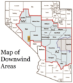
Map of Downwind Areas by the United States Department of Justice.png 200 × 228; 53 KB
-
Map of East Rim Hikes - Flickr - brewbooks (1).jpg 1,944 × 2,346; 1.67 MB
-
Map of Terrace, UT - Ghost town on old Transcontinental Railroad.jpg 3,024 × 3,024; 3.03 MB
-
Map of Utah State University RCDE.png 792 × 1,024; 212 KB
-
Map of World War II Japanese American internment camps.png 896 × 744; 105 KB
-
Mapa Gran Lago Salado.jpg 509 × 599; 74 KB
-
Milford Flat Fire perimeter.pdf 1,650 × 2,550; 4.31 MB
-
Military Reservation of Fort Cameron.png 1,408 × 2,386; 3.34 MB
-
Mineral resources of the United States (1913) (14775414434).jpg 1,552 × 3,632; 503 KB
-
Murray City Park map, Murray, Utah, Oct 16.jpg 2,592 × 1,944; 2.27 MB
-
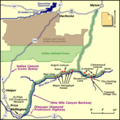
NineMileCanyon map.png 400 × 400; 28 KB
-
OldSpanishTrailUT.gif 765 × 600; 84 KB
-
Physiographic provinces of Utah (26308256114).jpg 1,700 × 2,200; 2.15 MB
-
PipeSpringMap.jpg 556 × 283; 38 KB
-
Plan of Fort Cameron.png 1,386 × 2,357; 3.17 MB
-
Pony Express Trail Through Utah.png 2,122 × 1,625; 38 KB
-
Population density of Utah counties (2020).png 3,590 × 4,042; 801 KB
-
Promised land brochure.jpg 789 × 907; 380 KB
-
Promontory.png 766 × 528; 7 KB
-
RC-2017 Utah Map.png 1,194 × 1,498; 128 KB
-
Rockland Ash map.png 283 × 334; 8 KB
-
Salt Lake Route newspaper ad.jpg 717 × 1,035; 171 KB
-
Temple Map of Utah.png 3,420 × 2,556; 310 KB
-
Temple Map of Utah Shaded.png 3,420 × 2,556; 307 KB
-
The Commercial and financial chronicle (1909) (14581945839).jpg 4,324 × 2,656; 2.96 MB
-
UintahIRmap.png 2,550 × 2,550; 287 KB
-
Updated 2009 Swine Flu outbreak in Utah.png 180 × 220; 13 KB
-
Upshot-knothole-harry-radiation.jpg 607 × 652; 100 KB
-
Utah 90.jpg 1,102 × 1,376; 407 KB
-
Utah county map divisions.png 6,900 × 4,275; 883 KB
-
Utah drought conditions (March 30, 2021).png 1,056 × 816; 53 KB
-
Utah Köppen.png 6,000 × 10,500; 506 KB
-
Utah Locator Map with US.PNG 296 × 368; 12 KB
-
Utah Municipality Population Density.png 1,486 × 1,845; 92 KB
-
Utah population map.png 600 × 600; 78 KB
-
UTMap-doton-HITTRRoad.png 153 × 200; 1 KB
-
UTMap-doton-SanJuanExp.png 153 × 200; 1 KB
-
UTMap-doton-WasatchFront.PNG 238 × 300; 18 KB
-
Verbreitung des Utah-Präriehundes 1920, 1970 und 1991.png 1,700 × 2,199; 738 KB
-
Wasatch Fault.gif 300 × 470; 80 KB
-
Wpdms utah territory 1851 idx esp.png 256 × 196; 16 KB
