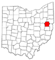
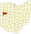
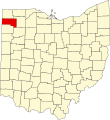
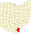
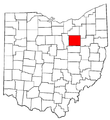
Category:Locator maps of counties of Ohio
Jump to navigation
Jump to search

States of the United States: Alabama · Alaska · Arizona · Arkansas · California · Colorado · Connecticut · Delaware · Florida · Georgia · Hawaii · Idaho · Illinois · Indiana · Iowa · Kansas · Kentucky · Louisiana · Maine · Maryland · Massachusetts · Michigan · Minnesota · Mississippi · Missouri · Montana · Nebraska · Nevada · New Hampshire · New Jersey · New Mexico · New York · North Carolina · North Dakota · Ohio · Oklahoma · Oregon · Pennsylvania · Rhode Island · South Carolina · South Dakota · Tennessee · Texas · Utah · Vermont · Virginia · Washington · West Virginia · Wisconsin · Wyoming
| NO WIKIDATA ID FOUND! Search for Locator maps of counties of Ohio on Wikidata | |
| Upload media |
English: Locator maps for counties in Ohio.
Subcategories
This category has the following 2 subcategories, out of 2 total.
C
Media in category "Locator maps of counties of Ohio"
The following 103 files are in this category, out of 103 total.
-
Ashtabula County.png 274 × 300; 14 KB
-
Butler County.png 274 × 300; 14 KB
-
Carroll County.png 274 × 300; 14 KB
-
Clermont County.png 274 × 300; 14 KB
-
Geauga County.png 274 × 300; 14 KB
-
Hamilton County.PNG 274 × 300; 14 KB
-
Lorain County.png 274 × 300; 14 KB
-
Mahoning County.png 274 × 300; 14 KB
-
Map of Ohio highlighting Adams County.png 274 × 300; 11 KB
-
Map of Ohio highlighting Adams County.svg 1,050 × 1,141; 37 KB
-
Map of Ohio highlighting Allen County.svg 1,050 × 1,141; 37 KB
-
Map of Ohio highlighting Ashland County.svg 1,050 × 1,141; 37 KB
-
Map of Ohio highlighting Ashtabula County.svg 1,050 × 1,141; 37 KB
-
Map of Ohio highlighting Athens County.svg 1,050 × 1,141; 37 KB
-
Map of Ohio highlighting Auglaize County.svg 1,050 × 1,141; 37 KB
-
Map of Ohio highlighting Belmont County.svg 1,050 × 1,141; 37 KB
-
Map of Ohio highlighting Brown County.svg 1,050 × 1,141; 37 KB
-
Map of Ohio highlighting Butler County.svg 1,050 × 1,141; 37 KB
-
Map of Ohio highlighting Carroll County.svg 1,050 × 1,141; 37 KB
-
Map of Ohio highlighting Champaign County.svg 1,050 × 1,141; 37 KB
-
Map of Ohio highlighting Clark County.svg 1,050 × 1,141; 37 KB
-
Map of Ohio highlighting Clermont County.svg 1,050 × 1,141; 37 KB
-
Map of Ohio highlighting Clinton County.svg 1,050 × 1,141; 37 KB
-
Map of Ohio highlighting Columbiana County.svg 1,050 × 1,141; 37 KB
-
Map of Ohio highlighting Coshocton County.svg 1,050 × 1,141; 37 KB
-
Map of Ohio highlighting Crawford County.svg 1,050 × 1,141; 37 KB
-
Map of Ohio highlighting Cuyahoga County.svg 1,050 × 1,141; 37 KB
-
Map of Ohio highlighting Darke County.svg 1,050 × 1,141; 37 KB
-
Map of Ohio highlighting Defiance County.svg 1,050 × 1,141; 37 KB
-
Map of Ohio highlighting Delaware County.svg 1,050 × 1,141; 37 KB
-
Map of Ohio highlighting Erie County.svg 1,050 × 1,141; 37 KB
-
Map of Ohio highlighting Fairfield County.svg 1,050 × 1,141; 37 KB
-
Map of Ohio highlighting Fayette County.svg 1,050 × 1,141; 37 KB
-
Map of Ohio highlighting Franklin County.svg 1,050 × 1,141; 37 KB
-
Map of Ohio highlighting Fulton County.svg 1,050 × 1,141; 37 KB
-
Map of Ohio highlighting Gallia County.svg 1,050 × 1,141; 37 KB
-
Map of Ohio highlighting Geauga County.svg 1,050 × 1,141; 37 KB
-
Map of Ohio highlighting Greene County.svg 1,050 × 1,141; 37 KB
-
Map of Ohio highlighting Guernsey County.svg 1,050 × 1,141; 37 KB
-
Map of Ohio highlighting Hamilton County.svg 1,050 × 1,141; 37 KB
-
Map of Ohio highlighting Hancock County.svg 1,050 × 1,141; 37 KB
-
Map of Ohio highlighting Hardin County.svg 1,050 × 1,141; 37 KB
-
Map of Ohio highlighting Harrison County.svg 1,050 × 1,141; 37 KB
-
Map of Ohio highlighting Henry County.svg 1,050 × 1,141; 37 KB
-
Map of Ohio highlighting Highland County.svg 1,050 × 1,141; 37 KB
-
Map of Ohio highlighting Hocking County.svg 1,050 × 1,141; 37 KB
-
Map of Ohio highlighting Holmes County.svg 1,050 × 1,141; 37 KB
-
Map of Ohio highlighting Huron County.svg 1,050 × 1,141; 37 KB
-
Map of Ohio highlighting Jackson County.svg 1,050 × 1,141; 37 KB
-
Map of Ohio highlighting Jefferson County.svg 1,050 × 1,141; 37 KB
-
Map of Ohio highlighting Knox County.svg 1,050 × 1,141; 37 KB
-
Map of Ohio highlighting Lake County.svg 1,050 × 1,141; 37 KB
-
Map of Ohio highlighting Lawrence County.svg 1,050 × 1,141; 37 KB
-
Map of Ohio highlighting Licking County.svg 1,050 × 1,141; 37 KB
-
Map of Ohio highlighting Logan County.svg 1,050 × 1,141; 37 KB
-
Map of Ohio highlighting Lorain County.svg 1,050 × 1,141; 37 KB
-
Map of Ohio highlighting Lucas County.svg 1,050 × 1,141; 37 KB
-
Map of Ohio highlighting Madison County.svg 1,050 × 1,141; 37 KB
-
Map of Ohio highlighting Mahoning County.svg 1,050 × 1,141; 37 KB
-
Map of Ohio highlighting Marion County.svg 1,050 × 1,141; 37 KB
-
Map of Ohio highlighting Medina County.svg 1,050 × 1,141; 37 KB
-
Map of Ohio highlighting Meigs County.svg 1,050 × 1,141; 37 KB
-
Map of Ohio highlighting Mercer County.svg 1,050 × 1,141; 37 KB
-
Map of Ohio highlighting Miami County.svg 1,050 × 1,141; 37 KB
-
Map of Ohio highlighting Monroe County.svg 1,050 × 1,141; 37 KB
-
Map of Ohio highlighting Montgomery County.svg 1,050 × 1,141; 37 KB
-
Map of Ohio highlighting Morgan County.svg 1,050 × 1,141; 37 KB
-
Map of Ohio highlighting Morrow County.svg 1,050 × 1,141; 37 KB
-
Map of Ohio highlighting Muskingum County.svg 1,050 × 1,141; 37 KB
-
Map of Ohio highlighting Noble County.svg 1,050 × 1,141; 37 KB
-
Map of Ohio highlighting Ottawa County.svg 1,050 × 1,141; 37 KB
-
Map of Ohio highlighting Paulding County.svg 1,050 × 1,141; 37 KB
-
Map of Ohio highlighting Perry County.svg 1,050 × 1,141; 37 KB
-
Map of Ohio highlighting Pickaway County.svg 1,050 × 1,141; 37 KB
-
Map of Ohio highlighting Pike County.svg 1,050 × 1,141; 37 KB
-
Map of Ohio highlighting Portage County.svg 1,050 × 1,141; 37 KB
-
Map of Ohio highlighting Preble County.svg 1,050 × 1,141; 37 KB
-
Map of Ohio highlighting Putnam County.svg 1,050 × 1,141; 37 KB
-
Map of Ohio highlighting Richland County.svg 1,050 × 1,141; 37 KB
-
Map of Ohio highlighting Ross County.svg 1,050 × 1,141; 37 KB
-
Map of Ohio highlighting Sandusky County.svg 1,050 × 1,141; 37 KB
-
Map of Ohio highlighting Scioto County.svg 1,050 × 1,141; 37 KB
-
Map of Ohio highlighting Seneca County.svg 1,050 × 1,141; 37 KB
-
Map of Ohio highlighting Shelby County.svg 1,050 × 1,141; 37 KB
-
Map of Ohio highlighting Stark County.svg 1,050 × 1,141; 37 KB
-
Map of Ohio highlighting Summit County.svg 1,050 × 1,141; 37 KB
-
Map of Ohio highlighting Trumbull County.svg 1,050 × 1,141; 37 KB
-
Map of Ohio highlighting Tuscarawas County.svg 1,050 × 1,141; 37 KB
-
Map of Ohio highlighting Union County.svg 1,050 × 1,141; 37 KB
-
Map of Ohio highlighting Van Wert County.svg 1,050 × 1,141; 37 KB
-
Map of Ohio highlighting Vinton County.svg 1,050 × 1,141; 37 KB
-
Map of Ohio highlighting Warren County.svg 1,050 × 1,141; 37 KB
-
Map of Ohio highlighting Washington County.svg 1,050 × 1,141; 37 KB
-
Map of Ohio highlighting Wayne County.svg 1,050 × 1,141; 37 KB
-
Map of Ohio highlighting Williams County.svg 1,050 × 1,141; 37 KB
-
Map of Ohio highlighting Wood County.svg 1,050 × 1,141; 37 KB
-
Map of Ohio highlighting Wyandot County.svg 1,050 × 1,141; 37 KB
-
Medina County.png 274 × 300; 14 KB
-
Montgomery County.png 274 × 300; 14 KB
-
Portage County.png 274 × 300; 14 KB
-
Stark County.png 274 × 300; 14 KB
-
Warren County.png 274 × 300; 14 KB
-
Wayne County.png 274 × 300; 14 KB


