
Category:Locator maps of counties of Oregon

States of the United States: Alabama · Alaska · Arizona · Arkansas · California · Colorado · Connecticut · Delaware · Florida · Georgia · Hawaii · Idaho · Illinois · Indiana · Iowa · Kansas · Kentucky · Louisiana · Maine · Maryland · Massachusetts · Michigan · Minnesota · Mississippi · Missouri · Montana · Nebraska · Nevada · New Hampshire · New Jersey · New Mexico · New York · North Carolina · North Dakota · Ohio · Oklahoma · Oregon · Pennsylvania · Rhode Island · South Carolina · South Dakota · Tennessee · Texas · Utah · Vermont · Virginia · Washington · West Virginia · Wisconsin · Wyoming
| NO WIKIDATA ID FOUND! Search for Locator maps of counties of Oregon on Wikidata | |
| Upload media |
English: Locator maps for counties in Oregon.
Media in category "Locator maps of counties of Oregon"
The following 45 files are in this category, out of 45 total.
-
 Central Oregon - 2.png 1,434 × 1,177; 91 KB
-
 Central Oregon cropped.png 1,157 × 856; 91 KB
-
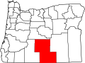
 Central Oregon.png 1,434 × 1,177; 101 KB
-
 Central Oregon.svg 859 × 593; 146 KB
-
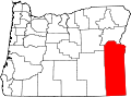
 Eastern Oregon.png 1,434 × 1,177; 88 KB
-
 Map of Oregon highlighting Baker County.svg 1,433 × 1,069; 104 KB
-
 Map of Oregon highlighting Benton County.svg 1,433 × 1,069; 104 KB
-
 Map of Oregon highlighting Clackamas County.svg 1,433 × 1,069; 104 KB
-
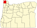 Map of Oregon highlighting Clatsop County.svg 1,433 × 1,069; 104 KB
-
 Map of Oregon highlighting Columbia County.svg 1,433 × 1,069; 104 KB
-
 Map of Oregon highlighting Coos County.svg 1,433 × 1,069; 104 KB
-
 Map of Oregon highlighting Crook County.svg 1,433 × 1,069; 104 KB
-
 Map of Oregon highlighting Curry County.svg 1,433 × 1,069; 104 KB
-
 Map of Oregon highlighting Deschutes County.svg 1,433 × 1,069; 104 KB
-
 Map of Oregon highlighting Douglas County.svg 1,433 × 1,069; 104 KB
-
 Map of Oregon highlighting Gilliam County.svg 1,433 × 1,069; 104 KB
-
 Map of Oregon highlighting Grant County.svg 1,433 × 1,069; 104 KB
-
 Map of Oregon highlighting Harney County.svg 1,433 × 1,069; 104 KB
-
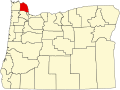
 Map of Oregon highlighting Hood River County.svg 1,433 × 1,069; 104 KB
-
 Map of Oregon highlighting Jackson County.svg 1,433 × 1,069; 104 KB
-
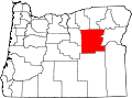
 Map of Oregon highlighting Jefferson County.svg 1,433 × 1,069; 104 KB
-
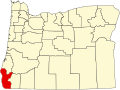
 Map of Oregon highlighting Josephine County.svg 1,433 × 1,069; 104 KB
-
 Map of Oregon highlighting Klamath County.svg 1,433 × 1,069; 104 KB
-
 Map of Oregon highlighting Lake County.svg 1,433 × 1,069; 104 KB
-
 Map of Oregon highlighting Lane County.svg 1,433 × 1,069; 104 KB
-
 Map of Oregon highlighting Lincoln County.svg 1,433 × 1,069; 104 KB
-
 Map of Oregon highlighting Linn County.svg 1,433 × 1,069; 104 KB
-
 Map of Oregon highlighting Malheur County.png 300 × 232; 10 KB
-
 Map of Oregon highlighting Malheur County.svg 1,433 × 1,069; 104 KB
-
 Map of Oregon highlighting Marion County.svg 1,433 × 1,069; 104 KB
-
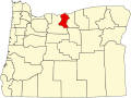
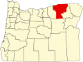
 Map of Oregon highlighting Morrow County.svg 1,433 × 1,069; 104 KB
-
 Map of Oregon highlighting Multnomah County.svg 1,433 × 1,069; 104 KB
-
 Map of Oregon highlighting Polk County.svg 1,433 × 1,069; 104 KB
-
 Map of Oregon highlighting Sherman County.svg 1,433 × 1,069; 104 KB
-
 Map of Oregon highlighting Tillamook County.svg 1,433 × 1,069; 104 KB
-
 Map of Oregon highlighting Umatilla County.svg 1,433 × 1,069; 104 KB
-
 Map of Oregon highlighting Union County.svg 1,433 × 1,069; 104 KB
-
 Map of Oregon highlighting Wallowa County.svg 1,433 × 1,069; 104 KB
-
 Map of Oregon highlighting Wasco County.svg 1,433 × 1,069; 104 KB
-
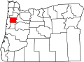
 Map of Oregon highlighting Washington County.svg 1,433 × 1,069; 104 KB
-
 Map of Oregon highlighting Wheeler County.svg 1,433 × 1,069; 104 KB
-
 Map of Oregon highlighting Yamhill County.svg 1,433 × 1,069; 104 KB
-
 Map of Oregon.svg 6,451 × 4,810; 136 KB
-
 Oregon Counties.gif 1,434 × 1,177; 74 KB
-
 Southern Oregon.gif 1,434 × 1,177; 74 KB


