Category:Locator maps of counties of Minnesota
Jump to navigation
Jump to search

States of the United States: Alabama · Alaska · Arizona · Arkansas · California · Colorado · Connecticut · Delaware · Florida · Georgia · Hawaii · Idaho · Illinois · Indiana · Iowa · Kansas · Kentucky · Louisiana · Maine · Maryland · Massachusetts · Michigan · Minnesota · Mississippi · Missouri · Montana · Nebraska · Nevada · New Hampshire · New Jersey · New Mexico · New York · North Carolina · North Dakota · Ohio · Oklahoma · Oregon · Pennsylvania · Rhode Island · South Carolina · South Dakota · Tennessee · Texas · Utah · Vermont · Virginia · Washington · West Virginia · Wisconsin · Wyoming
| NO WIKIDATA ID FOUND! Search for Locator maps of counties of Minnesota on Wikidata | |
| Upload media |
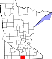
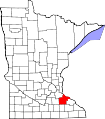
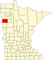
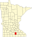
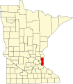
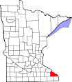
English: Locator maps for counties in Minnesota.
Media in category "Locator maps of counties of Minnesota"
The following 88 files are in this category, out of 88 total.
-
Map of Minnesota counties blank.svg 5,746 × 6,539; 106 KB
-
Map of Minnesota highlighting Aitkin County.svg 1,045 × 1,189; 67 KB
-
Map of Minnesota highlighting Anoka County.svg 1,045 × 1,189; 67 KB
-
Map of Minnesota highlighting Becker County.svg 1,045 × 1,189; 67 KB
-
Map of Minnesota highlighting Beltrami County.svg 1,045 × 1,189; 67 KB
-
Map of Minnesota highlighting Benton County.svg 1,045 × 1,189; 67 KB
-
Map of Minnesota highlighting Big Stone County.svg 1,045 × 1,189; 67 KB
-
Map of Minnesota highlighting Blue Earth County.svg 1,045 × 1,189; 67 KB
-
Map of Minnesota highlighting Brown County.svg 1,045 × 1,189; 67 KB
-
Map of Minnesota highlighting Carlton County.svg 1,045 × 1,189; 67 KB
-
Map of Minnesota highlighting Carver County.svg 1,045 × 1,189; 67 KB
-
Map of Minnesota highlighting Cass County.svg 1,045 × 1,189; 67 KB
-
Map of Minnesota highlighting Chippewa County.svg 1,045 × 1,189; 67 KB
-
Map of Minnesota highlighting Chisago County.svg 1,045 × 1,189; 67 KB
-
Map of Minnesota highlighting Clay County.svg 1,045 × 1,189; 67 KB
-
Map of Minnesota highlighting Clearwater County.svg 1,045 × 1,189; 67 KB
-
Map of Minnesota highlighting Cook County.svg 1,045 × 1,189; 67 KB
-
Map of Minnesota highlighting Cottonwood County.svg 1,045 × 1,189; 67 KB
-
Map of Minnesota highlighting Crow Wing County.svg 1,045 × 1,189; 67 KB
-
Map of Minnesota highlighting Dakota County.svg 1,045 × 1,189; 67 KB
-
Map of Minnesota highlighting Dodge County.svg 1,045 × 1,189; 67 KB
-
Map of Minnesota highlighting Douglas County.svg 1,045 × 1,189; 67 KB
-
Map of Minnesota highlighting Faribault County.svg 1,045 × 1,189; 67 KB
-
Map of Minnesota highlighting Fillmore County.svg 1,045 × 1,189; 67 KB
-
Map of Minnesota highlighting Freeborn County.svg 1,045 × 1,189; 67 KB
-
Map of Minnesota highlighting Goodhue County.svg 1,045 × 1,189; 67 KB
-
Map of Minnesota highlighting Grant County.svg 1,045 × 1,189; 67 KB
-
Map of Minnesota highlighting Hennepin County.svg 1,045 × 1,189; 67 KB
-
Map of Minnesota highlighting Houston County.svg 1,045 × 1,189; 67 KB
-
Map of Minnesota highlighting Hubbard County.svg 1,045 × 1,189; 67 KB
-
Map of Minnesota highlighting Isanti County.svg 1,045 × 1,189; 67 KB
-
Map of Minnesota highlighting Itasca County.svg 1,045 × 1,189; 67 KB
-
Map of Minnesota highlighting Jackson County.svg 1,045 × 1,189; 67 KB
-
Map of Minnesota highlighting Kanabec County.svg 1,045 × 1,189; 67 KB
-
Map of Minnesota highlighting Kandiyohi County.svg 1,045 × 1,189; 67 KB
-
Map of Minnesota highlighting Kittson County.svg 1,045 × 1,189; 67 KB
-
Map of Minnesota highlighting Koochiching County.svg 1,045 × 1,189; 67 KB
-
Map of Minnesota highlighting Lac qui Parle County.svg 1,045 × 1,189; 67 KB
-
Map of Minnesota highlighting Lake County.svg 1,045 × 1,189; 67 KB
-
Map of Minnesota highlighting Lake of the Woods County.svg 1,045 × 1,189; 67 KB
-
Map of Minnesota highlighting Le Sueur County.svg 1,045 × 1,189; 67 KB
-
Map of Minnesota highlighting Lincoln County.svg 1,045 × 1,189; 67 KB
-
Map of Minnesota highlighting Lyon County.svg 1,045 × 1,189; 67 KB
-
Map of Minnesota highlighting Mahnomen County.svg 1,045 × 1,189; 67 KB
-
Map of Minnesota highlighting Marshall County.svg 1,045 × 1,189; 67 KB
-
Map of Minnesota highlighting Martin County.svg 1,045 × 1,189; 67 KB
-
Map of Minnesota highlighting McLeod County.svg 1,045 × 1,189; 67 KB
-
Map of Minnesota highlighting Meeker County.svg 1,045 × 1,189; 67 KB
-
Map of Minnesota highlighting Mille Lacs County.svg 1,045 × 1,189; 67 KB
-
Map of Minnesota highlighting Morrison County.svg 1,045 × 1,189; 67 KB
-
Map of Minnesota highlighting Mower County.svg 1,045 × 1,189; 67 KB
-
Map of Minnesota highlighting Murray County.svg 1,045 × 1,189; 67 KB
-
Map of Minnesota highlighting Nicollet County.svg 1,045 × 1,189; 67 KB
-
Map of Minnesota highlighting Nobles County.svg 1,045 × 1,189; 67 KB
-
Map of Minnesota highlighting Norman County.svg 1,045 × 1,189; 67 KB
-
Map of Minnesota highlighting Olmsted County.svg 1,045 × 1,189; 67 KB
-
Map of Minnesota highlighting Otter Tail County.svg 1,045 × 1,189; 67 KB
-
Map of Minnesota highlighting Pennington County.svg 1,045 × 1,189; 67 KB
-
Map of Minnesota highlighting Pine County.svg 1,045 × 1,189; 67 KB
-
Map of Minnesota highlighting Pipestone County.svg 1,045 × 1,189; 67 KB
-
Map of Minnesota highlighting Polk County.svg 1,045 × 1,189; 67 KB
-
Map of Minnesota highlighting Pope County.svg 1,045 × 1,189; 67 KB
-
Map of Minnesota highlighting Ramsey County.svg 1,045 × 1,189; 67 KB
-
Map of Minnesota highlighting Red Lake County.svg 1,045 × 1,189; 67 KB
-
Map of Minnesota highlighting Redwood County.svg 1,045 × 1,189; 67 KB
-
Map of Minnesota highlighting Renville County.svg 1,045 × 1,189; 67 KB
-
Map of Minnesota highlighting Rice County.svg 1,045 × 1,189; 67 KB
-
Map of Minnesota highlighting Rock County.svg 1,045 × 1,189; 67 KB
-
Map of Minnesota highlighting Roseau County.svg 1,045 × 1,189; 67 KB
-
Map of Minnesota highlighting Saint Louis County.svg 1,045 × 1,189; 67 KB
-
Map of Minnesota highlighting Scott County.svg 1,045 × 1,189; 67 KB
-
Map of Minnesota highlighting Sherburne County.svg 1,045 × 1,189; 67 KB
-
Map of Minnesota highlighting Sibley County.svg 1,045 × 1,189; 67 KB
-
Map of Minnesota highlighting Stearns County.svg 1,045 × 1,189; 67 KB
-
Map of Minnesota highlighting Steele County.svg 1,045 × 1,189; 67 KB
-
Map of Minnesota highlighting Stevens County.svg 1,045 × 1,189; 67 KB
-
Map of Minnesota highlighting Swift County.svg 1,045 × 1,189; 67 KB
-
Map of Minnesota highlighting Todd County.svg 1,045 × 1,189; 67 KB
-
Map of Minnesota highlighting Traverse County.svg 1,045 × 1,189; 67 KB
-
Map of Minnesota highlighting Wabasha County.svg 1,045 × 1,189; 67 KB
-
Map of Minnesota highlighting Wadena County.svg 1,045 × 1,189; 67 KB
-
Map of Minnesota highlighting Waseca County.svg 1,045 × 1,189; 67 KB
-
Map of Minnesota highlighting Washington County.svg 1,045 × 1,189; 67 KB
-
Map of Minnesota highlighting Watonwan County.svg 1,045 × 1,189; 67 KB
-
Map of Minnesota highlighting Wilkin County.svg 1,045 × 1,189; 67 KB
-
Map of Minnesota highlighting Winona County.svg 1,045 × 1,189; 67 KB
-
Map of Minnesota highlighting Wright County.svg 1,045 × 1,189; 67 KB
-
Map of Minnesota highlighting Yellow Medicine County.svg 1,045 × 1,189; 67 KB


