Category:Locator maps of counties of Utah
Appearance

States of the United States: Alabama · Alaska · Arizona · Arkansas · California · Colorado · Connecticut · Delaware · Florida · Georgia · Hawaii · Idaho · Illinois · Indiana · Iowa · Kansas · Kentucky · Louisiana · Maine · Maryland · Massachusetts · Michigan · Minnesota · Mississippi · Missouri · Montana · Nebraska · Nevada · New Hampshire · New Jersey · New Mexico · New York · North Carolina · North Dakota · Ohio · Oklahoma · Oregon · Pennsylvania · Rhode Island · South Carolina · South Dakota · Tennessee · Texas · Utah · Vermont · Virginia · Washington · West Virginia · Wisconsin · Wyoming
| NO WIKIDATA ID FOUND! Search for Locator maps of counties of Utah on Wikidata | |
| Upload media |
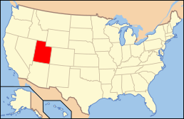
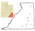
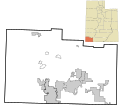
English: Locator maps for counties in Utah.
Subcategories
This category has the following 30 subcategories, out of 30 total.
L
M
Media in category "Locator maps of counties of Utah"
The following 79 files are in this category, out of 79 total.
-
Boxeldermap ut.png 600 × 782; 12 KB
-
Cache County Utah incorporated and unincorporated areas.svg 883 × 590; 7.46 MB
-
Cachemap ut.png 600 × 782; 12 KB
-
Carbonmap ut.jpg 600 × 782; 104 KB
-
Carbonmap ut.png 600 × 782; 12 KB
-
Daggettmap ut.png 600 × 782; 12 KB
-
Davismap ut.png 600 × 782; 12 KB
-
Duchesnemap ut.png 600 × 782; 12 KB
-
Emery County Utah incorporated and unincorporated areas.svg 835 × 741; 10.04 MB
-
Emerymap ut.jpg 600 × 782; 104 KB
-
Emerymap ut.png 600 × 782; 12 KB
-
Garfield County Utah incorporated and unincorporated areas.svg 972 × 602; 1.68 MB
-
Garfieldmap ut.jpg 600 × 782; 48 KB
-
Grandmap ut.jpg 600 × 782; 102 KB
-
Grandmap ut.png 600 × 782; 12 KB
-
Ironmap ut.png 600 × 782; 12 KB
-
Juabmap ut.jpg 600 × 782; 101 KB
-
Juabmap ut.png 600 × 782; 12 KB
-
Kanemap ut.jpg 600 × 782; 103 KB
-
Kanemap ut.png 600 × 782; 12 KB
-
Map of Utah highlighting Beaver County.svg 891 × 1,113; 52 KB
-
Map of Utah highlighting Box Elder County.svg 891 × 1,113; 52 KB
-
Map of Utah highlighting Cache County.png 238 × 300; 16 KB
-
Map of Utah highlighting Carbon County.svg 891 × 1,113; 52 KB
-
Map of Utah highlighting Daggett County.svg 891 × 1,113; 52 KB
-
Map of Utah highlighting Davis County.svg 891 × 1,113; 52 KB
-
Map of Utah highlighting Duchesne County.svg 891 × 1,113; 52 KB
-
Map of Utah highlighting Emery County.png 238 × 300; 17 KB
-
Map of Utah highlighting Emery County.svg 891 × 1,113; 52 KB
-
Map of Utah highlighting Iron County.png 238 × 300; 16 KB
-
Map of Utah highlighting Iron County.svg 891 × 1,113; 52 KB
-
Map of Utah highlighting Juab County.svg 891 × 1,113; 52 KB
-
Map of Utah highlighting Kane County.png 238 × 300; 17 KB
-
Map of Utah highlighting Kane County.svg 891 × 1,113; 52 KB
-
Map of Utah highlighting Millard County.svg 891 × 1,113; 52 KB
-
Map of Utah highlighting Morgan County.svg 891 × 1,113; 52 KB
-
Map of Utah highlighting Piute County.svg 891 × 1,113; 52 KB
-
Map of Utah highlighting Rich County.svg 891 × 1,113; 52 KB
-
Map of Utah highlighting Salt Lake County.svg 891 × 1,113; 52 KB
-
Map of Utah highlighting San Juan County.png 238 × 300; 17 KB
-
Map of Utah highlighting San Juan County.svg 891 × 1,113; 52 KB
-
Map of Utah highlighting Sanpete County.svg 891 × 1,113; 52 KB
-
Map of Utah highlighting Sevier County.png 238 × 300; 16 KB
-
Map of Utah highlighting Sevier County.svg 891 × 1,113; 52 KB
-
Map of Utah highlighting Summit County.svg 891 × 1,113; 52 KB
-
Map of Utah highlighting Tooele County.svg 891 × 1,113; 52 KB
-
Map of Utah highlighting Uintah County.png 238 × 300; 16 KB
-
Map of Utah highlighting Uintah County.svg 891 × 1,113; 52 KB
-
Map of Utah highlighting Utah County.svg 891 × 1,113; 52 KB
-
Map of Utah highlighting Wasatch County.svg 891 × 1,113; 52 KB
-
Map of Utah highlighting Washington County.svg 891 × 1,113; 52 KB
-
Map of Utah highlighting Wayne County.svg 891 × 1,113; 52 KB
-
Map of Utah highlighting Weber County.svg 891 × 1,113; 52 KB
-
Millardmap ut.png 600 × 782; 12 KB
-
Morganmap.png 600 × 782; 12 KB
-
Piutemap ut.jpg 600 × 782; 102 KB
-
Piutemap ut.png 600 × 782; 12 KB
-
Richmap ut.png 600 × 782; 11 KB
-
Saltlakemap ut.png 600 × 782; 12 KB
-
San Juan County Utah incorporated and unincorporated areas.svg 835 × 741; 9.6 MB
-
Sanjuanmap ut.png 600 × 782; 12 KB
-
Sanpetemap ut.jpg 600 × 782; 48 KB
-
Sanpetemap ut.png 600 × 782; 12 KB
-
Sevier County Utah incorporated and unincorporated areas.svg 835 × 741; 6.28 MB
-
Seviermap ut.jpg 600 × 782; 105 KB
-
Seviermap ut.png 600 × 782; 12 KB
-
Summitmap ut.png 600 × 782; 12 KB
-
Tooelemap ut.png 600 × 782; 12 KB
-
Uintahmap ut.png 600 × 782; 12 KB
-
Utah Locator Map.PNG 292 × 364; 5 KB
-
Utahmap ut.jpg 600 × 782; 107 KB
-
Utahmap ut.png 600 × 782; 12 KB
-
Wasatchmap ut.png 600 × 782; 12 KB
-
Washington County Utah incorporated and unincorporated areas.svg 835 × 741; 7.25 MB
-
Washingtonmap ut.png 600 × 782; 11 KB
-
Wayne County Utah incorporated and unincorporated areas.svg 1,560 × 741; 4.51 MB
-
Waynemap ut.jpg 600 × 782; 48 KB
-
Waynemap ut.png 600 × 782; 12 KB
-
Webermap ut.png 600 × 782; 11 KB


