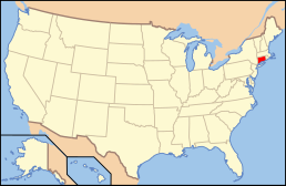
Category:Locator maps of counties of Connecticut
Jump to navigation
Jump to search

States of the United States: Alabama · Alaska · Arizona · Arkansas · California · Colorado · Connecticut · Delaware · Florida · Georgia · Hawaii · Idaho · Illinois · Indiana · Iowa · Kansas · Kentucky · Louisiana · Maine · Maryland · Massachusetts · Michigan · Minnesota · Mississippi · Missouri · Montana · Nebraska · Nevada · New Hampshire · New Jersey · New Mexico · New York · North Carolina · North Dakota · Ohio · Oklahoma · Oregon · Pennsylvania · Rhode Island · South Carolina · South Dakota · Tennessee · Texas · Utah · Vermont · Virginia · Washington · West Virginia · Wisconsin · Wyoming
| NO WIKIDATA ID FOUND! Search for Locator maps of counties of Connecticut on Wikidata | |
| Upload media |
English: Locator maps for counties in Connecticut.
Subcategories
This category has only the following subcategory.
Media in category "Locator maps of counties of Connecticut"
The following 12 files are in this category, out of 12 total.
-
2020 Presidential Election by CT COG.svg 810 × 595; 33 KB
-
Connecticut-counties-map Fairfield Windham Hartford.PNG 721 × 543; 15 KB
-
Connecticut-counties-map Windham and Hartford.PNG 721 × 543; 16 KB
-
Connecticut-counties-map-LichfieldandNew Haven.png 721 × 543; 17 KB
-
Map of Connecticut highlighting Fairfield County.svg 1,624 × 1,184; 10 KB
-
Map of Connecticut highlighting Hartford County.svg 1,624 × 1,184; 10 KB
-
Map of Connecticut highlighting Litchfield County.svg 1,624 × 1,184; 10 KB
-
Map of Connecticut highlighting Middlesex County.svg 1,624 × 1,184; 10 KB
-
Map of Connecticut highlighting New Haven County.svg 1,624 × 1,184; 10 KB
-
Map of Connecticut highlighting New London County.svg 1,624 × 1,184; 10 KB
-
Map of Connecticut highlighting Tolland County.svg 1,624 × 1,184; 10 KB
-
Map of Connecticut highlighting Windham County.svg 1,624 × 1,184; 10 KB


