
Atlas of Romania

|
Wikimedia Commons Atlas of the World The Wikimedia Atlas of the World is an organized and commented collection of geographical, political and historical maps available at Wikimedia Commons. Discussion • Update the atlas • Index of the Atlas • Atlas in categories • Other atlases on line |
|
| ||||||||||||||||||||||||||||||||||||||||||||


General maps

|
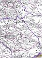
Hartă generală a României Übersichtskarte von Rumänien General map of Romania Carte générale de la Roumanie |

|
Harta fizică şi generală a României Physical and general map Carte physique et générale de la Roumanie |

|
Harta României Karte von Rumänien Map of Romania Carte de la Roumanie |

|
Harta României Map of Romania in Romanian |

|
Románia térkép Same map in Hungarian |

|
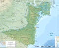
Harta fizică Physical map |

|
Harta fizică Physical map |

|
Harta geologică Geological map |

|
The Moldavian highland |

|
The Transylvanian highland |

|
The Walachian plain |

|
Harta hidrografică a României Karte der Flüsse in Rumänien Rivers map Carte des fleuves en Roumanie |

|
Hartă topografică a României Topographic map |

|
Hartă topografică a României Relief map of Romania |

|
Mountains of Romania |

|
The Eastern Carpathian mountains |

|
The Turning Carpathian mountains |

|
The Southern Carpathian (Transylvanian Alpine) mountains |

|
The Western Carpathian mountains (Apuseni or Bihor, and Banat ranges) |

|
The Harghita volcanic mountains |

|
The hercynian Măcin range in Dobruja, Romania |

|
Climate of Romania |

|
GHI Solar ressource 2011 |

|
Romanian railway system |

|
Romanian national roads |

|
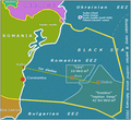
Romanian waters in the Black Sea, since 2009 |
Maps of divisions
This section holds maps of the administrative divisions. Traditional provinces (unofficial). Be careful: Bucovina is contoured according to the Romanian counties of the interwar period, not to the Austro-Hungarian borders of 1775-1918.
-
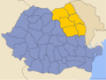
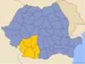
 Transylvania, Banat, Crişana and Maramureş in Romania
 -
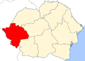
 Banat in Romania
 -
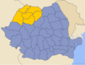
 Transylvania in Romania
 -
 Crişana in Romania
 -
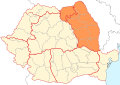
 Maramureş in Romania
 -
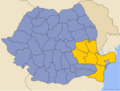
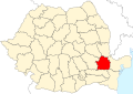
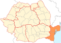 Dobrudja in Romania
 -
 Wallachia in Romania
 -
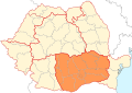
 Oltenia in Romania
 -
 Oltenia in Walachia
 -
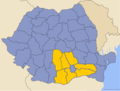
 Muntenia in Romania
 -
 Muntenia in Walachia
 -
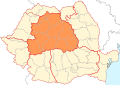
 Moldavia and Bucovina in Romania
 -
 (Western) Moldavia in Romania
 -
 Southern Bucovina in Romania


Maps of divisions
This section holds maps of the administrative divisions. Current administrative organisation (official)

|
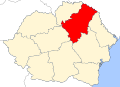
The 4 macroregions |

|
The 8 development Euro-Regions |

|
The 8 development Euro-Regions |
-
 Cental development region
 -
 North-Eastern development region
 -
 North-Western development region
 -
 Southern development region
 -
 South-Eastern development region
 -
 South-Western development region
 -
 Western development region


|
Counties of Romania |

|
The counties with their capital cities |

|
Counties of Romania with their capital cities |

|
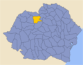
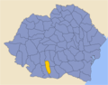
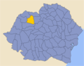
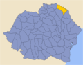
The 41 Counties of Romania |

|
The 41 Counties of Romania with their codes and names |
-
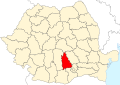
 Alba county
 -
 Arad county
 -
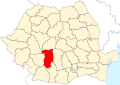
 Argeş county
 -
 Bacău county
 -
 Bistriţa-Năsăud county
 -
 Bihor county
 -
 Botoşani county
 -
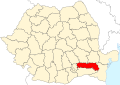
 Brăila county
 -
 Braşov county
 -
 Buzău county
 -
 Călăraşi county
 -
 Caraş-Severin county
 -
 Cluj county
 -
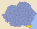
 Constanţa county
 -
 Covasna county
 -
 Dâmboviţa county
 -
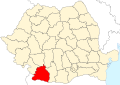 Dolj county
 -
 Galaţi county
 -
 Giurgiu (Vlaşca) county
 -
 Gorj county
 -
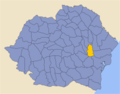
 Harghita county
 -
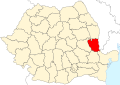
 Hunedoara county
 -
 Ialomiţa county
 -
 Iaşi county
 -
 Ilfov county
 -
 Maramureş county
 -
 Medehinţi county
 -
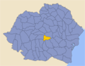
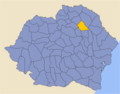
 Mureş county
 -
 Neamţ county
 -
 Olt county
 -
 Prahova county
 -
 Sălaj county
 -
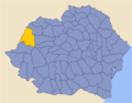
 Satu Mare county
 -
 Sibiu county
 -
 Suceava county
 -
 Teleorman county
 -
 Timiş county
 -
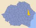
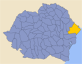
 Tulcea county
 -
 Vâlcea county
 -
 Vaslui county
 -
 Vrancea county
 -
 Bucharest municipality


|
The 3137 Communes of Romania, towns and municipalities |

|
Communes of Romania |

|
Administrative map of the Romanian Orthodox Church |
_Church_map.svg)
|
Administrative map of the Romanian Greek-Catholic (Uniate) Church |

|
Administrative map of the Romanian Roman-Catholic Church |
History maps
This section holds a short summary of the history of the area of present-day Romania, illustrated with maps, including historical maps of former countries and empires that included present-day Romania.

|
Thracian and Illyrian languages |

|
Dacia 82 B.C. by Adrian Hubert Brue |

|
Dacia 82 B.C. |

|
Territorial development of the Roman Empire 264 BC-192, including the conquest of Dacia |

|
The Roman Empire in 116 |

|
Dacia in the Roman Empire (116)) |

|
Moesia Inferior in the Roman Empire (116)) |

|
"Blue area" Moesia Superior and Inferior in the Roman Empire |

|
The Roman Empire at its greatest extend |

|
The Roman Empire in 117 |

|
Roman era in the Balkans |

|
Roman Empire in 117 |

|
Dacia in the Roman Empire |
.svg)
|
The roman province Dacia |

|
Romanised (blue) and no-romanised (pink) Dacians and Thracians on the low-Danube |

|
Roman era in the Balkans |

|
Dacia Trajana and Aureliana (Romanian historians see it as their original home. The Hungarian and Russian historians deny their persistence on the north of the Danube, the Serb and Bulgarian historians deny their persistence on the south of the Danube) |

|
Origins of the Romanians (here shown, according with the romanian thesis of "links between the Eastern part of the Roman Empire and the genesis of the Vlachs-Wallachians-Romanians from the romanisation of the Dacian-Getian-Thracian populations") |

|
Origins of the Romanians (here missing, according with the austro-hungarian and russian thesis of the "absence during thousand years" of the eastern romance populations between 276 and the 14th century) |

|
Vlachs (Romanians) shown in Transylvania in the 6th-8th century (according to the historical atlas for schools, published in Belgrade in 1970, representing a view of Yugoslav historians from that time, denied by the Hungarian historians) |

|
Four german maps showing history of Central Europe 9-th to XIII-th centuries (These maps showing that the "vanishing for a thousand years" of Albanian and Eastern Romance languages, thesis published by Eduard Rösler in Romänische Studien: untersuchungen zur älteren Geschichte Rumäniens ("Roman studies: investigations into the ancient history of Romania"), Leipzig, 1871, is not unanimously accepted by all publishers, even Germans - see History of Romania) |

|
The vlach-bulgarian kingdom under Ivan Assen/Ioan Asan II, 1218-41 |

|
The campaigns of Ivan Assen/Ioan Asan II |

|
The wallachian & bulgarian states under the Tsar Todor Svetoslav (1307) |

|
Principality of Walachia 14th-15th centuries |

|
Principality of Walachia during Mircea the Elder (after 1404) |

|
Amlaş and Făgăraş duchies 14th-15th centuries |

|
Development of the European part of the Ottoman Empire |

|
Growth of the Ottoman Empire (without differentiation between the christian vassal states and the turkish provinces) |

|
Growth of the Ottoman Empire(without differentiation between the christian vassal states and the turkish provinces) |

|
Principality of Moldavia |
.png)
|
Principality of Moldavia during the reign of Stephen the Great (1457 - 1504) |
| Romanian principalities 1600 |

|
The current romanian territory in 1600 |

|
Romanian principalities and Ottoman eyalets in 1683 |

|
Growth of Habsburg dominions |

|
Romanian principalities 1793-1812 |

|
Romanian principalities 1793-1812 |

|
Map of the Ottoman Empire 1801 |

|
Bukovina as a part of Galicia, the autonomous Transylvania and the Turkish/Russian Moldovas |

|
The Balkans after 1856 |

|
Romanian principalities 1856-1859 |

|
Romania (1868) in the context of "modern Dacia" |

|
Romania 1859-1878 |

|
Territorial evolution of Romania |

|
Romania 1878 (red), compared to interwar Romania (all colors) and to the 1947 Romania (blue border) |

|
Romania in 1879 (German) |

|
Northwestern Black Sea basin in 1886 |
.jpg)
|
Romania in 1886 (French/Romanian) |

|
Romania in 1891 |

|
Romania in 1897 (Hungarian) |
.JPG)
|
Romania in 1898 (French) |

|
Romania in 1903 (Polish) (together with Serbia and Bulgaria) |

|
Romania in 1901 (German) |

|
Romania in 1905 (German) |

|
Citizens of Romania (1899) |

|
Soil map and climate map of Romania before the First World War |

|
Romanian-populated regions in Austria-Hungary at the beginning of the 20th century |

|
The austrian lands (until 1867, among which Bukowina and Transylvania) |

|
Historical map of Austria-Hungary (from the Bibliothek allgemeinen und praktischen Wissens für Militäranwärter Band I, 1905) |

|
Romania (Treaty of Bucharest, 1918, french map) |
_%C3%96sterreichische_Milit%C3%A4rvorschlag.jpg)
|
Austria-Hungary and Romania (Treaty of Bucharest, 1918, german map) |
.jpg)
|
Austria-Hungary and Romania before 1913, ethnic map (Romanian) |

|
Romania 1913-1916/18 |

|
Romanian Campaign (World War I) |

|

|

|
Central Powers' offensive in Romania, 1916 |

|
WWI in Romania, 1916 (spanish) |

|
WWII in Romania, 1944 (spanish) |

|
The Allied offensive on Southern Central Europe |

|
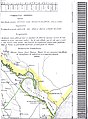
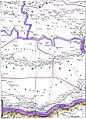
Railway map of the region of Moldova in 1917. |

|
Romanian borders according to the Bucharest Peace Treaty (May 1918) and than to WWI Peace Treaties (1919-1920) |

|
Romania in 1924 |

|
Historical regions in Romania and neighboring (modern Romania extends over several historical european regions inherited from medieval geography, which it shares, for some, with its neighbors. A nationalist ideology considers that a historical region cannot belong to several modern countries but must be framed within the current borders of an alone, thus subjecting history to current geography. The nationalists see here an irredentist map, because for them, the adjective “românești” can only mean “claimed by modern Romania” (when in reality it means "including Romanian populations"). For those who think that Romanians have no history before 1856, a traditional region cannot be a “common historical heritage” (e.g. Hungary and Romania sharing historical regions such as Banat or Körösvidék-Crișana). That's why they're try to remove this map wherever they can. These activist ideas are not specific to Romania: there are conributors who think that the Italians did not exist before the Risorgimento since it was the latter who created consciousness to be Italians, and that they therefore have no history before 1870.) |

|
Historical regions (only within current Romania) |

|
Historical regions coloured |

|
Regions of Greater Romania with counties of 1930 |

|
Historical regions only within current Romania |

|
Wallachian counties during XIVth - XVIth centuries |

|
Counties of Wallachia between 1601 and 1718 |

|
Counties of Moldavia between 1601 and 1718 |

|
The austrian Bezirke of the Great-Duchy of Transylvania and the counties of the Danubian principalities of Moldavia and Wallachia in 1711 |

|
Counties of Wallachia and Moldavia in 1800, according with N. Iorga and C. Giurescu |

|
Counties of Romania between 1856 and 1878 |
.svg)
|
Counties of Romania between 1878 and 1913 |

|
Counties of Romania between 1919 and 1925 |

|
The original proposal for the administrative unification of interwar Romania (Simion Mehedinţi Commission, 1920) |
.JPG)
|
Counties and regions of Romania before 1926 |

|
Romania 1918—1940, Administrative map (after 1926) |

|
Interwar Romania (administrative map) |

|
Physical map of Romania 1926-1929 |

|
Romania in 1930 (administrative map including the counties, the towns and the county subdivisions plăşi) |

|
Romania in 1935 (administrative map including the traditional regions and the counties) |

|
Romania in 1938 (administrative map including the new counties, towns and subdivisions plăşi) |

|
Romania 1939, administrative map |

|
The 70 counties of Romania between 1936 and 1939 |
-
 Former Alba county
 -
 Former Arad county
 -
 Former Argeş county
 -
 Former Bacău county
 -
 Former Baia county
 -
 Former Bălţi county
 -
 Former Bihor county
 -
 Former Botoşani county
 -
 Former Brăila county
 -
 Former Braşov county
 -
 Former Buzău county
 -
 Former Cahul county
 -
 Former Caliacra county
 -
 Former Caraş county (after 1926)
 -
 Former Caraş-Severin county (until 1926)
 -
 Former Câmpulung county
 -
 Former Cernăuţi county
 -
 Former Cetatea Albă county
 -
 Former Ciuc county
 -
 Former Cluj county
 -
 Former Constanţa county
 -
 Former Covurlui county
 -
 Former Dâmboviţa county
 -
 Former Dolj county
 -
 Former Dorohoi county
 -
 Former Durostor county
 -
 Former Făgăraş county
 -
 Former Fălciu county
 -
 Former Gorj county
 -
 Former Hotin county
 -
 Former Hunedoara county
 -
 Former Ialomiţa county
 -
 Former Iaşi county
 -
 Former Ilfov county
 -
 Former Ismail county
 -
 Former Lăpuşna county
 -
 Former Maramureş county
 -
 Former Mehedinţi county
 -
 Former Mureş county
 -
 Former Muscel county
 -
 Former Năsăud county
 -
 Former Neamţ county
 -
 Former Odorhei county
 -
 Former Olt county
 -
 Former Orhei county
 -
 Former Prahova county
 -
 Former Putna county
 -
 Former Rădăuţi county
 -
 Former Râmnicu Sărat county
 -
 Former Roman county
 -
 Former Romanaţi county
 -
 Former Sălaj county
 -
 Former Satu Mare county
 -
 Former Severin county (after 1926)
 -
 Former Sibiu county
 -
 Former Someş county
 -
 Former Soroca county
 -
 Former Storojineţ county
 -
 Former Suceava county
 -
 Former Târnava Mare county
 -
 Former Târnava Mică county
 -
 Former Tecuci county
 -
 Former Teleorman county
 -
 Former Tighina county
 -
 Former Timiş-Torontal county
 -
 Former Trei Scaune county
 -
 Former Tulcea county
 -
 Former Turda county
 -
 Former Tutova county
 -
 Former Vâlcea county
 -
 Former Vaslui county
 -
 Former Vlaşca county


-
 Former Ținut of the Argeş (Ținutul Argeşului)
 -
 Former Ținut of the Crişuri (Crişurilor)
 -
 Former Ținut of the Danube (Dunării)
 -
 Former Ținut of the Jiu (Jiului)
 -
 Former Ținut of the Sea (Mării)
 -
 Former Ținut of the Mureş (Mureşului)
 -
 Former Ținut of the Dniestr (Nistrului)
 -
 Former Ținut of the Pruth (Prutului)
 -
 Former Ținut of Suceava (Sucevei)
 -
 Former Ținut of the Timiş (Timişului)


|
Romania's 1940 lost territories |

|
Romania 1940-1941 (german map) |

|
Romania 1940-1941 |

|
Jewish communities in 1930 (red: borders 1940) |

|
Romania in September 1940, administrative map |

|
Romania 1941 |

|
Administrative map of the Governorate of Bessarabia (in existence between 1941 and 1944). |
| Romania controlled (August 19, 1941 - January 29, 1944) the "Transnistrian" region (historical Podolia) between Dniester, Bug rivers and Black Sea coast. The region was divided into 13 judeţe (counties). |
| Northern Transylvania as part of Hungary (1940-1944 de facto, 1940-1947 de jure) |

|
Romania 1942 |

|
Administrative map of Romania in 1942 |

|
Administrative map of Romania, 1950-1952 |

|
Administrative map of Romania, 1952-1956 |

|
Administrative map of Romania, 1960-1968 |

|
Romania in 1967 |

|
Proposed administrative reorganisation of the teritory of Romania, 1968 |

|
Romania until 1991 (fall of USSR) |

|
Romania after WW II |

|
Romania 1947 |

|
Danube Delta 1940 - 1948 |

|
Repressive network of Romania and soviet Moldova 1946-1989 |

|
Romania's anticommunist Resistance 1948-1960 |

|
A hypotetical map of Moldova united with Romania as it is demanded by the unionist movement |

|
The so-called "Belkovski proposal": a political union of Moldova and Romania, without Transnistria |
Banat

|
"Green area" historic Banat |

|
detailed map of the south-eastern part of Pannonian Sea (including area of modern Banat) during the Miocene Epoch |

|
Indo-European peoples in Banat in ancient times |

|
Roman province of Dacia and Roman cities in Banat (2nd century) |

|
Lands ruled by Buta-ul, 8th century |

|
Voivodship of Glad, 9th century |

|
Voivodship of Ahtum, 11th century |

|
Eyalet of Temeşvar, and Banate of Lugos and Karansebes in 1568 |

|
Eyalet of Temeşvar in 1572 |

|
Elayet of Temeşvar in the middle of the 17th century |

|
Eyalet of Temeşvar in 1699 |

|
Banat of Temeswar in 1718 |

|
Banat of Temeswar in 1739 |

|
Banat of Temeswar in 1745 |

|
Banat of Temeswar in 1751-1778 |

|
Vlach (Romanian) Banatian regiment in the end of the 18th century |

|
Counties in Bačka, Banat and Srem in 1881 |

|
Division of Banat between Vojvodina and Transylvania (proposed by Aurel Popovici in 1906) |

|
Banat Republic in 1918 |

|
Banat Republic in 1918 |

|
Republic of Banatia (proposed by Banatian Germans at a Paris Peace Conference in 1920) |

|
The dividing of Banat (1919-1923) |
Moldavia and Bucovina

|
"Blue area" historic Moldavia |
-en.png)
|
The principality of Moldavia in 1483, during the reign of Stephen the Great (1457-1504) |

|
The regions of the historical principality of Moldavia, with the distribution of these regions to modern states |

|
Ethnic map of Hotin County (northern Bessarabia) in 1844 |

|
Ethnic map of Chernivtsy Oblast (Northern Bukovina and Hotin County) in 2001 |

|
Ethnic map of Hotin County (northern Bessarabia) in 1930 |

|
"Orange area" historic Bucovina in Ukraine ans Romania |

|
Ethnic map of Bucovina in 1930 |

|
The division of Bukovina after the Soviet occupation of the northern half of the province in 1940 |

|
Administrative map of the Governorate of Bucovina in May 1942 |

|
Southern Bucovina within the modern Suceava County |
Historical maps on Transylvania
| "Blue area" historic Transylvania |
| "Green area" historic Transylvania |
| Magyars in Transylvania |
| Traditional ethnographic romanian lands of Transylvania & Partium |

|
Duchies of Gelu, Glad and Menumorut according to the Gesta Hungarorum (9th century) |

|
Transylvania in the 13th century |
.jpg)
|
Hungary and Transylvania in 1629 |

|
Emigration of the Szeklers |

|
Banate of Severin, 13th century |
|
|
Transylvania in the 13th century |

|
Transylvania in the 16th century |

|
Transylvania in 1570 |

|
Kingdom of Hungary in 1550 |
| Transylvania in 17th century |

|
The seats of the Transylvanian Saxons |

|
Counties (comitates), Szeklerland and Saxonland in Transylvania |

|
The Transylvanian Principality in 1857 |

|
The Transylvanian Principality in 1862 |

|
Administrative division of Transylvania, 1300-1867 |

|
Sibiu County (South-Central Transylvania) in 1937 |
| Northern Transylvania administratered by Hungary (de facto 1940-1944, de jure 1940-1947) |

|
Magyar Autonomous Region in 1952 |

|
Mureş-Magyar Autonomous Region (1952-1968) |

|
Ethnic Hungarians in Romania |

|
Szekely Land |
Wallachia and Dobruja

|
"Blue area" historic Wallachia |

|
"Blue area" historic Dobruja |

|
Historic Wallachia |

|
Scythia Minor |

|
Scythia Minor |

|
Principality of Dobrotitch cca 1370 |

|
Principality of Dobrotitch cca 1385 |

|
Historical borders in Dobruja |

|
Map of Romania and Bulgaria with Dobruja highlighted |

|
Counties of Dobruja (1878-1879) |

|
The two counties of Northern Dobruja |

|
The original border between Northern and Southern Dobruja |

|
The new border between Romania and Bulgaria (1913-1918 and 1919-1940) |
Old Maps
| Transylvania in 1532, by Johannes Honter |

|
Romanian territory in 1543 by Johannes Honter |
| Map of Transsylvania by Johann Sambucus |

|
Map of Moldova by Georg Reichsdorffer, 16th century |

|
Moldova by Dimitrie Cantemir, 1716 |

|
Wallachia (principality) and "Romania" meaning Rum-ili, Rumelia, the European part of the Ottoman Empire |
.jpg)
|
Old map of Ukraine by Johann Homann, confusing Wallachia and Moldavia inverted (pink) |

|
Balkans, by T. Jefferys, 1785 |

|
Principality of Moldavia, by Auguste-Henri Dufour, 1810 |

|
The oldest known map with the name "Rumania", 1816 |

|
Other map with the name "Rumania", 1855 |

|
The southwestern russian-moldavian border in Bessarabia between 1856 and 1978 |
-
 The 54 files of the Charta Principateloru Unite ale României (Bucharest, 1860, by George Filipescu-Dubau & Anton Parteni-Antoninu)
 -
 "Charta Principateloru Unite ale României" -file 1
 -
 idem -file 2- Oaş (Ugocea)
 -
 idem -file 3- Maramureş
 -
 idem -file 4- Bihor/Sălaj
 -
 idem -file 5- Șimleu/Zalău
 -
 idem -file 6- Dej/Bistriţa
 -
 idem -file 7- North-Western Bucovina
 -
 idem -file 8- North-Eastern Bucovina
 -
 idem -file 9- Northern Bessarabia
 -
 idem -file 10- South-Western Bucovina
 -
 idem -file 11- South-Eastern Bucovina
 -
 idem -file 12- Iaşi and around
 -
 idem -file 13- Soroca and around
 -
 idem -file 14- Statistics and Legend
 -
 idem -file 15- Legend
 -
 idem -file 16- Bălţi/Orhei
 -
 idem -file 17- Chişinău/Dubăsari and Statistics
 -
 idem -file 18- Statistics
 -
 idem -file 19- Eastern Bihor
 -
 idem -file 20- Cluj/Moţs county/Alba-Iulia
 -
 idem -file 21- Country of the Târnave rivers
 -
 idem -file 22- Caransebeş/Mehadia
 -
 idem -file 23- Hunedoara/Haţeg country/Târgu-Jiu
 -
 idem -file 24- Sibiu/Râmnicu-Vâlcea
 -
 idem -file 25- Western Székely county
 -
 idem -file 26- Eastern Székely & Csángó counties/Piatra-Neamţ
 -
 idem -file 27- Roman/Vaslui/Bârlad
 -
 idem -file 28- Braşov/Câmpulung/Câmpina
 -
 idem -file 29- Covasna/Vrancea/Buzău
 -
 idem -file 30- Tecuci/Focşani/Râmnicu-Sărat
 -
 idem -file 31- Hânceşti/Huşi/Leova/Comrat
 -
 idem -file 32- Chişinău/Tighina-Bender/Căuşeni
 -
 idem -file 33- Mouths of the Dniestr
 -
 idem -file 34- Galaţi/Reni/Bolgrad
 -
 idem -file 35- Izmail/Chilia/Chilia & Sulina branchs
 -
 idem -file 36- Tuzla in Budzak/Snakes Is.
 -
 idem -file 37- Orşova/Turnu-Severin/Vidin/Iron Gates
 -
 idem -file 38- Central Oltenia/Craiova
 -
 idem -file 39- Piteşti/Slatina/Caracal
 -
 idem -file 40- North-Western Bulgaria in the Ottoman Empire
 -
 idem -file 41- North-Western Bulgaria/Danube
 -
 idem -file 42- Islaz/Turnu-Măgurele/Danube/Northern Bulgaria
 -
 idem -file 43- Central Muntenia/Târgovişte/Vlaşca county
 -
 idem -file 44- Bucharest/Ploieşti/Olteniţa
 -
 idem -file 45- Slobozia/Călăraşi/Bărăgan
 -
 idem -file 46- Alexandria/Zimnicea/Giurgiu
 -
 idem -file 47- Northern Bulgaria between Ruse/Tutrakan/Razgrad
 -
 idem -file 48- North-Eastern Bulgaria around Silistra
 -
 idem -file 49- Central Dobrudja
 -
 idem -file 50- North-Eastern Dobrudja/St-George branch and Statistics
 -
 idem -file 51- Statistics
 -
 idem -file 52- Southern Dobrudja around Mangalia
 -
 idem -file 53- Statistics
 -
 idem -file 54- Statistics


Ethno-linguistic maps

|
The spread of ethnic Romanians |

|
Blue: spread of ethnic Romanians (Moldovans included), black borders beginning of 20th c., red borders beginning of 21th c. |
.PNG)
|
The 3 main subdivisions of the Daco-Romanians |

|
Romanian varieties |

|
Some representative isoglosses of three main varieties (dialects) of Daco-Romanian |

|
Vlachs in the Balkans |
.png)
|
Romanians in Romania (2002) |

|
Romanians in Romania (2011) by counties |
| Romanians in Transylvania (1850) |
.png)
|
Hungarians in Romania, by communes and cities (2002) |
| Hungarians in Transylvania (1850) |
| Declared Hungarians in Transylvania (1850) |
| Declared Szekelys in Transylvania (1850) |
|
|
Hungarians in Romania, by counties (2002) |

|
Hungarians in Romania, by counties (2011) |

|
Hungarians in Transylvania, Banat, Crişana, Maramureş (2002) |

|
Roma (Gypsies) in Romania (2002) |
_Romania_2002.png)
|
Roma (Gypsies) in Romania (2002) |

|
Roma (Gypsies) in Romania (2002) |

|
Roma (Gypsies) in Romania (2002) |

|
Roma (Gypsies) in Romania (2011) by counties |
| Gypsies in Transylvania (1850) |
.png)
|
Germans in Romania (2002) |
| Germans in Transylvania (1850) |
| Declared Germans in Transylvania (1850) |
| Declared Saxons in Transylvania (1850) |

|
Ukrainians in Romania (2002) |

|
Russians and Lipovans in Romania (2002) |
.png)
|
Turks in Romania (census 2002) |

|
Tatars in Romania (census 2002) |
.png)
|
Serbs in Romania (census 2002) |

|
Slovaks in Romania (census 2002) |
.png)
|
Bulgarians in Romania (census 2002) |
.png)
|
Croats in Romania (census 2002) |
.PNG)
|
Greeks in Romania (census 2002) |
.png)
|
Jews in Romania (census 2002) |
| Jews in Transylvania (1850) |
.png)
|
Czechs in Romania (census 2002) |
.png)
|
Poles in Romania (census 2002) |
.png)
|
Italians in Romania (census 2002) |
.png)
|
Armenians in Romania (census 2002) |
| Armenians in Transylvania (1850) |
.png)
|
Eastern Orthodoxy in Romania (census 2002) |
.png)
|
Eastern Orthodoxy in Romania (census 1930) |
| Eastern Orthodoxy in Transylvania (1850) |
.png)
|
Roman Catholicism in Romania (census 2002) |
.png)
|
Roman Catholicism in Romania (census 1930) |
| Roman Catholicism in Transylvania (1850) |
.png)
|
Protestantism in Romania (census 2002) |
.png)
|
Protestantism in Romania (census 1930) |
| Protestantism in Transylvania (1850) |
.png)
|
Reformed (Calvins) in Romania (census 2002) |
.png)
|
Reformed (Calvins) in Romania (census 1930) |
| Reformed (Calvins) in Transylvania (1850) |
.png)
|
Pentecostals in Romania (census 2002) |
.png)
|
Greek Catholics in Romania (census 2002) |
.png)
|
Greek Catholics in Romania (census 1930) |
| Greek Catholics in Transylvania (1850) |
.png)
|
Baptists in Romania (census 2002) |
.png)
|
Baptists in Romania (census 1930) |
.png)
|
Adventists in Romania (census 2002) |
.png)
|
Adventists in Romania (census 1930) |
.png)
|
Muslims in Romania (census 2002) |
.png)
|
Unitarians in Romania (census 2002) |
.png)
|
Unitarians in Romania (census 1930) |
| Unitarians in Transylvania (1850) |
.png)
|
The United Brethrens in Romania (census 2002) |
_Romania_(2002).png)
|
The Old believers in Romania (census 2002) |
_in_Romania_(2002).png)
|
The distribution of the Lutherans (on the north of the Carpathians) and other Evangelical churches (on the south of the Carpathians) in Romania (census 2002) |
.png)
|
Lutherans in Romania (census 1930) |
| Lutherans in Transylvania (1850) |
| Ethnic groups in Transylvania (1850) |
| Ethnic groups in Transylvania (1850) with Saxons and Szeklers |
.jpg)
|
Ethnic map of the European Turkey and its vassal states (1861) |

|
Ethnic map of the Balkan Peninsula (1898) |
_in_Hungary,_census_1890.jpg)
|
Vlachs (Romanians) in Hungary, census 1890 |
.jpg)
|
Ethnic map of Austria-Hungary, census 1880. German version |
.JPG)
|
Ethnic map of Austria-Hungary, census 1890. English version |

|
Territories inhabited by Romanians in 1908 |

|
Territories inhabited by Romanians before the First World War |

|
Religions of Austria-Hungary, including Transsylvania |

|
Linguistic map of Transylvania, Banat, Crişana, Sătmar and Maramureş in 1910 |
| Historical ethnic map of Transylvania |

|
Transylvanian Saxon settlements (1890) |

|
The Lutheran church in Transylvania (1904) |
.jpg)
|
German-inhabited settlements in Southern Transylvania and the Romanian Banat in 1940 |

|
South Slavs in Romania |
.JPG)
|
Ethnic map (1861). See also the legend |

|
Ethnic map (1903) |
.JPG)
|
Ethnic map (1918) |

|
Dobruja Germans |

|
Ethnic map of Romania according to the 1930 census |

|
Ethnic map of Bessarabia according to the 1930 census |

|
Ethnic map of Romania (including Transnistria) in 1941 |

|
Ethnic composition of Bessarabia in 1941 |

|
Ethnic map of Romania (census 1977) |

|
Ethnic map of Romania (census 1992) |

|
Ethnic map of Romania (census 2002) |

|
Ethnic map of Romania (census 2011) by communes and cities |

|
Ethnic map of Romania (census 2011) by counties |

|
Religious map of Romania (census 2002) |
.png)
|
Religious map of Romania (census 1930) |
| Religions in Transylvania (1850) |

|
Foreign residents in Romania (census 2002) by country of citizenship |

|
Visa requirements for Romanian citizens |
Satellite maps

|
Satellite image of Romania in December 2001 |
Regional topographic maps
-
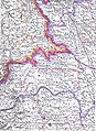
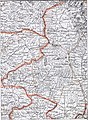
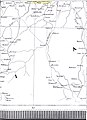
 Topographic map of Dobruja
 -
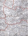
 Protected areas of Dobruja
 -
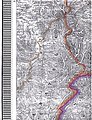
 Topographic map of the area surrounding the city of Sibiu/Hermannstadt, Southern Transylvania (scale 1:100.000)
 -
 Topographic map of the area surrounding the town of Târgu Neamţ, Moldavia (scale 1:75.000)


Economy maps
-
 Agriculture production (1898)
 -
 Oilfields in Romania (1900)
 -
 Natural gas maritime fields in romanian EEZ (2020)
 -
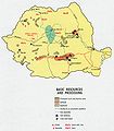 Romania - Basic Resources and Processing (1970)
 -
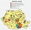 Industrial centers (1970)
 -
 Romanian economy (1990)
 -
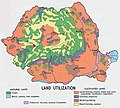 Romania - Land Utilization (1970)
 -
 Romania - Land Use (1990)
 -
 Income in Romania
 -
 Contributions to the Romanian budget
 -
 The waterway connecting North Sea with Black Sea
 -
 Illiteracy in Romania 2011
 -
 Literacy in Romania 1930
 -
 Crime map (2009)
 -
 Homicides in Romania
 -
 Suicides in Romania
 -
 Car accidents in Romania
 -
 Romanian Order of Architects

.JPG)

.jpg)
.jpg)
.jpg)
.jpg)
.jpg)

.map.PNG)


.PNG)


Election maps
-
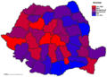
 Results of the 1937 general elections at county level
 -
 Results of the 2008 local elections at county and municipality level
 -
 Results of the 2008 legislative elections in the Senate constituencies within Romania
 -
 Results of the 2008 legislative elections in the Chamber of Deputies constituencies within Romania


Notes and references
|
General remarks:
|